
Harju County, is one of the fifteen counties of Estonia. It is situated in Northern Estonia, on the southern coast of the Gulf of Finland, and borders Lääne-Viru County to the east, Järva County to the southeast, Rapla County to the south, and Lääne County to the southwest. The capital and largest city of Estonia, Tallinn, is situated in Harju County. Harju County is the largest county in Estonia in terms of population, as almost half (45%) of the Estonia's population lives in Harju County.

Hiiumaa is one of 15 counties of Estonia, being the smallest county both in terms of area and population. It consists of Hiiumaa, the second largest island of Estonia, and several smaller islands near it. The county borders Lääne County to the east and Saare County to the south.
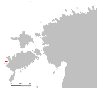
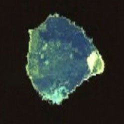
The island of Vilsandi, Saaremaa Parish, Saare County, Estonia is located in the Baltic Sea. It covers an area of some 9 square km and is the westernmost populated island in Estonia. The surrounding waters are shallow and rocky and many ships travelling the Baltic have perished nearby. The island of Vilsandi can be reached by boat, by truck having suitable clearance or on foot by wading from Saaremaa. Much of the island is now part of Vilsandi National Park, which grew from a bird reserve founded in 1910. It is a highly sensitive ecosystem due to the use of the area by many migratory birds as a breeding and nesting ground. Hunting is absolutely prohibited. This park is a popular tourist destination not only for local Estonians, but also people of Finland who are visiting Estonia in greater and greater numbers.

Kose Parish is a rural municipality in northern Estonia. It is a part of Harju County. The municipality has a population of 5,737 and covers an area of 237.33 km2 (91.63 sq mi). The population density is 24.2 inhabitants per km2.

Viimsi Parish is a rural municipality in Northern Estonia, located North-East and neighbouring the capital Tallinn. It occupies an area of 72.84 km2 (28.12 sq mi) with a population of 20 580. The municipality contains the Viimsi Peninsula and several islands, including Naissaar, Prangli, and Aksi.

Naissaar is an island northwest of Tallinn in Estonia. The island covers an area of 18.6 square kilometres. It is 8 kilometres long and 3.5 kilometres wide, and lies about 8.5 kilometres from the mainland. The highest point on the island is Kunilamägi, which is 27 metres above sea level. The island consists predominantly of coniferous forest and piles of stones and boulders. In 2005, the island had a population of ten; in 2011 the island had 35 or so permanent residents and some summer residents. Administratively the island is divided into three villages: Lõunaküla (Storbyn), Tagaküla (Bakbyn), and Väikeheinamaa (Lillängin).

Utö is a small island in the Archipelago Sea in the Baltic sea and belongs to Finland's Pargas municipality. It is the southernmost year-round inhabited island in Finland. Utö has an area of 0.81 square kilometres and the population was c. 40.
Bolshoi Tyuters is an island in the Gulf of Finland of the Baltic Sea, located 75 km (47 mi) away from the coast of Finland, to the south-east from Hogland. The island is a part of the Leningrad Oblast, Russia. The area is approximately 8.3 km2 (3.2 sq mi). There are no permanent inhabitants, save for a lighthouse keeper.
Hobulaid is a Baltic Sea island belonging to the country of Estonia.
Harilaid is small uninhabited island in Estonia. It lies about 4 kilometres west of the island of Vormsi. It should not be confused with the larger former island of Harilaid which is now a peninsula on the northwest coast of the island of Saaremaa.

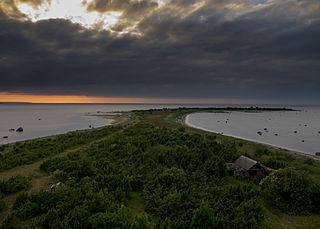
Prangli is an Estonian island in the Gulf of Finland.

Kanepi Parish is a rural municipality of Estonia, in Põlva County. It has a population of 4,662 and an area of 524.68 km2 (202.58 sq mi). The administrative centre is Kanepi.

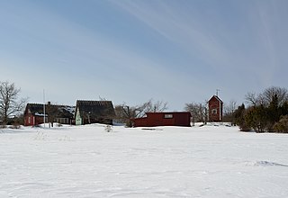
Äksi is a village in Kose Parish, Harju County in northern Estonia.
Idaotsa is a village in Viimsi Parish, Harju County in northern Estonia, on the island of Prangli. The nearby Aksi island also belongs to Idaotsa village.

Kelnase is a village on Prangli Island in Viimsi Parish, Harju County in northern Estonia.
Ammuta is a village in Ridala Parish, Lääne County, in western Estonia.

Keri is a 3.1-hectare (7.7-acre) Estonian island in the Gulf of Finland. It is located about 6 km north of the island Prangli, and is one of the northernmost islands of Estonia. Keri is the site of the notable Keri Lighthouse.

Mohni is an island of Estonia. It limits the Eru Bay from the north. The closest settlement at the mainland is Viinistu.

Pedassaar is an island in the Gulf of Finland belonging to Estonia.
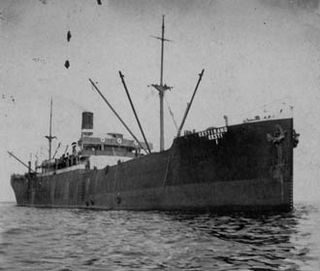
SS Eestirand, built in 1910, was an Estonian steel-hulled cargo steamship. She was one of the largest ships in her class at the time and served as the mother-ship of the first Estonian herring expeditions in the 1930s. In World War II she served as a Soviet Navy transport vessel and was subsequently sunk in 1941 near Prangli Island during the Soviet evacuation of Tallinn.
This page is based on this
Wikipedia article Text is available under the
CC BY-SA 4.0 license; additional terms may apply.
Images, videos and audio are available under their respective licenses.

