
Hiiu County is one of 15 counties of Estonia, being the smallest county both in terms of area and population. It consists of Hiiumaa, the second largest island of Estonia, and several smaller islands near it. The county borders Lääne County to the east and Saare County to the south.
Hõralaid is a small, uninhabited Estonian island of approximately 20 hectares in the Baltic Sea. The coordinates of Hõralaid are 58°53′55″N23°04′26″E.
Külalaid is a small island in the Baltic Sea belonging to the country of Estonia. Its coordinates are 58°58′43″N22°24′19″E.

Kadakalaid is a small island in the Baltic Sea belonging to the country of Estonia. Its coordinates are 58°58′55″N23°00′39″E

Vissulaid is a small, uninhabited island in the Baltic Sea belonging to the country of Estonia. Its coordinates are 59°00′40″N22°50′26″E
Kõrgelaid is a small, uninhabited, moraine-based island in the Baltic Sea, belonging to the country of Estonia. Its coordinates 58°45′09″N23°05′35″E.
Ninalaid is a small Baltic Sea island belonging to the country of Estonia. Its coordinates are 58°59′52″N22°26′31″E.

Saarnaki laid is an uninhabited, moraine-based island in the Baltic Sea belonging to the country of Estonia. Its coordinates are 58°48′38″N22°59′37″E.

Kõverlaid is a small, moraine-based Baltic Sea island belonging to the country of Estonia. Its coordinates are 58°49′01″N23°04′46″E.

Hülgerahu is a small, uninhabited, moraine-based Baltic Sea island belonging to the country of Estonia.

Langekare is a small, uninhabited Baltic Sea island belonging to the country of Estonia. Its coordinates are 58°48′21″N23°09′03″E
Luigerahu is a small, moraine-based Baltic Sea island that belongs to the country of Estonia.

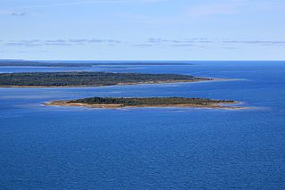
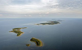
Hanikatsi laid is an islet in Estonia, in the Baltic Sea, south east of Hiiumaa island. It has a surface area of 83 hectares and no permanent habitation. The islet belongs to Hiiu County, Pühalepa Parish and is part of Hiiumaa Islets Landscape Reserve, which in turn is part of West Estonian Archipelago Biosphere Reserve.
Ahelaid is a small uninhabited islet in Estonia. It lies in the Baltic Sea, south-east of Hiiumaa island. It has a surface area of 25 hectares. It is part of the Hiiumaa Islets Landscape Reserve.
Öakse is an island in the Baltic Sea belonging to the country of Estonia.

Rukkirahu is a small, uninhabited island in the Baltic Sea belonging to the country of Estonia.
Uuemaarahu is a small, Baltic Sea islet comprising 0.0234 hectares belonging to the country of Estonia.
Ooslamaa is a small islet in the Baltic Sea belonging to the country of Estonia.
Reigilaid is a small islet in the Baltic Sea belonging to the country of Estonia.
Liivanuka ots is an Estonian islet with surface area of 0.0059 hectares. It is a sandy, oval-shaped islet, stretching in a north-south direction. It lies southeast of the island of Hiiumaa in the Jausa rand, next to the islet of Hanerahu. Liivanuka ots is part of Hiiumaa Parish, Hiiu County. The islet belongs to Hiiumaa Islets Landscape Reserve.
