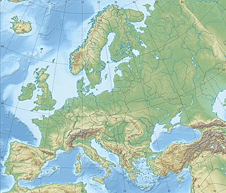
Location in the Baltic Sea region | |
Geography | |
---|---|
Location | Baltic Sea |
Coordinates | 58°27′N23°15′E / 58.450°N 23.250°E Coordinates: 58°27′N23°15′E / 58.450°N 23.250°E |
Archipelago | West Estonian archipelago |
Area | 2.8 ha (6.9 acres) |
Length | 1 km (0.6 mi) |
Administration | |
County | Saare County |
Additional information | |
Time zone |
|
Anulaid (alternatively: Aru saar and Anu saar) [1] is an uninhabited island belonging to the country of Estonia.
Anulaid is 1 km long and covers 2.8 ha in area. It is located on the northwest coast of Muraja Bay off the southeastern part of Saaremaa and administratively belongs to the village of Kakuna in Saaremaa Municipality. Anulaid belongs to the Kahtla-Kübassaare Hoiuala Limited-Conservation Area and is under nature protection. [2]
Saaremaa is the largest island in Estonia, measuring 2,673 km2 (1,032 sq mi). The main island of Saare County, it is located in the Baltic Sea, south of Hiiumaa island and west of Muhu island, and belongs to the West Estonian Archipelago. The capital of the island is Kuressaare, which in January 2018 had 13,276 inhabitants. The whole island had a recorded population in January 2020 of 31,435.
Counties are the state administrative subdivisions of Estonia. Estonian territory is composed of 15 counties, including 13 on the mainland and 2 on islands. County governments were abolished at the end of 2017, with their duties split between state authorities and local governments, and nowadays counties have no noteworthy independent competences. Counties are composed of municipalities of two types: urban municipalities and rural municipalities, which are by law required to cooperate in development of their county.
Kuressaare is a town on Saaremaa island in Estonia. It is the administrative centre of Saaremaa Municipality and the capital of Saare County. Kuressaare is the westernmost town in Estonia. The recorded population on 1 January 2018 was 13,276.
Saare County is one of 15 counties of Estonia. It consists of Saaremaa, the largest island of Estonia, and several smaller islands near it, most notably Muhu, Ruhnu, Abruka and Vilsandi. The county borders Lääne County to the east, Hiiu County to the north, and Latvia to the south. In 2022 Saare County had a population of 31,292, which was 2.4% of the population of Estonia.
Lääne County is one of 15 counties of Estonia. It is located in western Estonia and borders the Baltic Sea to the north, Harju County to the north-east, Rapla County to the east, Pärnu County to the south, and the island counties of Saare and Hiiu to the west. In January 2009 Lääne County had a population of 23,810 – constituting 2.0% of the total population in Estonia.
Muhu, is an island in the West Estonian archipelago of the Baltic Sea. With an area of 198 km2 (76 sq mi) it is the third largest island belonging to Estonia, after Saaremaa and Hiiumaa.
Kihnu is an island in the Baltic Sea. With an area of 16.4 km2 (6.3 sq mi) it is the largest island in the Gulf of Riga and the seventh largest island of Estonia. The length of the island is 7 km (4.3 mi) and width 3.3 km (2.1 mi), the highest point is at 8.9 metres (29.2 ft) above sea level.
Linnusitamaa is a 5.07 ha uninhabited Estonian islet in the Gulf of Riga. It's located about 300 m (980 ft) south of the island of Abruka. Administratively Linnusitamaa belongs to the Abruka village in Lääne-Saare Parish, Saare County.
Oeselians or Osilians is a historical name for the people who prior to the Northern Crusades in the 13th century lived in the Estonian island of Saaremaa (Ösel) – the Baltic Sea island was also referred as Oeselia or Osilia in written records dating from around that time. In Viking Age literature, the inhabitants were often included under the name "Vikings from Estonia". The earliest known use of the word in the (Latinised) form of "Oeselians" in writing was by Henry of Livonia in the 13th century. The inhabitants of Saaremaa (Ösel) are also mentioned in a number of historic written sources dating from the Estonian Viking Age.
Laevaranna is a village in Saaremaa Parish, Saare County, Estonia, on the island of Saaremaa. As of 2011 Census, the settlement's population was 5.
Sõrve Peninsula is a peninsula which forms the southernmost section of the Estonian island Saaremaa. Its length is 32 km, and its maximum width 10 km. South of it lies Irbe Strait, the main entrance to the Gulf of Riga of the Baltic Sea.
Vesitükimaa is a small, uninhabited Estonian islet located in Saaremaa Parish, at the tip of Sõrve Peninsula of Saaremaa island. It is a site of European Community importance for the Boreal Biogeographical Region, its coordinates are 57°53′49″N22°02′26″E and its territory is 12,6 km2.
Loonalaid is a small island in the Baltic Sea belonging to the country of Estonia. Its coordinates are 58°19′42″N21°48′19″E. Loonalaid lies just off the northwest coast of the island of Saaremaa, is administered by Saaremaa Municipality, Saare County and is also part of Vilsandi National Park.
Nootamaa is a small, uninhabited island in the Baltic Sea belonging to the country of Estonia. It marks the westernmost part of Estonia's territorial boundary.
Ooslamaa is a small islet in the Baltic Sea belonging to the country of Estonia.
Tõõdilaid is a small Estonian islet within Saastna Bay off the south-east coast of the island of Saaremaa in the Baltic Sea. The island covers 0.0136 hectares and has a perimeter of 0.6 kilometers and lies in an oblong Southwest-Northeast position. Tõõdilaid is administered by Saaremaa Parish, Saare County and is part of the Kahtla-Kübassaare hoiuala Limited-conservation area.
Pitkasääremaa is a small islet in the Baltic Sea belonging to the country of Estonia.
Siiasaar is a small islet in the Baltic Sea belonging to the country of Estonia.
Lombimaa is a small islet in the Baltic Sea belonging to the country of Estonia.
The COVID-19 pandemic in Estonia was a part of the ongoing worldwide pandemic of coronavirus disease 2019 caused by severe acute respiratory syndrome coronavirus 2.