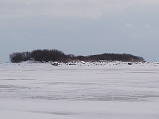
Hanerahu is an uninhabited Estonian islet with surface area of 1.2 hectares. It lies south-east of Hiiumaa island and is part of Pühalepa Municipality. The islet belongs to Hiiumaa Islets Landscape Reserve.
Külalaid is a small island in the Baltic Sea belonging to the country of Estonia. Its coordinates are 58°58′43″N22°24′19″E.

Kõrgelaid is a small, uninhabited, moraine-based island in the Baltic Sea, belonging to the country of Estonia. Its coordinates 58°45′09″N23°05′35″E.

Saarnaki laid is an uninhabited, moraine-based island in the Baltic Sea belonging to the country of Estonia. Its coordinates are 58°48′38″N22°59′37″E.

Kõverlaid is a small, moraine-based Baltic Sea island belonging to the country of Estonia. Its coordinates are 58°49′01″N23°04′46″E.

Hülgerahu is a small, uninhabited, moraine-based Baltic Sea island belonging to the country of Estonia.

Langekare is a small, uninhabited Baltic Sea island belonging to the country of Estonia. Its coordinates are 58°48′21″N23°09′03″E

Hanikatsi laid is an islet in Estonia, in the Baltic Sea, south east of Hiiumaa island. It has a surface area of 83 hectares and no permanent habitation. The islet belongs to Hiiu County, Pühalepa Parish and is part of Hiiumaa Islets Landscape Reserve, which in turn is part of West Estonian Archipelago Biosphere Reserve.
Ahelaid is a small uninhabited islet in Estonia. It lies in the Baltic Sea, south-east of Hiiumaa island. It has a surface area of 25 hectares. It is part of the Hiiumaa Islets Landscape Reserve.
Öakse is an island in the Baltic Sea belonging to the country of Estonia.

Rukkirahu is a small, uninhabited island in the Baltic Sea belonging to the country of Estonia.

Uuemererahu is a small Baltic Sea islet comprising 2.3 hectares in area, belonging to the country of Estonia.
Uuemaarahu is a small, Baltic Sea islet comprising 0.0234 hectares belonging to the country of Estonia.

Pöörilaid is an islet in the Baltic Sea belonging to the country of Estonia.
Ooslamaa is a small islet in the Baltic Sea belonging to the country of Estonia.

Reigilaid is a former small islet in the Baltic Sea belonging to the country of Estonia. Now a peninsula of Hiiumaa island.
Liivanuka ots is an Estonian islet with surface area of 0.0059 hectares. It is a sandy, oval-shaped islet, stretching in a north-south direction. It lies southeast of the island of Hiiumaa in the Jausa rand, next to the islet of Hanerahu. Liivanuka ots is part of Hiiumaa Parish, Hiiu County. The islet belongs to Hiiumaa Islets Landscape Reserve.
Võrkrahu is a small islet belonging to the country of Estonia off the west coast of the larger island of Saaremaa in the Kuusnõmme Gulf of the Baltic Sea. It is administered by Lääne-Saare Parish. Võrkrahu lies in an oblong north–south direction and is covered in pine and junipers. It covers an area of 6.07618 hectares and a circumference of 1.32628 kilometers and is part of Vilsandi National Park.
Piiukaarelaid is a small, uninhabited islet in the Baltic Sea belonging to the country of Estonia. Piiukaarelaid has an approximate area of 8.5 hectares and a circumference of 1.8 kilometers and is administered by the village of Mereäärse, Varbla Parish, Pärnu County. The islet is fully protected as part of the Varbla Islets Landscape reserve, and is an important breeding site for 54 species of birds, including: the velvet scoter, the little tern, the red-backed shrike, the curlew, the common tern, the Arctic tern, the redshank, the northern shoveler, the gadwall, the black-tailed godwit, the Greylag goose the tufted duck, the mute swan, the common gull, the goosander, the common eider, the lapwing, and others.

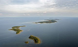
Hiiumaa Islets Landscape Conservation Area is a protected area situated in Hiiu County, Estonia. Its area is 3224 ha.
