Related Research Articles

Hiiu County is one of 15 counties of Estonia, being the smallest county both in terms of area and population. It consists of Hiiumaa, the second largest island of Estonia, and several smaller islands near it. The county borders Lääne County to the east and Saare County to the south.
Hanerahu is an uninhabited Estonian islet with surface area of 1.2 hectares. It lies south-east of Hiiumaa island and is part of Pühalepa Municipality. The islet belongs to Hiiumaa Islets Landscape Reserve.
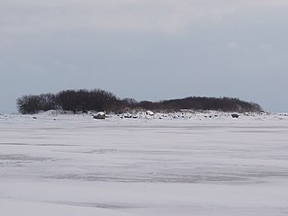
Külalaid is a small island in the Baltic Sea belonging to the country of Estonia. Its coordinates are 58°58′43″N22°24′19″E.

Harilaid Peninsula is a peninsula on the northwest coast of the island of Saaremaa in Estonia. It should not be confused with the islet of Harilaid which lies between the islands of Vormsi and Hiiumaa.
Kõrgelaid is a small, uninhabited, moraine-based island in the Baltic Sea, belonging to the country of Estonia. Its coordinates 58°45′09″N23°05′35″E.

Saarnaki laid is an uninhabited, moraine-based island in the Baltic Sea belonging to the country of Estonia. Its coordinates are 58°48′38″N22°59′37″E.

Kõverlaid is a small, moraine-based Baltic Sea island belonging to the country of Estonia. Its coordinates are 58°49′01″N23°04′46″E.

Hülgerahu is a small, uninhabited, moraine-based Baltic Sea island belonging to the country of Estonia.

Langekare is a small, uninhabited Baltic Sea island belonging to the country of Estonia. Its coordinates are 58°48′21″N23°09′03″E
Luigerahu is a small, moraine-based Baltic Sea island that belongs to the country of Estonia.

Hanikatsi laid is an islet in Estonia, in the Baltic Sea, south east of Hiiumaa island. It has a surface area of 83 hectares and no permanent habitation. The islet belongs to Hiiu County, Pühalepa Parish and is part of Hiiumaa Islets Landscape Reserve, which in turn is part of West Estonian Archipelago Biosphere Reserve.
Ahelaid is a small uninhabited islet in Estonia. It lies in the Baltic Sea, south-east of Hiiumaa island. It has a surface area of 25 hectares. It is part of the Hiiumaa Islets Landscape Reserve.

Põgari-Sassi is a village in Ridala Parish, Lääne County, in western Estonia.
Öakse is an island in the Baltic Sea belonging to the country of Estonia.

Rukkirahu is a small, uninhabited island in the Baltic Sea belonging to the country of Estonia.

Uuemererahu is a small Baltic Sea islet comprising 2.3 hectares in area, belonging to the country of Estonia.
Uuemaarahu is a small, Baltic Sea islet comprising 0.0234 hectares belonging to the country of Estonia.
Ooslamaa is a small islet in the Baltic Sea belonging to the country of Estonia.
Reigilaid is a small islet in the Baltic Sea belonging to the country of Estonia.
Võrkrahu is a small islet belonging to the country of Estonia off the west coast of the larger island of Saaremaa in the Kuusnõmme Gulf of the Baltic Sea. It is administered by Lääne-Saare Parish. Võrkrahu lies in an oblong North-South direction and is covered in pine and junipers. It covers an area of 6.07618 hectares and a circumference of 1.32628 kilometers and is part of Vilsandi National Park.
References
Coordinates: 58°46′0.69″N22°43′17.74″E / 58.7668583°N 22.7215944°E
| | This Hiiu County location article is a stub. You can help Wikipedia by expanding it. |