Uuluti laid

Last updated

Uuluti laid is a small islet positioned just off the coast of Virtsu Peninsula in the Baltic Sea belonging to the country of Estonia. [1]

Virtsu Place in Pärnu County, Estonia

Virtsu is a small borough in Lääneranna Parish, Pärnu County, Estonia. It lies on the western coast of continental Estonia, and is a location of the main port for traffic to and from Saaremaa, the largest island of Estonia. The Virtsu ferry goes to Kuivastu, which is located on the island of Muhu, which is in turn connected to Saaremaa by the largest causeway in Estonia, the Väinatamm.

Baltic Sea A sea in Northern Europe bounded by the Scandinavian Peninsula, the mainland of Europe, and the Danish islands

The Baltic Sea is a marginal sea of the Atlantic Ocean, enclosed by Denmark, Estonia, Finland, Latvia, Lithuania, Sweden, northeast Germany, Poland, Russia and the North and Central European Plain.

Estonia Republic in Northern Europe

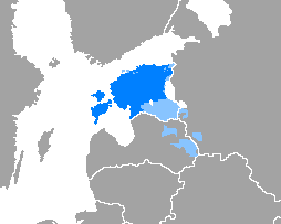
Estonia, officially the Republic of Estonia, is a country in Northern Europe. It is bordered to the north by the Gulf of Finland with Finland on the other side, to the west by the Baltic Sea with Sweden on the other side, to the south by Latvia (343 km), and to the east by Lake Peipus and Russia (338.6 km). The territory of Estonia consists of a mainland and 2,222 islands in the Baltic Sea, covering a total area of 45,227 km2 (17,462 sq mi), water 2,839 km2 (1,096 sq mi), land area 42,388 km2 (16,366 sq mi), and is influenced by a humid continental climate. The official language of the country, Estonian, is the third most spoken Finno-Ugric language.

Uuluti laid covers an area of 24.2 hectares [2] and is administered by Pärnu County (Estonian: Pärnu maakond).

Pärnu County County of Estonia

Pärnu County, or Pärnumaa, is one of 15 counties of Estonia. It is situated in south-western part of the country, on the coast of Gulf of Riga, and borders Lääne and Rapla counties to the north, Järva and Viljandi counties to the east, and Latvia to the south. In January 2013 Pärnu County had a population of 81,428 – constituting 6.3% of the total population of Estonia.

Estonian language Finno-Ugric language spoken in Estonia

The Estonian language is the official language of Estonia, spoken natively by about 1.1 million people: 922,000 people in Estonia and 160,000 outside Estonia. It is a Southern Finnic language and is the second most spoken language among all the Finnic languages.

Related Research Articles

Noogimaa is a small, uninhabited Estonian island in the Baltic Sea. Its coordinates are: 58°22′09″N21°54′45″E.

Jõeranna Village in Hiiu County, Estonia

Jõeranna is a village in Hiiumaa Parish, Hiiu County in northwestern Estonia.

Innarahu is a small, uninhabited Baltic Sea islet belonging to the country of Estonia.

Adralaid is a small islet belonging to Virtsu small borough in Lääneranna Parish, Pärnu County, Estonia.

Uuemererahu is a small Baltic Sea islet comprising 2.3 hectares in area, belonging to the country of Estonia.

Uuemaarahu is a small, Baltic Sea islet comprising 0.0234 hectares belonging to the country of Estonia.

Oosäär is a small islet in the Gulf of Riga, belonging to Estonia.

Pöörilaid

Pöörilaid is an islet in the Baltic Sea belonging to the country of Estonia.

Ooslamaa is a small islet in the Baltic Sea belonging to the country of Estonia.

Reigilaid is a small islet in the Baltic Sea belonging to the country of Estonia.

Liivanuka ots is an Estonian islet with surface area of 0.0059 hectares. It is a sandy, oval-shaped islet, stretching in a north-south direction. It lies southeast of the island of Hiiumaa in the Jausa rand, next to the islet of Hanerahu. Liivanuka ots is part of Emmaste Parish, Hiiu County. The islet belongs to Hiiumaa Islets Landscape Reserve.

Tõõdilaid is a small Estonian islet within Saastna Bay off the south-east coast of the island of Saaremaa in the Baltic Sea. The island covers 0.0136 hectares and has a perimeter of 0.6 kilometers and lies in an oblong Southwest-Northeast position. Tõõdilaid is administered by Laimjala Parish, Saare County and is part of the Kahtla-Kübassaare hoiuala Limited-conservation area.

Võrkrahu is a small islet belonging to the country of Estonia off the west coast of the larger island of Saaremaa in the Kuusnõmme Gulf of the Baltic Sea. It is administered by Lääne-Saare Parish. Võrkrahu lies in an oblong North-South direction and is covered in pine and junipers. It covers an area of 6.07618 hectares and a circumference of 1.32628 kilometers and is part of Vilsandi National Park.

Piiukaarelaid is a small, uninhabited islet in the Baltic Sea belonging to the country of Estonia. Piiukaarelaid has an approximate area of 8.5 hectares and a circumference of 1.8 kilometers and is administered by the village of Mereäärse, Varbla Parish, Pärnu County. The islet is fully protected as part of the Varbla Islets Landscape reserve, and is an important breeding site for 54 species of birds, including: the velvet scoter, the little tern, the red-backed shrike, the curlew, the common tern, the Arctic tern, the redshank, the northern shoveler, the gadwall, the black-tailed godwit, the Greylag goose the tufted duck, the mute swan, the common gull, the goosander, the common eider, the lapwing, and others.

Pitkasääremaa is a small islet in the Baltic Sea belonging to the country of Estonia.

Tagarahu is a small island in the Baltic Sea belonging to the country of Estonia.

Paljarahu is a small island in the Baltic Sea belonging to the country of Estonia.

Siimurahu is a small uninhabited island in the Baltic Sea belonging to the country of Estonia.

Väike Siimurahu is a small uninhabited island in the Baltic Sea belonging to the country of Estonia.

References

Coordinates: 58°39′59″N23°31′41″E / 58.66639°N 23.52806°E / 58.66639; 23.52806

Geographic coordinate system Coordinate system

A geographic coordinate system is a coordinate system that enables every location on Earth to be specified by a set of numbers, letters or symbols. The coordinates are often chosen such that one of the numbers represents a vertical position and two or three of the numbers represent a horizontal position; alternatively, a geographic position may be expressed in a combined three-dimensional Cartesian vector. A common choice of coordinates is latitude, longitude and elevation. To specify a location on a plane requires a map projection.