HealthLine

Last updated
Cleveland HealthLine logo.svg
Cleveland RTA New Flyer XN60 (51981936057).jpg
A HealthLine bus passes the Cleveland Clinic Lerner College of Medicine
Overview
Operator GCRTA
GarageHayden
Vehicle New Flyer XN60
StatusOperational
Began serviceOctober 24, 2008 [1]
Route
Route type Bus rapid transit
Locale Cleveland and East Cleveland, Cuyahoga County, Ohio
Start Public Square
End Louis Stokes Station at Windermere
Length6.8 mi (11 km)
Stations59
Service
Operates24 hours
Ridership1,462,001 (2020)
    

The HealthLine (formerly known as the Silver Line [2] and as the Euclid Corridor Transportation Project) is a bus rapid transit (BRT) line run by the Greater Cleveland Regional Transit Authority in Cleveland and East Cleveland, Ohio, United States. The line runs along Euclid Avenue from Public Square in downtown Cleveland to the Louis Stokes Station at Windermere in East Cleveland. It began operation on October 24, 2008. [3] Its current name was the result of a naming rights deal with the Cleveland Clinic and University Hospitals of Cleveland. [4] The HealthLine is denoted with a silver color and abbreviated simply as HL on most RTA publications.

The HealthLine's ridership peaked at 5.08 million rides in 2014, but has since declined by over 25% through 2018, with 3.7 million rides that year. [5]

The Healthline is tied with Connecticut Transit's CTfastrak as the second-top rated BRT system in the United States each with Silver rating according to the BRT Standard. [6] [7] Only ABQ RIDE's Albuquerque Rapid Transit has achieved the top rating of Gold.

History

Going back to the 1950s, the city of Cleveland considered alternatives for rapid transit along Euclid Avenue between downtown and University Circle. In 1985, the city commissioned a study called the Dual Hub Corridor Alternatives Analysis/Draft Environmental Impact Statement. The study estimated the cost of a subway along this corridor to be $1 billion and an option that involved a light rail component at $750 million. [8] A further study in 1993 examined additional alternatives, including a bus rapid transit plan, which ultimately was selected by the RTA in 1995. Upon adoption by the Northeast Ohio Areawide Coordinating Agency in December 1995, the name of the project was changed from the Dual Hub Corridor to the Euclid Corridor. [9]

The plan included the Euclid Corridor busway, relocating five Red Line stations and right-of-way improvements on East 17th and East 18th Streets. At the time, the estimated cost of the project was $210 million with the federal government funding 80% of the cost. [9] In 1996, the Federal Transit Administration provided $4.0 million in funds for initial engineering studies. The initial ridership projections were 29,500 boardings per day by 2025. In 1999, the plan was scaled back to include only the busway and a budget of $228.6 million was established with the city seeking a 59% federal government share, or $135.0 million. [10] The final design was completed in 2002 and the project was funded in 2004, with completion in 2008. The total cost was $197.2 million, which accounted for some additional changes to the initial scope. [11]

In 2008, the RTA secured a naming rights deal with the Cleveland Clinic and University Hospitals for $6.25 million over 25 years and the route was renamed the HealthLine. [12]

Route description

The HealthLine route travels 6.8 miles (11 km) along Euclid Avenue from Public Square in Downtown Cleveland to Louis Stokes Station at Windermere in East Cleveland. It passes through the neighborhoods of Downtown, Midtown, Fairfax, University Circle and the suburb of East Cleveland. [3]

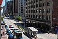
There are 59 stations along Euclid Avenue that serve the HealthLine. All stations are equipped with a fare card vending machine, 24-hour lighting and an emergency phone. An illuminated text display informs passengers of expected arrival times. Between Public Square and East 107th Street, all stations have raised platforms that align with the floor of the rapid transit vehicle, easing boarding and alighting. [13]

Between Public Square and East 105th Street, Euclid Avenue has two "bus only" lanes close to the inner median which only allow HealthLine vehicles passage, reducing delays due to conflicts with general traffic during busy times. Complementing the HealthLine is a set of bike lanes on the outer edges of the stretch Euclid Avenue that connects Cleveland State University with Case Western Reserve University. [14]

As late as July 2010, the trip from East Cleveland to downtown during rush hour was more than 40 minutes – longer than the planned 33 minutes. This was due to traffic light timing and the 25  mph speed limit along most of the route. The speed limit was raised to 35 mph for buses and traffic light timing was adjusted further to combat this issue. [15] [16]

Shortly after the line began service, signal priority was discontinued along portions of the line. The decision has been referred to as a form of BRT creep. [17]

The HealthLine operates out of the Hayden Garage, located behind the Stokes-Windermere station.

Bus fleet

A HealthLine bus at the Adelbert Road bus stop HealthLine 2.jpg
A HealthLine bus at the Adelbert Road bus stop

The HealthLine's original fleet consists of 21 articulated New Flyer DE60LFA vehicles, each with a seating capacity of 47 and able to accommodate 53 more standing up. The vehicles have two doors on each side and run on a diesel-electric hybrid motor system, producing 90% fewer carbon emissions than conventional diesel buses; [18] [19] a Caterpillar C9 low-sulfur diesel engine generates electrical power to run smaller electric motors mounted on each of the wheels. [20] Each vehicle also has a GPS locator on board, which allowed automated traffic signals to give the HealthLine buses priority at busy intersections, until the feature was discontinued.

Sixteen CNG-powered New Flyer Xcelsior buses were added to the HealthLine fleet in 2021, commencing service in January 2022. [21]

Bus stops

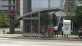
The RTA classifies its bus rapid transit stops as "curb stations" and "median stations". Median stations are located within the Euclid Avenue busway and can only be accessed using crosswalks. Median stations can utilize left- or right-side boarding, as buses have doors on both sides. Curb stations are more traditional bus stops where buses open their doors to the right curb of the street.

Schedule

On weekdays, the HealthLine runs every 7-10 minutes from 6:10 am to 7:10 pm, and every 15-30 minutes outside that window. On weekends and holidays, it runs every 15 minutes from 4:40 am to 11:40 pm and every 30 minutes outside that window. [22]

Stations

All stations are ADA-accessible Alternative Handicapped Accessible sign.svg

StationPlatform styleDoors openedLocationConnections / Notes
Public Square/West Roadwaycurbleft Downtown RTA Bus: 1, 3, 8, 9, 11, 14, 14A, 15, 19, 19A, 19B, 22, 25, 26, 26A, 39, 45, 51, 51A, 53, 53A, 55, 55B, 55C, 71, 77, 90, 251, B-Line Trolley
eastbound stop
Public Square/Tower City RTA Rapid Transit:       Red Line,       Blue Line,       Green Line,       Waterfront Line at Tower City station
RTA Bus: 1, 3, 8, 9, 11, 14, 14A, 15, 19, 19A, 19B, 22, 25, 26, 26A, 39, 45, 51, 51A, 53, 53A, 55, 55B, 55C, 71, 77, 90, 251, B-Line Trolley
Laketran: 10, 11, 12
METRO RTA: 61
PARTA: 100
SARTA: 4
eastbound stop
East 2nd Streetmedian
East 6th Street
East 9th Street
East 14th Street
East 19th Street2 medianright METRO RTA: 61
East 24th Street
East 30th Street Central
East 36th Street
East 40th Street
East 51st Street
East 59th StreetRTA Bus: 16
East 66th Street
East 71st Street
East 79th Street Fairfax RTA Bus: 2
East 83rd Street
East 89th Street
East 93rd StreetRTA Bus: 48, 50
East 100th StreetSunday service only
METRO RTA: 61 (weekdays only)
East 105th Street University Circle RTA Bus: 10, 11
Easternmost stop on exclusive BRT right-of-way
Stokes/Stearns2 curbRTA Bus: 9, 11, 50
Adelbert RoadRTA Bus: 9
Cornell RoadRTA Bus: 9
East 115th Street
East 118th Street
East 123rd Street
Lakeview Road East Cleveland
Delmont AvenuecurbWestbound stop
Roxbury RoadEastbound stop
Emily StreetWestbound stop
Garfield RoadEastbound stop
Superior Avenue2 curb RTA Rapid Transit:       Red Line at Superior station
RTA Bus: 3, 40
Eddy RoadcurbWestbound stop
Wellesley AvenueEastbound stop
Lakefront RoadWestbound stop
Belmore AvenueEastbound stop
Debra Ann LaneWestbound stop
Louis Stokes–Windermere Parking icon.svg RTA Rapid Transit:       Red Line (direct connection)
RTA Bus: 3, 7, 7A, 28, 28A, 31, 35, 37, 41, 41F

See also

Related Research Articles

<span class="mw-page-title-main">Bus rapid transit</span> Public transport system

Bus rapid transit (BRT), also referred to as a busway or transitway, is a bus-based public transport system designed to have much more capacity, reliability and other quality features than a conventional bus system. Typically, a BRT system includes roadways that are dedicated to buses, and gives priority to buses at intersections where buses may interact with other traffic; alongside design features to reduce delays caused by passengers boarding or leaving buses, or paying fares. BRT aims to combine the capacity and speed of a light rail or metro system (LRT) or heavy rail with the flexibility, lower cost and simplicity of a bus system.

<span class="mw-page-title-main">RTA Rapid Transit</span> Public transit network in Cleveland, Ohio

RTA Rapid Transit is a rapid transit and light rail system owned and operated by the Greater Cleveland Regional Transit Authority (GCRTA).

<span class="mw-page-title-main">Greater Cleveland Regional Transit Authority</span> Public transit agency for the city and suburbs of Cleveland, Ohio, USA

The Greater Cleveland Regional Transit Authority is the public transit agency for Cleveland, Ohio, United States and the surrounding suburbs of Cuyahoga County. RTA is the largest transit agency in Ohio, with a ridership of 19,104,900, or about 67,300 per weekday as of the first quarter of 2023.

<span class="mw-page-title-main">Transitway (Ottawa)</span> Bus rapid transit system in Ottawa, Canada

The Transitway is a bus rapid transit (BRT) network operated by OC Transpo in Ottawa, Ontario, Canada. It comprises a series of bus-only roadways and reserved lanes on city streets and highways. The dedicated busways ensure that buses and emergency vehicles on the Transitway rarely intersect directly with the regular traffic, and make it possible for them to continue at full speed even during rush hour. OC Transpo operates a network of rapid routes which use the Transitway to connect communities with the O-Train light rail system. Additional bus routes also use segments of the Transitway.

<span class="mw-page-title-main">University Circle</span> Neighborhood of Cleveland, Ohio, United States

University Circle is a district in the neighborhood of University on the East Side of Cleveland, Ohio. It is home to the Cleveland Museum of Art, Severance Hall, the Cleveland Institute of Art, Case Western Reserve University, the Cleveland Institute of Music, the Museum of Contemporary Art Cleveland; the Cleveland Botanical Garden; historic Lake View Cemetery; the Cleveland Museum of Natural History; and University Hospitals/Case Medical Center.

<span class="mw-page-title-main">Waterfront Line</span>

The Waterfront Line is a light rail line of the RTA Rapid Transit system in Cleveland, Ohio, running from Tower City Center downtown, then north and northeast to South Harbor station, adjacent to the Cleveland Municipal Parking Lot. The Waterfront Line is the newest rail line in Cleveland, having opened in 1996. The 2.2 mile line is unique in that it is an extension of the Blue and Green lines, but has its own naming designation. All RTA light rail lines use overhead lines and pantographs to draw power.

<span class="mw-page-title-main">Blue Line (RTA Rapid Transit)</span>

The Blue Line is a light rail line of the RTA Rapid Transit system in Cleveland and Shaker Heights, Ohio, running from Tower City Center downtown, then east and southeast to Warrensville Center Blvd near Chagrin Blvd. 2.6 miles (4.2 km) of track, including two stations, are shared with the rapid transit Red Line, the stations have low platforms for the Blue Line and high platforms for the Red Line. The Blue Line shares the right-of-way with the Green Line in Cleveland, and splits off after passing through Shaker Square. All RTA light rail lines use overhead lines and pantographs to draw power.

<span class="mw-page-title-main">Green Line (RTA Rapid Transit)</span>

The Green Line is a light rail line of the RTA Rapid Transit system in Cleveland and Shaker Heights, Ohio, running from Tower City Center downtown, then east to Green Road near Beachwood. 2.6 miles (4.2 km) of track, including two stations, are shared with the rapid transit Red Line, the stations have low platforms for the Green Line and high platforms for the Red Line. The Green Line shares the right-of-way with the Blue Line in Cleveland, and splits off after passing through Shaker Square. All RTA light rail lines use overhead lines and pantographs to draw power.

<span class="mw-page-title-main">Red Line (RTA Rapid Transit)</span>

The Red Line is a rapid transit line of the RTA Rapid Transit system in Cleveland, Ohio, running from Cleveland Hopkins International Airport northeast to Tower City in downtown Cleveland, then east and northeast to Windermere. 2.6 miles (4.2 km) of track, including two stations, are shared with the light rail Blue and Green Lines; the stations have high platforms for the Red Line and low platforms for the Blue and Green Lines. The whole Red Line is built next to former freight railroads. It follows former intercity passenger rail as well, using the pre-1930 right-of-way of the New York Central from Brookpark to West 117th, the Nickel Plate from West 98th to West 65th, and the post-1930 NYC right-of-way from West 25th to Windermere. The Red Line uses overhead lines and pantographs to draw power and trains operate using One-man operation. In 2022, the line had a ridership of 2,808,200, or about 9,000 per weekday as of the first quarter of 2023.

<span class="mw-page-title-main">Metro Red Line (Minnesota)</span>

The Metro Red Line is a bus rapid transit line between the Twin Cities suburbs of Bloomington, Minnesota and Apple Valley, Minnesota. The Red Line travels primarily on Minnesota State Highway 77 and Cedar Avenue from the Apple Valley station in Apple Valley, north through Eagan, Minnesota, to the Mall of America station in Bloomington where it connects to the Metro Blue Line. The line has bus rapid transit elements including bus-only lanes, specially branded vehicles, transit signal priority, and dedicated stations.

The Riverview Corridor is a transit corridor connecting Downtown Saint Paul and the Mall of America in Bloomington via the Minneapolis-Saint Paul International Airport. The corridor serves an area from the Saint Paul Union Depot to the Mall via parts of the Metro Green Line and the Metro Blue Line, and a route running parallel to West 7th Street, which runs southwest from Downtown Saint Paul. The corridor creates a triangle connecting opposite ends of the Blue Line and Green Line.

<span class="mw-page-title-main">Louis Stokes Station at Windermere</span> Rapid transit station in Cleveland

Louis Stokes Station at Windermere is a rapid transit station on the RTA Red Line in East Cleveland, Ohio. It is located on the northwest side of Euclid Avenue between Bryn Mawr and Doan Roads. It is the eastern terminus of the Red Line and the HealthLine, a bus rapid transit route.

<span class="mw-page-title-main">Euclid–East 120th station</span>

Euclid–East 120th was a station on the RTA Red Line in the University Circle neighborhood of Cleveland, Ohio. It was located at the Euclid Avenue and Coltman Road intersection, near the western end of Lake View Cemetery. At the end of service on August 11, 2015, it became the first, and thus far only, station in the history of the RTA to permanently close.

<span class="mw-page-title-main">CT Fastrak</span> Bus rapid transit operations in Connecticut, USA

CTfastrak is a regional bus rapid transit system currently operating between downtown Hartford and Downtown New Britain station in New Britain in central Connecticut. Operated by Connecticut Transit, it is the first bus rapid transit system in Connecticut and the second in New England after the MBTA Silver Line. CTfastrak opened on March 28, 2015 after fifteen years of planning and three years of construction.

<span class="mw-page-title-main">South Busway</span>

The South Busway is a two-lane bus rapid transit highway serving southern portions of the city of Pittsburgh. The busway runs for 4.3 miles (6.9 km) from the Mt. Washington Transit Tunnel across the Monongahela River from Downtown Pittsburgh to the Overbrook neighborhood of the city, bypassing the crowded Pennsylvania Route 51. It is owned and maintained by Pittsburgh Regional Transit, the public transit provider for Allegheny County and the Pittsburgh region.

<span class="mw-page-title-main">Winnipeg RT</span> Winnipeg Rapid Transit

Winnipeg RT is a bus rapid transit system of Winnipeg Transit in Winnipeg, Manitoba, Canada, currently consisting of the Southwest Transitway. Future expansions are in the planning stages, consisting of an Eastern Corridor connecting downtown to Transcona and a West-North Corridor connecting St. James with Downtown and West Kildonan.

<span class="mw-page-title-main">RapidRide G Line</span> Future bus rapid transit route in Seattle, Washington

The RapidRide G Line is a future RapidRide bus service in Seattle, Washington, operated by King County Metro on Madison Street between Downtown Seattle and Madison Valley. The line is projected to open for service in 2024 and cost $133.4 million.

<span class="mw-page-title-main">Transportation in Cleveland</span>

The transportation system of Cleveland is a network that includes several modes of transportation including sidewalks, roads, public transit, bicycle paths and regional and international airports.

<span class="mw-page-title-main">CMAX</span> Bus rapid transit line in Columbus, Ohio

CMAX is a bus rapid transit (BRT) service in Central Ohio, operated by the Central Ohio Transit Authority (COTA). The line begins in Downtown Columbus, traveling northeast to Westerville. CMAX is Central Ohio's first bus rapid transit line; it began operation in 2018.

References

  1. Greater Cleveland Regional Transit Authority (24 October 2008). "HealthLine opens, pumping new life into Cleveland" . Retrieved 26 January 2020.
  2. Clinic, UH pay to name Euclid Corridor buses. The Plain Dealer. Retrieved on March 4, 2008.
  3. 1 2 "Where it goes" -
  4. "Greater Cleveland Regional Transit Authority". www.riderta.com. 11 March 2013. Retrieved 2015-04-12.
  5. "The Greater Cleveland Regional Transit Authority (GCRTA) | National Transit Database". www.nationaltransitdatabase.org. Retrieved 2019-08-13.
  6. "Albuquerque, NM Opens First USA Gold Standard BRT on Historic Route 66". Transport Matters. Institute for Transportation and Development Policy. November 27, 2017. Retrieved April 26, 2020.
  7. "BRT Rankings". Institute for Transportation and Development Policy. 2020. Retrieved April 26, 2020.
  8. "Cleveland, Ohio, Euclid Avenue BRT" (PDF). Transportation Research Board. Retrieved 2020-05-01.
  9. 1 2 Report on Funding Levels and Allocations of Funds for Transit Major Capital Investments: Report of the Secretary of Transportation to the United States Congress Pursuant to 49 U.S.C. 5309(m)(3) (formerly Section 3(j) of the Federal Transit Act). Federal Transit Administration. 1997. Retrieved 2020-05-01.
  10. Department of Transportation and Related Agencies Appropriations Bill, 2003. United States Congress. p. 123. Retrieved 2020-05-01.
  11. Euclid Corridor Transportation Project Before-and-After Study (2012) (PDF). Federal Transit Administration. 2012. Retrieved 2020-05-01.
  12. "Clinic, UH pay to name Euclid Corridor buses". The Plain Dealer. 2008-02-28.
  13. "What it is - Station" -
  14. Rapid Transit Vehicles - http://euclidtransit.org/rapid_transit_system/euclid_corridor_vehicles.asp Archived 2008-06-21 at the Wayback Machine
  15. McIntyre, Michael (17 July 2010). "Cleveland allows RTA buses to drive faster on Euclid Avenue". Cleveland Plain Dealer. Retrieved 1 August 2010.
  16. Farkas, Karen (6 July 2010). "HealthLine buses moving slower than expected on Euclid Avenue". Cleveland Plain Dealer Blog. Retrieved 1 August 2010.
  17. Ross, Benjamin. "Big Philanthropy Takes the Bus". Dissent Magazine. Dissent Magazine. Retrieved 5 October 2016.
  18. RTA HealthLine -
  19. "What it is - Vehicle" -
  20. Euclid Corridor Transportation Project - http://euclidtransit.org/rapid_transit_system/euclid_corridor_vehicles.asp Archived 2008-06-21 at the Wayback Machine
  21. "Greater Cleveland Regional Transit Authority 6001-6016". CPTDB Wiki. Canadian Public Transit Discussion Board. Retrieved 2023-04-05.
  22. "Schedule Effective April 21, 2013" - http://www.riderta.com/sites/default/files/schedule-pdfs/HealthLine.pdf
Template:Attached KML/HealthLine
KML is from Wikidata