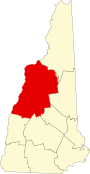
Hebron is a town in Grafton County, New Hampshire, United States. The population was 632 at the 2020 census. Settlements include the town center and the village of East Hebron.
The Lyndeborough Center Historic District, located in the town of Lyndeborough, New Hampshire, United States, consists of three structures: the Town Pound, Town Hall, and Congregational Church. The district was placed on the National Register of Historic Places in 1984. In 2010, by town meeting vote, this district became part of a larger, officially zoned local historic district.


The Amherst Village Historic District encompasses the historic village center of Amherst, New Hampshire. Centered on the town's common, which was established about 1755, Amherst Village is one of the best examples of a late-18th to early-19th century New England village center. It is roughly bounded on the north by Foundry Street and on the south by Amherst Street, although it extends along some roads beyond both. The western boundary is roughly Davis Lane, the eastern is Mack Hill Road, Old Manchester Road, and Court House Road. The district includes the Congregational Church, built c. 1771-74, and is predominantly residential, with a large number of Georgian, Federal, and Greek Revival houses. Other notable non-residential buildings include the Farmer's Bank, a Federal-style brick building built in 1806, and the Amherst Brick School, a brick Greek Revival structure that has served as the School Administrative Unit 39 offices since 1997.

The Grasmere Schoolhouse No. 9 and Town Hall, also known as the Grasmere Grange Hall, is a historic municipal building located at 87 Center Street in the village of Grasmere in Goffstown, New Hampshire. Built in 1889 as a town hall and school, it has served a variety of civic and community functions since its construction, and is a good example of civic Queen Anne architecture. It was listed on the National Register of Historic Places in 1990.

The New Hampshire State Register of Historic Places (NHSRHP) is a register of historic places administered by the state of New Hampshire and the New Hampshire Division of Historical Resources. Buildings, districts, sites, landscapes (such as cemeteries, parks or town forests), structures, or objects can be added to the register. The register was initiated in 2001 and is authorized by RSA 227 C:33.

The East Andover Village Center Historic District encompasses the historic village center of East Andover, New Hampshire, United States. The 2.2-acre (0.89 ha) district includes a cemetery and three buildings: the Andover Congregational Church, the Highland Lake Grange Hall, and the East Andover Schoolhouse. It is located at the corner of New Hampshire Route 11 and Chase Hill Road. The district is unified by the appearance of the three buildings, and their styling, which is predominantly vernacular 19th century.
The Salisbury Academy Building is a historic school building at 9 Old Coach Road in Salisbury, New Hampshire. Built in 1796, the building has housed a district school, private secondary school, the local Grange chapter, and town offices and civic functions. The building was listed on the National Register of Historic Places in 1975. It presently houses town offices.

The Canaan Street Historic District encompasses the historic original town center of Canaan, New Hampshire. It is a basically linear district, running along Canaan Street roughly from Prospect Hill Road in the north to Moss Flower Lane in the south. The town flourished first as a stagecoach stop, and then as a resort colony in the late 19th century. The historic district was listed on the National Register of Historic Places in 1973. It included 60 contributing buildings.

The Dorchester Common Historic District encompasses three public buildings that front the public common in the village of Dorchester, New Hampshire. The oldest of the three buildings is the schoolhouse, which dates to 1808 and is now a local museum. The Dorchester Community Church was built in 1828, and the town hall in 1844, on the site of the town's first (1828) town hall. The district was listed on the National Register of Historic Places in 1985; the church was also separately listed in 1980.
The Dublin Village Historic District encompasses the historic village center of Dublin, New Hampshire. Dublin's center developed in the 19th century after its original village center was abandoned due to harsher winter conditions nearer Dublin Pond. The district extends along Main Street from its junction with Lake Street in the west to the junction with Old County Road in the east, and includes sections of Old Common Road, Harrisville Road, and Church Street. The district was listed on the National Register of Historic Places in 1983.

The Orford Street Historic District encompasses a particularly attractive stretch of Orford Street in Orford, New Hampshire. It was described as early as the 18th century as "the most charming country village", with a tree-lined promenade that is still a focus of the town center. The district consists of about 0.5 miles (0.80 km) of Orford Street, between its junctions with New Hampshire Route 25A and Archertown Road, and was listed on the National Register of Historic Places in 1977.

The Hancock Village Historic District encompasses the town center of Hancock, New Hampshire. It extends the length of Hancock's Main Street, from Pine Ridge Cemetery and the common to the west, and the junction of Bennington, Norway Hill, and Forest roads to the east. It then extends a short way up Bennington Road. The common was laid out in 1785, and the village developed nearby over the next 100+ years. The district was listed on the National Register of Historic Places in 1988.

The Wakefield Village Historic District encompasses the historic village center of Wakefield, New Hampshire. It is centered at the junction of New Hampshire Route 153 and Mountain Laurel Road, which was historically the major north–south route in Carroll County. The district consists mainly of residential properties dating from the 18th to early 20th centuries, and also includes the 1836 town hall, public library¸ Grange Hall, and a one-room schoolhouse that now houses the local historical society. The district was listed on the National Register of Historic Places in 1984.

The Temple Town Hall, also known as the Union Hall and the Miller Grange Hall, is a historic municipal building in the center of Temple, New Hampshire. Built in 1842, it is a fine example of Greek Revival architecture, which has served the community as a church, Grange hall, and town hall. It continues to be used for social functions. The building was listed on the National Register of Historic Places in June 2007, and the New Hampshire State Register of Historic Places in April 2007.

The North Charlestown Historic District encompasses a 19th-century rural village in Charlestown, New Hampshire. Located about 5 miles (8 km) north of the town's center, the district includes a small cluster of buildings along New Hampshire Route 12A that is a remnant portion of a larger agricultural village. First settled in the 1750s, the oldest buildings in the district date to the 1790s, and most of the major buildings were built in the 19th century. Its economy was based on lumber and farming. The village was once considered a much larger, dispersed settlement, but construction of New Hampshire Route 11 in the 1960s separated some of the more remote parts of the village from its nucleus, which was bypassed by that construction.

The Monument Square Historic District of Alton, New Hampshire, encompasses the 19th-century heart of the town, a roughly triangular open space formed by the junction of Main Street and Old Wolfeboro Road between Factory Street and Church Street. It is notable for its well-preserved 19th-century buildings, and for its relatively uncommon shape, born out of the area's origin as a major road junction. The district was listed on the National Register of Historic Places in 1984.

The Francestown Town Hall and Academy and Town Common Historic District encompasses a collection of historic 18th and 19th-century civic resources in the center of Francestown, New Hampshire. Located at the junction of New Boston and Greenfield Roads are the town's 1846 Greek Revival town hall and academy building, a former academic dormitory building, and the town's historic common, which includes a rare example of an early 20th-century platform scale. The district was listed on the National Register of Historic Places in 2016.

Owls Head is an historic log cabin located on the shore of Newfound Lake in Hebron, New Hampshire. Built in 1927, it was added to the National Register of Historic Places in 2015.