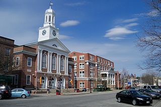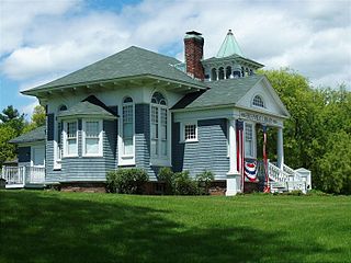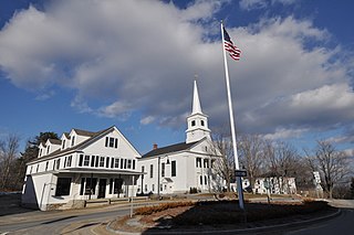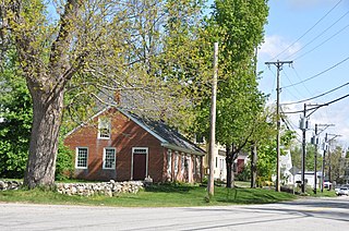
Lebanon is the only city in Grafton County, New Hampshire, United States. The population was 14,282 at the 2020 census, up from 13,151 at the 2010 census. Lebanon is in western New Hampshire, south of Hanover, near the Connecticut River. It is the home to Dartmouth–Hitchcock Medical Center and Dartmouth College's Geisel School of Medicine, together comprising the largest medical facility between Boston, Massachusetts, and Burlington, Vermont.

Enfield is a town in Grafton County, New Hampshire, United States. The population was 4,465 at the 2020 census. The town includes the villages of Enfield, Enfield Center, Upper Shaker Village, Lower Shaker Village, Lockehaven, and Montcalm.

The Hotchkissville Historic District is a historic district in the town of Woodbury, Connecticut, United States that was listed on the National Register of Historic Places in 1995. The district encompasses most of the historic village of Hotchkissville, which is centered at the junction of Washington and Weekeepeemee roads. The village began as a dispersed rural agricultural community, but developed in the 19th century with the arrival of industry, primarily the manufacture of textiles. Despite this, the village has retained a significantly rural character, and includes a broad cross-section of 18th- and 19th-century architectural styles.

The Enfield Shaker Museum is an outdoor history museum and historic district in Enfield, New Hampshire, in the United States. It is dedicated to preserving and sharing the history of the Shakers, a Protestant religious denomination, who lived on the site from 1793 to 1923. The museum features exhibitions, artifacts, eight Shaker buildings and restored Shaker gardens. It is located in a valley between Mount Assurance and Mascoma Lake in Enfield.

The Troy Village Historic District is a historic district encompassing the historic village center of Troy, New Hampshire, United States. The district is centered along New Hampshire Route 12, north to Marlborough Road and south to the junction with South Main Street. To the east of NH 12 it includes School Street, Mill Street, and Monadnock Street as far as Mill Street, and most of the abutting streets. On the west side it includes Russell, Water, and Prospect streets, and South Main Street nearly to Longmeadow Drive. It was listed on the National Register of Historic Places in 2002.

The Waterville Village Historic District encompasses most of the history 19th and early 20th-century village center of Waterville, Vermont. The village grew from beginnings late in the 18th century to serve as a modest civic, commercial, and residential hub for the rural community. It was added to the National Register of Historic Places in 2007.

The East Jaffrey Historic District is a historic district running roughly along NH Route 124 through Jaffrey, New Hampshire. It encompasses what is now the economic and civic heart of the town, centered on the Jaffrey Mills and the crossing of the Contoocook River by Route 124. It extends as far west as St. Patrick's Church beyond Charlonne Street and as far east as the US Post Office building at Route 124 and Ellison Street. To the north it extends along Peterborough Street to Christian Court, and to the south it extends along River Street and School Street to their junction. The district includes early 19th-century residential structures, as well as industrial buildings and housing associated with the Jaffrey Mills which arose in the mid-19th century. The district was added to the National Register of Historic Places in 2002.

The Somers Historic District encompasses the historic civic and social center of the town of Somers, Connecticut. It stretches along Main Street, with extensions along Springfield Road and Battle Street, and includes a significant number of vernacular Federal and Greek Revival houses. It includes the town's early churches, as well as important civic buildings, including the town hall and library. The district was listed on the National Register of Historic Places in 1982.

The West Chesterfield Historic District is a historic district that encompasses the 19th century industrial and residential heritage of the village of West Chesterfield in the town of Chesterfield, Massachusetts. Centered at the junction of Main Road and Ireland Street, it was one of the town's main industrial sites for many years. The district was listed on the National Register of Historic Places in 2008.

The Haverhill Corner Historic District encompasses the early civic center of Haverhill, New Hampshire, United States. The district is focused on the junction of New Hampshire Route 10 and Court Street, which was historically a major through route. Court Street is flanked at the junction by a pair of large grassy common areas which are bounded by School Street and Route 10. Buildings, predominantly Federal in character and built in the late 18th and early 19th centuries, are arrayed around these commons, and historic buildings line Route 10 and Court Street for a short distance away from the commons. Prominent buildings in the district include the 1827 Federal-style First Congregational Church, the 1840 former courthouse that now houses the public library and local historical society, and the Romanesque Revival 1897 Haverhill Academy Junior High School building. The area declined in importance after the railroad bypassed it, resulting in the gradual relocation of civic functions to the Woodsville area. The district was listed on the National Register of Historic Places in 1987.

The Hewitt House is a historic house on United States Route 4 in Enfield, New Hampshire. Built in 1871, it is a particularly fine example of late Italianate architecture, built for the manager of local woolen mills. The house was listed on the National Register of Historic Places in 1985, and included in the Enfield Village Historic District in 2010.

The Dublin Village Historic District encompasses the historic village center of Dublin, New Hampshire. Dublin's center developed in the 19th century after its original village center was abandoned due to harsher winter conditions nearer Dublin Pond. The district extends along Main Street from its junction with Lake Street in the west to the junction with Old County Road in the east, and includes sections of Old Common Road, Harrisville Road, and Church Street. The district was listed on the National Register of Historic Places in 1983.

The Jaffrey Center Historic District encompasses the traditional civic heart of the small town of Jaffrey, New Hampshire. The district lies to the west of the Jaffrey's main business district, extending along Main Street from Harkness Road to the Jaffrey Common, and along Thorndike Pond Road northward from Main Street. It includes the town's oldest civic buildings, and was its main center until the mills of East Jaffrey eclipsed it. The district was listed on the National Register of Historic Places in 1975.

The Bennington Village Historic District of Bennington, New Hampshire encompasses the 19th-century center of the village. Growth of the village followed a typical pattern for rural New Hampshire towns, based in this case around the growth in the early 19th century of the paper industry, which continues to be a significant economic force in the community. The district is centered on the junctions of Main, Center, and School Streets with Bible Hill Road and Francestown Road. The district was listed on the National Register of Historic Places in 2010.

The New Ipswich Center Village Historic District encompasses the historic center of the rural town of New Ipswich, New Hampshire. The center village is the town's most densely populated area, with a history dating to the town's founding in 1735. The district extends along Turnpike Road between King and Porter Roads, and southward in a roughly triangular shape, the southern point of which is at the junction of Main Street and Willard Road. The village includes a large number of residences, which were mainly agricultural at first, but also include a number of properties built as summer resort houses in the late 19th and early 20th centuries. It also includes most of the town's historic civic buildings, including its historic town hall, and the Barrett House, now a museum property owned by Historic New England. The district was listed on the National Register of Historic Places in 1991.

The Lower Village District encompasses a historic industrial area down the Sugar River a short way from the historic center of Claremont, New Hampshire. The area was developed beginning in the 1830s by the Claremont Mill Company, and extends on either side of the river roughly from the Main Street crossing in the west to the junction of Main and Central Streets.

The Newmarket Industrial and Commercial Historic District encompasses the heart of a distinctive 19th century mill town, Newmarket, New Hampshire. Its mill complex is regionally distinctive for its extensive use of stone from an early date, and the town is relatively well-preserved due to a significant economic decline after the mills closed in 1920. The district was listed on the National Register of Historic Places in 1980. The Stone School, listed in 1978, is a contributing resource.

The North Charlestown Historic District encompasses a 19th-century rural village in Charlestown, New Hampshire. Located about 5 miles (8 km) north of the town's center, the district includes a small cluster of buildings along New Hampshire Route 12A that is a remnant portion of a larger agricultural village. First settled in the 1750s, the oldest buildings in the district date to the 1790s, and most of the major buildings were built in the 19th century. Its economy was based on lumber and farming. The village was once considered a much larger, dispersed settlement, but construction of New Hampshire Route 11 in the 1960s separated some of the more remote parts of the village from its nucleus, which was bypassed by that construction.

The Tilton Downtown Historic District encompasses a roughly one-block section of Main Street in the center of Tilton, New Hampshire. It extends from Central Street in the west to Bridge and School Streets in the east, including all of the buildings on the north side of this section, and a cluster of buildings on the south side near Bridge Street. The area has long been a commercial and industrial center for the town, although most of the buildings now date from the late 19th century onward, and include a fine array of Victorian architecture. The district was listed on the National Register of Historic Places in 1983.

The Monument Square Historic District of Alton, New Hampshire, encompasses the 19th-century heart of the town, a roughly triangular open space formed by the junction of Main Street and Old Wolfeboro Road between Factory Street and Church Street. It is notable for its well-preserved 19th-century buildings, and for its relatively uncommon shape, born out of the area's origin as a major road junction. The district was listed on the National Register of Historic Places in 1984.


