Stone Arch Underpass | |
 | |
  | |
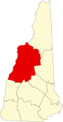
| Location | Glen Rd., Lebanon, New Hampshire |
|---|---|
| Coordinates | 43°38′3″N72°18′21″W / 43.63417°N 72.30583°W |
| Area | 0.2 acres (0.081 ha) |
| Built | 1848 |
| Built by | Northern Railroad |
| NRHP reference No. | 85002190 [1] |
| Added to NRHP | September 12, 1985 |
The Stone Arch Underpass is a historic stone arch bridge spanning Glen Road in Lebanon, New Hampshire. Built about 1848, it carried the Boston and Maine Railroad's former Northern Line. It is one of a small number of 19th-century stone arch bridges in the state, and the only one known in central western New Hampshire. The bridge was listed on the National Register of Historic Places in 1985. [1] The railroad right-of-way has been functionally abandoned, and the bridge may become part of a continuation of the Northern Rail Trail.