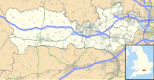
Site of Special Scientific Interest | |
Location | Berkshire |
---|---|
Grid reference | SU 378 597 [1] |
Coordinates | 51°20′02″N1°27′32″W / 51.334°N 1.459°W |
Interest | Biological |
Area | 23.7 hectares (59 acres) [1] |
Notification | 1988 [1] |
Location map | Magic Map |
Hog's Hole is a 23.7-hectare (59-acre) biological Site of Special Scientific Interest in the civil parish of Combe in the English county of Berkshire. [1] [2]
Hog's Hole is one of three nationally important chalk grassland sites that lie within the North Wessex Downs along with Rushmore and Conholt Downs (SSSI) and part of Inkpen and Walbury Hills (SSSI). [3]
Hog's Hole consists of a dry valley, or combe, cut in the Middle and Upper Chalk. The steep east and west-facing valley sides support only thin rendzina soils, an unusual feature being lines of bare chalk and flint scree. The valley opens out in its southern part, the remainder of the site consisting of a moderately steep and undulating south-facing slope and a steep west-facing slope rising to a plateau area. [4]
The site has been predominantly used for grazing sheep. [4]
The site has the following Fauna: [4]
The site has the following Flora: [4]
Beacon Hill is near the village of Burghclere and Watership Down, in north Hampshire. The hill's name is derived from the fact that it was one of many Beacon Hills in England and beyond. This hill was once the site of the most famous beacon in Hampshire. It is 261 metres high and has one of England's most well known hill forts on its slopes, visible from the main A34 road which passes close by. From there, outstanding views of the surrounding area and much of Hampshire may be obtained. The site is open to the public and managed by Hampshire County Council. It is an 80.7-hectare (199-acre) biological Site of Special Scientific Interest called Burghclere Beacon and a Nature Conservation Review site, Grade I.
Aire Point to Carrick Du SSSI is a Site of Special Scientific Interest on the Penwith Peninsula, Cornwall, England. It is 5.98 square kilometres in extent, stretching from grid reference SW360279 to grid reference SW513410. The site is designated both for its biological and its geological interest.
Beacon Hill, Warnford is a 46.4-hectare (115-acre) biological Site of Special Scientific Interest west of Warnford in Hampshire. It is a Nature Conservation Review site, and an area of 40.1 hectares is a national nature reserve. There is a round barrow cemetery dating to the Late Neolithic or Bronze Age on the hill, and this is a scheduled monument.
Bratton Downs is a 395.8 hectare biological and geological Site of Special Scientific Interest in Wiltshire, England, near the villages of Bratton and Edington, and about 3 miles (5 km) east of the town of Westbury. It was notified in 1971. The designated area consists mainly of chalk grassland, as well as some ancient woodland, and supports a diverse range of native flora and fauna. It overlays notable geological features—principally landforms created by glaciation in the Pleistocene.
Bowerchalke Downs, is a 134 hectares biological Site of Special Scientific Interest in southern Wiltshire, England, notified in 1971.
Pewsey Downs is a 305.3 hectare biological Site of Special Scientific Interest on the southern edge of the Marlborough Downs north of Pewsey in Wiltshire, notified in 1951. It includes the Pewsey Downs National Nature Reserve.
Gallows Hill SSSI is a Site of Special Scientific Interest on the north side of the Ebble Valley in south Wiltshire, England. Its chalk grassland and scrub contain a number of animal and plant species that are nationally rare. The 27.8 hectares site was notified in 1965.
Park Gate Down or Parkgate Down is a 7-hectare (17-acre) biological Site of Special Scientific Interest south-east of Stelling Minnis in Kent. It is also a Special Area of Conservation and is managed by the Kent Wildlife Trust,
Clayton to Offham Escarpment is a 422.5-hectare (1,044-acre) linear biological Site of Special Scientific Interest (SSSI) which runs from Clayton in West Sussex to Lewes in East Sussex. Its ownership and management is divided between over fifteen landowners and farmers. Parts of Ditchling's Downs, e.g. TQ 323 133, and the scarp between Blackcap and Mount Harry, e.g. TQ 378 124, are owned by the National Trust. What remains of Ditchling Tenantry Down common at Ditchling Beacon is leased to the Sussex Wildlife Trust.
The Bottoms is a Site of Special Scientific Interest in County Durham, England. It lies just south of the A181 road, roughly midway between the villages of Cassop and Wheatley Hill, some 10 km south-east of Durham city.
Allolee to Walltown is the name given to a Site of Special Scientific Interest (SSSI) in Northumberland, England. The site, which follows the path of a section of Hadrian's Wall, is notable for an unusually wide range of grassland types growing on thin soil above the Whin Sill, a rock formation peculiar to the Northern Pennines.
Barrow Burn Meadows is a Site of Special Scientific Interest (SSSI) in north Northumberland, England. The site is a species-rich hay meadow of a sort now rare in Northumberland.
Beltingham River Shingle is the name given to a Site of Special Scientific Interest (SSSI) in Northumberland in the north-east of England, notable for an unusual community of flora tolerant to the high levels of naturally occurring heavy metals in the sediment of a section of the River South Tyne.
Streatley Warren is a 31.3-hectare (77-acre) biological Site of Special Scientific Interest west of Streatley in Berkshire. It is in the North Wessex Downs, which is an Area of Outstanding Natural Beauty.
Inkpen Crocus Fields is a 3.1-hectare (7.7-acre) biological Site of Special Scientific Interest near Inkpen in Berkshire. It is managed by the Berkshire, Buckinghamshire and Oxfordshire Wildlife Trust.
Westfield Farm Chalk Bank is a 14.1-hectare (35-acre) biological Site of Special Scientific Interest west of East Garston in Berkshire.
King's Copse is a 13.7-hectare (34-acre) biological Site of Special Scientific Interest between Chapel Row and Clay Hill in Berkshire. It is in the North Wessex Downs, which is an Area of Outstanding Natural Beauty. The site is private land but a public footpath runs through it.
Combe Wood and Linkenholt Hanging is a 106.5-hectare (263-acre) biological Site of Special Scientific Interest south of Hungerford in Berkshire. It is in the North Wessex Downs, which is an Area of Outstanding Natural Beauty.
Fallowlees Flush is the name given to a Site of Special Scientific Interest (SSSI) in mid-Northumberland, England. The steeply sloping site has calcium-rich springs supporting vegetation rare in the county.
Beeding Hill to Newtimber Hill is a 321 ha (790-acre) biological and geological Downland Site of Special Scientific Interest (SSSI) north of Shoreham-by-Sea in West Sussex. It is a Nature Conservation Review site, Grade 2, and it includes Devil's Dyke Geological Conservation Review site.