
Gedney is a village, civil parish and electoral ward in the South Holland district of Lincolnshire, England. It is just to the south of the A17 Boston to King's Lynn road, 2 miles (3.2 km) east from Holbeach and 2 miles (3.2 km) north-west from Long Sutton. The parish stretches east to The Wash, its villages and hamlets including Dawsmere, Gedney Broadgate, Gedney Drove End, Gedney Dyke, Gedney Marsh, and the geographic extension of Gedney Church End.

East Kirkby is a village and civil parish in the East Lindsey district of Lincolnshire, England. It is situated 7 miles (11 km) south-east from Horncastle, and on the A155 road.

Fleet is a village, civil parish and electoral ward in the South Holland district of Lincolnshire, England. It lies on Delph Bank, 3 miles (4.8 km) south-east from Holbeach. The population of the civil parish, including Fleet Hargate, at the 2011 census was 2136.

Kirmington is a village in North Lincolnshire, England. It is part of the civil parish of Kirmington and Croxton. From the 2011 census the village became a civil parish in its own name. Kirmington is situated just north from the A18 road, 5 miles (8 km) west from Immingham and 7 miles (11 km) east from Brigg. Less than 1 mile (1.6 km) to the west is Humberside International Airport, the former Second World War station, RAF Kirmington.

Hogsthorpe is a small village in the East Lindsey district of Lincolnshire, England. It is situated approximately 2 miles (3 km) from the North Sea and Chapel St Leonards, and about 7 miles (11 km) north from Skegness. Through Hogsthorpe runs the A52, the main road connecting the village to the nearby resorts of Skegness, Mablethorpe and Ingoldmells.

Honington is an English village and civil parish in the South Kesteven district of Lincolnshire. It lies just north of the junction between the A153 and A607 roads, about 5.5 miles (8.9 km) north of Grantham and 8 miles (12.9 km) west of Sleaford.
Fulstow is a marsh village and civil parish in the East Lindsey district of Lincolnshire, England. It is situated 6 miles (10 km) north of Louth and 8 miles (13 km) south of Grimsby.
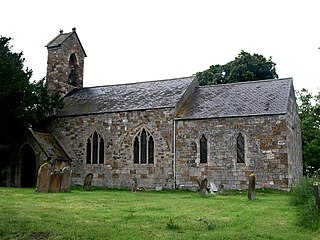
Hainton is a village and civil parish in the East Lindsey district of Lincolnshire, England. It is situated on the A157 road, 10 miles (16 km) west from Louth and 5 miles (8 km) south-east from Market Rasen.

South Willingham is a village and civil parish in the East Lindsey district of Lincolnshire, England. It is situated 1 mile (1.6 km) south-west from the A157 road, 8 miles (13 km) south-east from Market Rasen, 10 miles (16 km) north from Horncastle and 10 miles west from Louth.

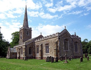
Gayton le Wold is a village and civil parish in the East Lindsey district of Lincolnshire, England. It lies 6 miles (10 km) west from Louth, 3 miles (5 km) north from Donington on Bain, and to the south of the A157. The parish includes Biscathorpe 1 mile (1.6 km) to the south-west.

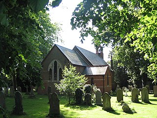
Gautby is a village in the East Lindsey district of Lincolnshire, England. The village is situated 6 miles (10 km) north-west from the town of Horncastle, and is part of the Minting civil parish.
Holbeach Hurn is a small fenland village in the civil parish of Holbeach in the South Holland district of southern Lincolnshire, England. It is situated 2.5 miles (4.0 km) north-east from Holbeach and 1 mile (1.6 km) north from the A17, and lies at the south-east of Holbeach Marsh.

Holbeach St Marks is a fenland village in the South Holland district of southern Lincolnshire, England. It is situated 4 miles (6 km) north from Holbeach, 3 miles (5 km) from The Wash, and at the centre of Holbeach Marsh.

Holbeach Fen is a fenland settlement and area in the South Holland district of southern Lincolnshire, England. It is situated 3 miles (5 km) south from Holbeach and 3 miles north-west from Sutton St James.

Fotherby is a village and civil parish in the East Lindsey district of Lincolnshire, England. It is situated just east from the A16 road, 13 miles (21 km) east from Market Rasen, and 10 miles (16 km) south from Cleethorpes.

Moulton Seas End is a village in the South Holland district of Lincolnshire, England. It is situated 5 miles (8.0 km) north-east from the centre of Spalding and 2 miles (3.2 km) north-west from Holbeach. The village is part of the civil parish of The Moultons, a village 2 miles to the south.

Holbeach Clough is a fenland village in the South Holland district of Lincolnshire, England. It is situated just under 2 miles (3 km) north from the market town of Holbeach, and on the A17 road. The village is almost conjoined at the east to the village of Holbeach Bank. The village is part of the Holbeach civil parish, and is at the south-west edge of Holbeach Marsh.

Holbeach Bank is a fenland village in the South Holland district of Lincolnshire, England. It is situated just under 2 miles (3 km) north from the market town of Holbeach, and 1 mile (2 km) to the east of the A17 road. The village is almost conjoined at the west to the village of Holbeach Clough. Holbeach Bank is part of the Holbeach civil parish and is at the south-east edge of Holbeach Marsh.

Holbeach Marsh is a fenland area in the South Holland district of Lincolnshire, England.

