Horseshoe Beach, Florida | |
|---|---|
 Aerial photo of Horseshoe Beach | |
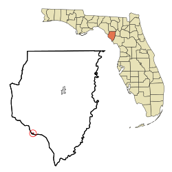 Location in Dixie County and the state of Florida | |
| Coordinates: 29°26′26″N83°17′17″W / 29.44056°N 83.28806°W | |
| Country | United States |
| State | Florida |
| County | Dixie |
| Settled (Butler Settlement) | c. 1820s-1890s [1] |
| Settled (Shelton) | 1910 [1] |
| Settled (Horseshoe) | 1935-1948 [1] |
| Incorporated (Town of Horseshoe Beach) | May 28, 1963 [1] [2] [3] |
| Government | |
| • Type | Mayor-Council |
| • Mayor [4] | Jeffrey "Jeff" Williams |
| • Councilmembers | Bryan Dodd, Brooke Hiers, James "JD" Nobles, and Brett Selph |
| • Town Clerk | Nicole "Nikki" Selph |
| • Town Attorney | Conrad Bishop Jr. |
| Area | |
• Total | 0.52 sq mi (1.34 km2) |
| • Land | 0.47 sq mi (1.21 km2) |
| • Water | 0.046 sq mi (0.12 km2) |
| Elevation | 7 ft (2.1 m) |
| Population (2020) | |
• Total | 165 |
| • Density | 352.0/sq mi (135.89/km2) |
| Time zone | UTC-5 (Eastern (EST)) |
| • Summer (DST) | UTC-4 (EDT) |
| ZIP code | 32648 |
| Area code | 352 |
| FIPS code | 12-32650 [7] |
| GNIS feature ID | 2405866 [6] |
| Website | www |
Horseshoe Beach is a town in southern Dixie County, Florida, United States. The town is part of Big Bend and the Nature Coast in North Florida, along the Gulf of Mexico. The population was 165 at the 2020 census.
