Howard Township, Centre County, Pennsylvania

Last updated
Howard Township,
Pennsylvania
Township
Howard VFW, Howard TWP, CentreCo PA.jpg
Howard VFW
Map of Howard Township, Centre County, Pennsylvania Highlighted.png
Map of Centre County, Pennsylvania highlighting Howard Township
Map of Pennsylvania highlighting Centre County.svg
Map of Centre County, Pennsylvania
Country United States
State Pennsylvania
County Centre
Settled1778
Incorporated1810
Area
[1]
  Total18.92 sq mi (49.00 km2)
  Land18.00 sq mi (46.63 km2)
  Water0.92 sq mi (2.38 km2)
Population
 (2020) [2]
  Total878 Decrease2.svg
  Estimate 
(2021) [2]
875
  Density53.22/sq mi (20.55/km2)
FIPS code 42-027-35968
Historical population
CensusPop.Note
2000 924
2010 9644.3%
2020 878−8.9%
2021 (est.)875 [2] −0.3%
U.S. Decennial Census [3]

Howard Township is a township in Centre County, Pennsylvania, United States. It is part of the State College, Pennsylvania Metropolitan Statistical Area. The population was 878 at the 2020 census. [2] Part of Bald Eagle State Park is in Howard Township.

Contents

Geography

According to the United States Census Bureau, the township has a total area of 18.9 square miles (49.0 km2), of which 18.0 square miles (46.6 km2) is land and 0.93 square miles (2.4 km2), or 4.85%, is water. [4]

Howard Township is bordered by Curtin Township to the northwest, Liberty Township to the northeast, Marion Township to the southeast and Boggs Township to the southwest and it surrounds the borough of Howard. The township includes the census-designated place of Mount Eagle and part of Holters Crossing.

Demographics

As of the census [5] of 2000, there were 924 people, 344 households, and 275 families residing in the township. The population density was 50.3 people per square mile (19.4 people/km2). There were 375 housing units at an average density of 20.4 per square mile (7.9/km2). The racial makeup of the township was 99.03% White, 0.54% African American, 0.22% Native American, 0.22% from other races. Hispanic or Latino of any race were 0.65% of the population.

There were 344 households, out of which 32.3% had children under the age of 18 living with them, 68.3% were married couples living together, 6.7% had a female householder with no husband present, and 19.8% were non-families. 15.7% of all households were made up of individuals, and 7.0% had someone living alone who was 65 years of age or older. The average household size was 2.69 and the average family size was 3.01.

In the township the population was spread out, with 23.4% under the age of 18, 7.5% from 18 to 24, 31.6% from 25 to 44, 27.2% from 45 to 64, and 10.4% who were 65 years of age or older. The median age was 38 years. For every 100 females, there were 104.4 males. For every 100 females age 18 and over, there were 103.4 males.

The median income for a household in the township was $39,375, and the median income for a family was $43,068. Males had a median income of $31,522 versus $21,316 for females. The per capita income for the township was $16,175. About 3.8% of families and 5.5% of the population were below the poverty line, including 9.8% of those under age 18 and 4.6% of those age 65 or over.

Notable people

Related Research Articles

<span class="mw-page-title-main">Germany Township, Adams County, Pennsylvania</span> Township in Pennsylvania, United States

Germany Township is a township in Adams County, Pennsylvania, United States. The population was 2,844 at the 2020 census. The majority of early settlers were from Germany and Great Britain.

<span class="mw-page-title-main">Hamiltonban Township, Adams County, Pennsylvania</span> Township in Pennsylvania, United States

Hamiltonban Township is a township in Adams County, Pennsylvania, United States. The population was 2,372 at the 2010 census.

<span class="mw-page-title-main">Liberty Township, Centre County, Pennsylvania</span> Township in Pennsylvania, United States

Liberty Township is a township in Centre County, Pennsylvania, United States. It is part of the State College, Pennsylvania Metropolitan Statistical Area. The population was 1,825 at the 2020 census, an increase over the figure of 2,118 tabulated in 2010. Part of Bald Eagle State Park is in Liberty Township.

<span class="mw-page-title-main">Potter Township, Centre County, Pennsylvania</span> Township in Pennsylvania, United States

Potter Township is a township in Centre County, Pennsylvania, United States. It is part of the State College, Pennsylvania Metropolitan Statistical Area. The population was 3,614 at the 2020 census.

<span class="mw-page-title-main">Walker Township, Centre County, Pennsylvania</span> Township in Pennsylvania, United States

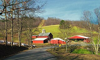
Walker Township is a township in Centre County, Pennsylvania, United States. It is part of the State College, Pennsylvania Metropolitan Statistical Area. The population was 4,639 at the 2020 census, an increase over the figure of 3,433 tabulated in 2010.

<span class="mw-page-title-main">Greenwood Township, Clearfield County, Pennsylvania</span> Township in Pennsylvania, United States

Greenwood Township is a township in Clearfield County, Pennsylvania, United States. The township has a population of 362 people, according to the 2020 United States census. Between Mahaffey and Grampian on U.S. Route 219, Greenwood Township contains the villages of Curry Run and Bells Landing. The West Branch of the Susquehanna River passes through it, along with several abandoned and presently used railroad grades.

<span class="mw-page-title-main">Main Township, Columbia County, Pennsylvania</span> Township in Pennsylvania, United States

Main Township is a township in Columbia County, Pennsylvania. It is part of Northeastern Pennsylvania. The population was 1,272 at the 2020 census. Main Township was settled in 1772 and incorporated in 1844. The iron industry was once preeminent in the township.

<span class="mw-page-title-main">Brownsville Township, Fayette County, Pennsylvania</span> Township in Pennsylvania, United States

Brownsville Township is a township in Fayette County, Pennsylvania, United States. The population was 534 at the 2020 census, a decline from the figure of 683 tabulated in 2010. It is served by the Brownsville School District.

<span class="mw-page-title-main">Connellsville Township, Fayette County, Pennsylvania</span> Township in Pennsylvania, United States

Connellsville Township is a township in Fayette County, Pennsylvania, United States. The population was 2,072 at the 2020 census, a decline from the figure of 2,391 tabulated in 2010.

<span class="mw-page-title-main">Springfield Township, Fayette County, Pennsylvania</span> Township in Pennsylvania, United States

Springfield Township is a township in Fayette County, Pennsylvania, United States. The population was 2,730 at the 2020 census. The Connellsville Area School District serves the township.

<span class="mw-page-title-main">Greene Township, Franklin County, Pennsylvania</span> Township in Pennsylvania, United States

Greene Township is a township in Franklin County, Pennsylvania, United States. The population was 18,436 at the 2020 census, up from 12,284 at the 2000 census. Part of Caledonia State Park is in Greene Township.

<span class="mw-page-title-main">Todd Township, Huntingdon County, Pennsylvania</span> Township in Pennsylvania, United States

Todd Township is a township in Huntingdon County, Pennsylvania, United States. The population was 899 at the 2020 census.

<span class="mw-page-title-main">Green Township, Indiana County, Pennsylvania</span> Township in Pennsylvania, United States

Green Township is a township in Indiana County, Pennsylvania, United States. Green Township was formed from Wheatfield Township circa 1816 and was named for the great evergreen forests covering the area. The population was 3,457 at the 2020 census. The township includes the communities of Bencetown, Berringer, Commodore, Cookport, Cush Cushion, Dixonville, Fleming Summit, Grisemore, Leard, Lovejoy, Martintown, Pine Flats, Prosperity Hill, Purchase Line, Shanktown, Starford, Spruce, Utah, Uniontown, and Wandin.

<span class="mw-page-title-main">Black Creek Township, Luzerne County, Pennsylvania</span> Township in Pennsylvania, United States

Black Creek Township is a township in Luzerne County, Pennsylvania, United States. The population was 1,904 as of the 2020 census.

<span class="mw-page-title-main">Granville Township, Mifflin County, Pennsylvania</span> Township in Pennsylvania, United States

Granville Township is a township in Mifflin County, Pennsylvania, United States. The population was 4,638 at the 2020 census.

<span class="mw-page-title-main">Hector Township, Potter County, Pennsylvania</span> Township in Pennsylvania, United States

Hector Township is a township in Potter County, Pennsylvania, United States. The population was 343 at the 2020 census.

<span class="mw-page-title-main">Bloss Township, Tioga County, Pennsylvania</span> Township in Pennsylvania, United States

Bloss Township is a township in Tioga County, Pennsylvania, United States. The population was 344 at the 2020 census.

<span class="mw-page-title-main">Chatham Township, Tioga County, Pennsylvania</span> Township in Pennsylvania, United States

Chatham Township is a township in Tioga County, Pennsylvania, United States. The population was 607 at the 2020 census.

<span class="mw-page-title-main">Lewis Township, Union County, Pennsylvania</span> Township in Pennsylvania, United States

Lewis Township is a township in Union County, Pennsylvania, United States. The population was 1,456 at the 2020 census. Sand Bridge State Park, a Pennsylvania state park, is in Lewis Township along Pennsylvania Route 192.

<span class="mw-page-title-main">Carroll Township, Washington County, Pennsylvania</span> Township in Pennsylvania, United States

Carroll Township is a township in Washington County, Pennsylvania, United States. The population was 5,381 at the 2020 census.

References

  1. "2016 U.S. Gazetteer Files". United States Census Bureau. Retrieved Aug 13, 2017.
  2. 1 2 3 4 Bureau, US Census. "City and Town Population Totals: 2020—2021". Census.gov. US Census Bureau. Retrieved August 12, 2022.
  3. "Census of Population and Housing". Census.gov. Retrieved June 4, 2016.
  4. "Geographic Identifiers: 2010 Census Summary File 1 (G001): Howard township, Centre County, Pennsylvania". U.S. Census Bureau, American Factfinder. Archived from the original on April 9, 2015. Retrieved April 9, 2015.
  5. "U.S. Census website". United States Census Bureau . Retrieved 2008-01-31.
41°01′00″N77°39′59″W / 41.01667°N 77.66639°W / 41.01667; -77.66639