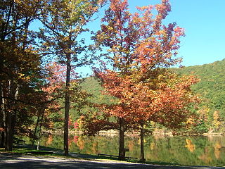
Eden Township is a township in southeastern Lancaster County, Pennsylvania, United States. At the 2020 census, the population was 2,248. It is part of the Solanco School District.

Albany Township is a township in Bradford County, Pennsylvania, United States. It is part of Northeastern Pennsylvania. The population was 860 at the 2020 census.

Penn Township is a township in Centre County, Pennsylvania, United States. It is part of the State College, Pennsylvania Metropolitan Statistical Area. The population was 1,214 at the 2020 census. Poe Valley State Park is in Penn Township.

Walker Township is a township in Centre County, Pennsylvania, United States. It is part of the State College, Pennsylvania Metropolitan Statistical Area. The population was 4,639 at the 2020 census, an increase over the figure of 3,433 tabulated in 2010.

Woodward is an unincorporated community and census-designated place in Haines Township, Centre County, Pennsylvania, United States. It is part of the State College, Pennsylvania, Metropolitan Statistical Area. The population was 110 at the 2010 census.

Franklin Township is a township in Columbia County, Pennsylvania. It is part of Northeastern Pennsylvania. The population was 552 at the 2020 census.

South Newton Township is a township in Cumberland County, Pennsylvania, United States. The population was 1,383 at the 2010 census.

Franklin Township is a township in Erie County, Pennsylvania, United States. As of the 2020 census, the township population was 1,509, which is down from the population of 1,633 in 2010.

Freeport Township is a township in Greene County, Pennsylvania, United States. The population was 268 at the 2020 census.

Young Township is a township in Jefferson County, Pennsylvania, United States. The population was 1,715 at the 2020 census. It was named for John Young, the pioneer judge of Westmoreland County. Young Township is the location of adjacent Punxsutawney's Groundhog Day celebration each February 2, during which thousands of attendees and international media outlets visit for an annual weather prediction by the groundhog Punxsutawney Phil. Although named for Punxsutawney, the actual prediction location, Gobbler's Knob, is in Young Township.

Fermanagh Township is a township in Juniata County, Pennsylvania, United States. The population was 2,865 at the 2020 census, an increase over the figure of 2,811 tabulated in 2010.

Southwest Madison Township is a township in Perry County, Pennsylvania, United States. The population was 1,020 at the 2020 census.

Eldred Township is a township in Schuylkill County, Pennsylvania, United States. Settled in 1805 and incorporated in 1849 from part of Upper Mahantongo Township, it is named for Judge Nathaniel Eldred. The population was 709 at the 2020 census.

Deerfield Township is a township in Tioga County, Pennsylvania, United States. The population was 541 at the 2020 census.

Delmar Township is a township in Tioga County, Pennsylvania, United States. The population was 2,796 at the 2020 census.

Farmington Township is a township in Tioga County, Pennsylvania, United States. The population was 664 at the 2020 census.

Tioga Township is a township in Tioga County, Pennsylvania, United States. The population was 941 at the 2020 census.

Deerfield Township is a township in Warren County, Pennsylvania, United States. The population was 270 at the 2020 census, down from 339 at the 2010 census.

Mount Pleasant Township is a township in Westmoreland County, Pennsylvania, United States. As of the 2020 census, the township population was 10,119. Mount Pleasant Township should not be confused with the Borough of Mount Pleasant, which is a separate municipality and comprises the town of that name.

Chanceford Township is a township located in the southeastern portion of York County, Pennsylvania, United States. The population was 5,935 at the 2020 census. The township is home to several campsites, Allegro Vineyards, and Apollo Park. The Mason-Dixon Trail runs through the township, and it borders the Susquehanna River on the east.


