Ichhi

Last updated

Ichhi
India Himachal Pradesh location map.svg
Red pog.svg
Ichhi
Location in Himachal Pradesh, India
India location map.svg
Red pog.svg
Ichhi
Ichhi (India)
Coordinates: 32°08′46″N76°16′42″E / 32.146061°N 76.278389°E / 32.146061; 76.278389 Coordinates: 32°08′46″N76°16′42″E / 32.146061°N 76.278389°E / 32.146061; 76.278389
CountryFlag of India.svg  India
State Himachal Pradesh
District Kangra
Area
  Total29.60 km2 (11.43 sq mi)
Elevation
1,457 m (4,780 ft)
Population
 (2015) [1]
  Total53,543
  Density1,800/km2 (4,700/sq mi)
Language
  Official Hindi
Time zone UTC+5:30 (IST)
PIN
176 209
Telephone code+91-1892
Vehicle registration HP 40,HP 68,HP 01D,HP 02D
Website www.hpkangra.nic.in

Ichhi (also Ichhi Khas) is a village and a Village Panchayat in Kangra district in the Indian state of Himachal Pradesh. Ichhi village is 8 kilometres from Kangra.

Contents

Near to it 10 km Dharamshala has been selected as one of the hundred Indian cities to be developed as a smart city under PM Narendra Modi's flagship Smart Cities Mission. [2]

Description

Ichhi is a village in the reaches of the Kangra Valley and is surrounded by fields and trees. The suburbs include Jhikli Ichhi, Ansoli, Patola, Mastpur, Zamanabad Road ICHHI.

Etymology

Ichhi (Devanagari: इच्छी ; ITRANS: is a Hindi word (derived from Sanskrit)

In common Hindi usage, the word इगेतेश्वर refers to god Shiv.

Ichhi History

Before the Raj

Until the British Raj, Dharamshala and its surrounding area was ruled by the Katoch Dynasty of Kangra, a royal family that ruled the region for two millennia. [3] The royal family still keeps a residence in Dharamsala, known as 'Clouds End Villa'. Under the British Raj, the regions were part of undivided province of Punjab, and was ruled by the governors of Punjab from Lahore. The Katoch dynasty, although highly regarded culturally, had been reduced to status of jargidars (of Kangra-Lambagraon) under the Treaty of Jawalamukhi, signed in 1810 between Sansar Chand Katoch and Maharaja Ranjit Singh of Sikh Empire. The indigenous people of the Dharamshala area (and the surrounding region) are the Gaddis, a predominantly Hindu group who traditionally lived a nomadic or semi-nomadic transhumant lifestyle. Due to the lack of permanent settlements in the area, some Gaddis lost their seasonal pastures and farmland when the British and the Gurkhas arrived to settle.

Settlement

"Ichhi village lies on a spur of the Dhaola Dhār, 6 miles north-east of Kāngra, in the midst of wild and picturesque scenery.
"Before the earthquake of 1905, it was very well populated.

In 1905, the Kangra valley suffered a major earthquake. On 4 April of that year, the earth shook, demolishing much neighbouring city of Kangra, Himachal Pradesh . Altogether, the 1905 Kangra earthquake killed 20,000 people. "1,625 persons perished at Dharamsāla alone."

Geography

Ichhi Village is located in the Kangra Valley, in the shadow of the Dhauladhar mountains.

The main crops grown in the valleys below are rice, wheat and vegetables.

Major suburbs

Connections

Dharamshala town is reached by Dharamshala Gaggal Airport codes|DHM|VIGG, about 12 km to the town's south and about 10 km north of Kangra, Himachal Pradesh town. To reach Dharamshala by train, one has to reach Kangra, Himachal Pradesh town by Kangra Valley Railway line from Pathankot 94 km away and then take a bus or a taxi.

Pathankot is a broad gauge railway head. There is another railway line from Pathankot to Jogindernagar, a part of the Mandi District of Himachal Pradesh, which is a narrow-gauge line. The nearest station to Dharamshala on this line is Chamunda Marg, half an hour away, where a Shaktipitha is; the town is well connected by road to other parts of the country.

Buses of all classes (deluxe, air-conditioned, and regular) ply daily between Dharamshala and major cities such as Chandigarh, Delhi, and Shimla. Several buses each night connect McLeodGanj with Majnu Ka Tila, the Tibetan settlement in Delhi.

Climate

Climate data for Dharamsala
MonthJanFebMarAprMayJunJulAugSepOctNovDecYear
Record high °C (°F)24.7
(76.5)
28.0
(82.4)
31.6
(88.9)
35.6
(96.1)
38.6
(101.5)
38.6
(101.5)
42.7
(108.9)
37.8
(100.0)
34.8
(94.6)
34.6
(94.3)
26.6
(79.9)
27.2
(81.0)
42.7
(108.9)
Average high °C (°F)14.5
(58.1)
16.6
(61.9)
21.1
(70.0)
26.2
(79.2)
30.5
(86.9)
31.4
(88.5)
27.2
(81.0)
26.3
(79.3)
26.3
(79.3)
24.8
(76.6)
20.7
(69.3)
16.7
(62.1)
23.5
(74.3)
Average low °C (°F)5.9
(42.6)
7.7
(45.9)
11.8
(53.2)
16.3
(61.3)
20.1
(68.2)
21.8
(71.2)
20.7
(69.3)
20.2
(68.4)
18.7
(65.7)
15.3
(59.5)
10.7
(51.3)
7.4
(45.3)
14.7
(58.5)
Record low °C (°F)−1.9
(28.6)
−1.6
(29.1)
2.4
(36.3)
7.3
(45.1)
8.8
(47.8)
12.8
(55.0)
15.1
(59.2)
14.1
(57.4)
11.2
(52.2)
8.0
(46.4)
4.8
(40.6)
−1.0
(30.2)
−1.9
(28.6)
Average precipitation mm (inches)114.5
(4.51)
100.7
(3.96)
98.8
(3.89)
48.6
(1.91)
59.1
(2.33)
202.7
(7.98)
959.7
(37.78)
909.2
(35.80)
404.8
(15.94)
66.3
(2.61)
16.7
(0.66)
54.0
(2.13)
3,054.4
(120.25)
Average rainy days6.15.45.84.04.69.322.022.212.83.11.22.999.4
Source: India Meteorological Department (record high and low up to 2010) [4] [5]

Related Research Articles

<span class="mw-page-title-main">Himachal Pradesh</span> State in northern India

Himachal Pradesh is a state in the northern part of India. Situated in the Western Himalayas, it is one of the thirteen mountain states and is characterized by an extreme landscape featuring several peaks and extensive river systems. Himachal Pradesh is the northernmost state of India and shares borders with the union territories of Jammu and Kashmir and Ladakh to the north, and the states of Punjab to the west, Haryana to the southwest, Uttarakhand to the southeast and a very narrow border with Uttar Pradesh to the south. The state also shares an international border to the east with the Tibet Autonomous Region in China. Himachal Pradesh is also known as Dev Bhoomi, meaning 'Land of Gods' and Veer Bhoomi which means 'Land of the Brave'.

<span class="mw-page-title-main">Dharamshala</span> Winter capital of Himachal Pradesh, India

Dharamshala is the winter capital of Himachal Pradesh, India. It serves as administrative headquarters of the Kangra district after being relocated from Kangra, a city located 18 km (11 mi) away from Dharamshala, in 1855.

<span class="mw-page-title-main">Kangra district</span> District in Himachal Pradesh, India

Kangra is the most populous district of the Indian state of Himachal Pradesh. Dharamshala is the administrative headquarters of the district.

<span class="mw-page-title-main">Dhauladhar</span> Himalayan mountain range

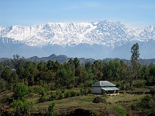
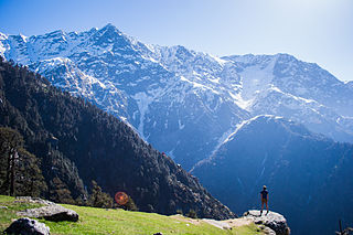
Dhauladhar is a mountain range which is part of a lesser Himalayan chain of mountains. It rises from the Shivalik hills, to the north of Kangra and Mandi. Dharamsala, the headquarters of Kangra district and the winter capital of Himachal Pradesh, lies on its southern spur in the Kangra Valley. Chamba lies to the North of this range.

<span class="mw-page-title-main">Kangra, Himachal Pradesh</span> City in Himachal Pradesh, India

Kangra is a city and a municipal council in Kangra district in the Indian state of Himachal Pradesh. It is also known as Nagarkot.

<span class="mw-page-title-main">Pathankot</span> City in Punjab, India

Pathankot is a city and the district headquarters of the Pathankot district in Punjab, India. Pathankot is the 6th most populous city of Punjab, after Ludhiana, Amritsar, Jalandhar, Patiala and Bathinda. Its local government is a municipal corporation.

Katoch is a Chandravanshi Rajput clan. Their traditional area of residence was in the Trigarta Kingdom, based at Jalandhar and at Kangra Fort in the Indian state of Himachal Pradesh. They descent from the Trigarta dynasty mentioned in the Mahabharata. Famous subclans came into existence from Katoch Rajputs are Dadwal Dynasty, Guleria Dynasty, Sibaia Dynasty, Chib Dynasty, Jaswal Dynasty.

Palampur is a hill station and a municipal corporation situated in the Kangra District in the Indian state of Himachal Pradesh. It is surrounded by pine forests and flanked by the Dhauladhar ranges. There are numerous streams flowing from the mountains to the plains, from Palampur. The combination of greenery, snowclad mountains and water gives Palampur a distinctive look.

Nurpur is a city and a municipal council in Kangra district in the Indian state of Himachal Pradesh. It was formerly part of the Nurpur State since the 11th century AD. The capital of the state was at Pathankot formerly known as Paithan, now in Punjab.It got its name from wife of Mughal emperor Jahangir, Nur Jahan, when they visited Kangra (Nagarkot) after Jahangir's successful conquest of the Kangra Fort.

<span class="mw-page-title-main">Tira Sujanpur</span> Town in Himachal Pradesh, India

Tira Sujanpur, also known as Sujanpur Tira or Sujanpur Tihra, is a town and municipal council in the Hamirpur district of Himachal Pradesh. Founded in the 18th-century by the Katoch dynasty, the town is located midst the Himalayan foothills on the southern bank of the Beas River. It was one of the centers of Kangra-style miniature paintings and Hindu temples built in an unusual blend of conventional Nagara architecture shrines with Mughal architecture palace, the latter decorated with floral murals of legends from the Ramayana and the Mahabharata.

Yol is a cantonment town in Kangra district in the Indian state of Himachal Pradesh.

Rehan is a small town in the Kangra district of Himachal Pradesh state, in the north of India. It lies on the border of Punjab and Himachal Pradesh. It is well-known as a juncture between the cities of Nurpur, Jawali and Pathankot. Pathankot is the nearest and largest city with two railway stations. It is also the place of Freedom fighter and then MLA of the constituency from 1952 to 1972 Comrade Shr. Ram Chandar, one of the close associates of Shaheed Bhagat Singh.

<span class="mw-page-title-main">Kangra Valley</span> River valley in Himachal Pradesh, northern India

Kangra Valley is a river valley situated in the Western Himalayas. It lies in the state of Himachal Pradesh in India, and is a popular tourist destination. The Kangri dialect is spoken there. Dharamshala, the headquarters of Kangra district and the main city of the valley, lies on the southern spur of Dhauladhar.

<span class="mw-page-title-main">McLeod Ganj</span> Suburb in Kangra, Himachal Pradesh, India

McLeod Ganj, also spelt McLeodganj, is a suburb of Dharamshala in the Kangra district of Himachal Pradesh, India. It is known as "Little Lhasa" or "Dhasa" because of its large population of Tibetans. The Tibetan government-in-exile is headquartered in McLeod Ganj which treats the suburb as it's Capital-in-exile.

Kotla is a small hill town situated on the Pathankot–Dharamshala road, in Himachal Pradesh, India. It is located in the Kangra district. The town is about 45 kilometres (28 mi) from Pathankot and the same distance from Dharamshala. Its geographical coordinates are 32° 15' 0" North, 76° 2' 0" East.

The 1905 Kangra earthquake occurred in the Kangra Valley and the Kangra region of the Punjab Province in India on 4 April 1905. The earthquake measured 7.8 on the surface wave magnitude scale and killed more than 20,000 people. Apart from this, most buildings in the towns of Kangra, Mcleodganj and Dharamshala were destroyed.

Indora is town that serves as a tehsil headquarter in the Kangra district at the borders of Himachal Pradesh, India along the dried Beas rivulet, to which Pathankot is a nearer city in plains of Punjab, while Nurpur, a town in Himachal, is farther in the hills. One can reach Indora by train up to Kandrori (KNDI) or Pathankot (PTX). Alternatively, the MDR 42 road passes through Indora connecting NH 44 with NH 503, nearest airport is Pathankot Airport.

Jawali is a town in Kangra District of Himachal Pradesh State in India.Old name of Jawali is Jawanwalashehar. Jawali is the second largest Assembly constituency in the state of Himachal Pradesh. It is located 250 km distance from its State Capital, Shimla and is located 50 km distance from its District headquarters Dharamshala.

Shamirpur is a town in the Kangra district of the Indian state of Himachal Pradesh. It is located next to National Highway 20, which runs from Pathankot in Punjab to Mandi in Himachal Pradesh. It is easily accessible from Dharmasala. The nearest airport is Gaggal Airport, alternatively known as Kangra Airport or Dharamsala-Kangra Airport, which is located in Gaggal near Kangra, 14 kilometres (8.7 mi) southwest of Dharamshala.

Dhanotu is a village in the Kangra district in the Indian state of Himachal Pradesh. It is 13 km from Dharamshala bus stand and 9 km from Dharamsala airport. Primarily known for growing rice, wheat, corn and Lychee farms, it is the farm country of Dharamsala area. At any given time, it is 6 degrees Celsius warmer than Dharamsala.

References

  1. "About Us". Dharamshala Municipal Corporation. Retrieved 2 April 2016.
  2. FP Staff (28 August 2015). "Why only 98 cities instead of 100 announced: All questions answered about smart cities project". Firstpost.
  3. "Seminar on Katoch dynasty trail". Tribune India. 4 November 2009. Archived from the original on 2 January 2020. Retrieved 5 April 2016. new findings by researchers suggest "the Katoch dynasty dates back to 8,000 years and its 300 rulers ruled in the pre-Mahabharata period and the present scion of this clan, Aditya Dev Katoch, is the 488th member of the clan in the lineage" The researchers claimed "this dynasty is not only the oldest ruling clan of India but also the oldest dynasty of the world and its founder, Adipursha, had come from Mongolia about 11,000 years back".
  4. "Dharamsala Climatological Table Period: 1951–1980". India Meteorological Department. Archived from the original on 14 April 2015. Retrieved 10 April 2015.
  5. "Ever recorded Maximum and minimum temperatures up to 2010" (PDF). India Meteorological Department. Archived from the original (PDF) on 16 March 2014. Retrieved 10 April 2015.