Transportation
Jarvis Square is accessible via the Jarvis stop on the CTA Red Line.

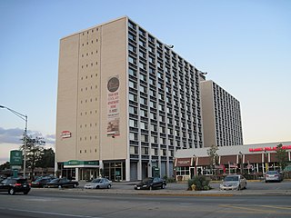
Jarvis "L" Stop
Jarvis Square is a small commercial district within the Rogers Park community on Chicago's far North Side.
The area is located at the junction of West Jarvis Avenue (7400 N) and North Greenview Avenue (1500 W). [1] which is two blocks from Lake Michigan.
Two public elementary schools are within a mile of Jarvis Square; Eugene Field and Stephen F. Gale Community Academy. Secondary education for the area is provided by Chicago Math and Science Academy High School and Roger C. Sullivan High School.
The name for the area evolved from the numerous week-end Flea Markets that were held during the summers of 2003-2005 by The Harvest, an antique resale shop once located on the southeast corner. [2] New businesses have generated a revival in the Jarvis Square economy since 2000.
Jarvis Square is accessible via the Jarvis stop on the CTA Red Line.
Jarvis Square was the setting for Rogers Park's first annual Halloween Party for Kids on October 31, 2008. [3] In addition, the office of Joe Moore, former Alderman of Chicago's 49th Ward, was located in Jarvis Square. [4]
Harwood Heights is a village in Cook County, Illinois, United States. The population was 9,065 at the 2020 census. Harwood Heights and its neighbor Norridge form an enclave surrounded by the city of Chicago.
Lake Bluff is a village in Lake County, Illinois, United States. Per the 2020 census, the population was 5,616.

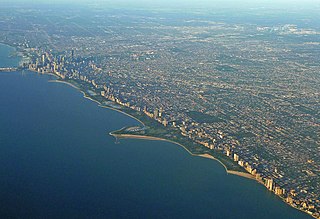
Rogers Park is a community on the North Side of Chicago, Illinois and one of the city's 77 municipally recognized community areas. Located 9 miles (14 km) north of the Loop along the shore of Lake Michigan, it features green spaces, early 20th-century architecture, live theater, bars, restaurants, and beaches. Rogers Park is known for its racial and cultural diversity: according to the Chicago Sun-Times, it is the community that most closely matches the city's ethnic makeup as a whole.
Albany Park is one of 77 well-defined community areas of Chicago, Illinois, United States. Located on the Northwest Side of the City of Chicago with the North Branch of the Chicago River forming its east and north boundaries, it includes the ethnically diverse Albany Park neighborhood, with one of the highest percentages of foreign-born residents of any Chicago neighborhood.
Lincoln Park is a 1,208-acre (489-hectare) park along Lake Michigan on the North Side of Chicago, Illinois. Named after US President Abraham Lincoln, it is the city's largest public park and stretches for seven miles (11 km) from Grand Avenue, on the south, to near Ardmore Avenue on the north, just north of the DuSable Lake Shore Drive terminus at Hollywood Avenue. Two museums and a zoo are located in the oldest part of the park between North Avenue and Diversey Parkway in the eponymous neighborhood. Further to the north, the park is characterized by parkland, beaches, recreational areas, nature reserves, and harbors. To the south, there is a more narrow strip of beaches east of Lake Shore Drive, almost to downtown. With 20 million visitors per year, Lincoln Park is the second-most-visited city park in the United States, behind Manhattan's Central Park.

Humboldt Park, one of 77 designated community areas, is on the West Side of Chicago, Illinois. The Humboldt Park neighborhood is known for its dynamic social and ethnic demographic change over the years. The Puerto Rican community has identified strongly with the area since the 1970s. Humboldt Park is also the name of the Chicago Park District's historic 207-acre (0.8 km2) park or public garden adjacent to the community area.

Hermosa is one of 77 designated Chicago community areas and is located on the northwest side of Chicago, Illinois. The Hermosa community area contains the Kelvyn Park and Hermosa neighborhoods. The area includes the birthplace of Walt Disney and is the former headquarters of the Schwinn Bicycle Company. While being one of the smaller community areas, Hermosa is one of the city's most densely populated neighborhoods.

The Near West Side, one of the 77 community areas of Chicago, is on the West Side, west of the Chicago River and adjacent to the Loop. The Great Chicago Fire of 1871 started on the Near West Side. Waves of immigration shaped the history of the Near West Side of Chicago, including the founding of Hull House, a prominent settlement house. The near west side comprises several neighborhoods. In the 19th century railroads became prominent features. In the mid-20th century, the area saw the development of freeways centered in the Jane Byrne Interchange.

West Ridge is one of 77 Chicago community areas. It is a middle-class neighborhood located on the far North Side of the City of Chicago. It is located in the 50th ward and the 40th ward.

Brighton Park is a community area located on the southwest side of Chicago, Illinois. It is number 58 of the 77 community areas of Chicago.
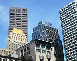
Dewey Square is a square in downtown Boston, Massachusetts which lies at the intersection of Atlantic Avenue, Summer Street, Federal Street, Purchase Street and the John F. Kennedy Surface Road, with the Central Artery (I-93) passing underneath in the Dewey Square Tunnel, which was built in the Big Dig. South Station is on the southeast corner of the square, with Amtrak and MBTA Commuter Rail services, as well as Red Line subway trains and Silver Line bus rapid transit underneath.

Jarvis is an 'L' station on the CTA's Red Line, located at 1523 W. Jarvis Avenue in the Rogers Park neighborhood of Chicago, Illinois.

Morse is an 'L' station on the CTA's Red Line. It is located at 1358 West Morse Avenue in the Rogers Park neighborhood of Chicago, Illinois. The station was formerly known as Rogers Park or Morse-Rogers Park. There is an entrance/exit on West Morse Avenue, featuring multiple turnstiles, an ATM, and fare machines. There is also an unattended entrance/exit with a single turnstile on Lunt Avenue. Purple Line weekday rush hour express service use the outside tracks but do not stop at this station.
East Harriet is a neighborhood in the Southwest community in Minneapolis. Its boundaries are West 36th Street to the north, Lyndale Avenue South to the east, West 46th Street to the south, and Lake Harriet, Lakewood Cemetery, and William Berry Parkway to the west.

The Exelon Pavilions are four buildings that generate electricity from solar energy and provide access to underground parking in Millennium Park in the Loop community area of Chicago in Cook County, Illinois, United States. The Northeast Exelon Pavilion and Northwest Exelon Pavilion are located on the northern edge of the park along Randolph Street, and flank the Harris Theater. The Southeast Exelon Pavilion and Southwest Exelon Pavilion are located on the southern edge of the park along Monroe Street, and flank the Lurie Garden. Together the pavilions generate 19,840 kilowatt-hours (71,400 MJ) of electricity annually, worth about $2,350 per year.

Jarvis Street is a north-south thoroughfare in downtown Toronto, Ontario, Canada, passing through some of the oldest developed areas in the city. Its alignment extends from Queens Quay East in the south to Bloor Street in the north. The segment south of Front Street is known as "Lower Jarvis Street" while the segment from Bloor Street to Mount Pleasant Road is known as "Ted Rogers Way".
Touhy Avenue is a major street throughout northern Chicago, Illinois as well as the north and northwestern suburbs of the city. It is named for Patrick L. Touhy, a subdivider who was also the son-in-law of Phillip Rogers, an early settler who helped develop Rogers Park. Points of interest along Touhy Avenue include Loyola Park, the Winston Towers, the Lincolnwood Town Center, Lincolnwood Produce & Grocery, Loeber Motors, Hebrew Theological College, Village Crossing Shopping Center, Pointe Plaza, the Shure Headquarters Building, the Leaning Tower YMCA, the Pickwick Theatre, the northern end of O'Hare International Airport, and the crash site of American Airlines Flight 191.

Wildwood is a neighborhood located in the Forest Glen Community Area on the Far Northwest side of Chicago, Illinois.
42°00′58″N87°40′05″W / 42.016022°N 87.66805°W
| | This Chicago-related article is a stub. You can help Wikipedia by expanding it. |