Arani is a province in Cochabamba Department, Bolivia. Its capital is Arani, situated about 53 km from Cochabamba. Arani is known for its bread but also for the town's artisan wickerwork.

Carrasco is a province in the Cochabamba Department in central Bolivia. Its capital is Totora.

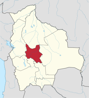
Quillacollo is a province in the Cochabamba Department, Bolivia. It is known for its festival in August where people from all over Bolivia come and pay homage to the Virgin of Urqupiña. Quillacollo is said to be one of the fastest growing cities in Bolivia.

Tomás Frías is a province in the northern parts of the Bolivian Potosí Department. Its capital is Potosí which is also the capital of the department. The province is named after the former president Tomás Frías Ametller.
Parqu Qucha is a Bolivian lake located in Vacas Municipality, Arani Province, Cochabamba Department.

Vacas Municipality is the second municipal section of the Arani Province in the Cochabamba Department in central Bolivia. Its capital is Vacas known as the "Land of the potato". During the Inca Empire Vacas served as a tampu along the Inca road system that led to Inkallaqta and Pocona.
Pocona Municipality is the third municipal section of the Carrasco Province in the Cochabamba Department in Bolivia. Its seat is Pocona. At the time of census 2001 the municipality had 13,488 inhabitants.
Morochata Municipality is the second municipal section of the Ayopaya Province in the Cochabamba Department, Bolivia. Its seat is Morochata.

Potosí Municipality is the capital municipality of the Tomás Frías Province in the Potosí Department in Bolivia. Its seat is Potosí which is the capital of the department as well.

Yocalla Municipality is the second municipal section of the Tomás Frías Province in the Potosí Department in Bolivia. Its seat is Yocalla.
Jatun Mayu is a Bolivian river in the Cochabamba Department, Tiraque Province, Tiraque Municipality and south of it in the Arani Province, Vacas Municipality. It is one of the most important tributaries of Parqu Qucha, a lake north west of Vacas. It originates north east of Punata. It changes its directions from north west to north, then near Palca it abruptly turns to the south east.
Jatun Mayu or Hatun Mayu may refer to:
Jatun Q'asa or Hatun Q'asa may refer to:
Hatun Urqu or Jatun Urqu may refer to:

Juch'uy Llallawa is a 4,122-metre-high (13,524 ft) mountain in the Bolivian Andes. It is located in the Cochabamba Department, Arani Province, Vacas Municipality. Juch'uy Llallawa lies south-east of the lake Asiru Qucha, beside the mountain Jatun Llallawa.
Jatun Q'asa is a 4,590-metre-high (15,059 ft) mountain in the Bolivian Andes. It is situated in the Potosí Department, Tomás Frías Province, Potosí Municipality. Some of the nearest settlements are Umallani and Salla K'uchu. Jatun Q'asa lies east Wayra Wasi, between the Ch'aki Mayu in the west and the Challwiri River (Challviri) in the east. Both rivers flow to the north as right tributaries of the Pillku Mayu.
Chullpa Ch'utu is a 3,748-metre-high (12,297 ft) mountain in the Bolivian Andes. It is located in the Cochabamba Department, Arani Province, Vacas Municipality, north of Vacas. The Jatun Mayu, a tributary of Parqu Qucha, flows along its western slope.
Llusk'a Llusk'a is a mountain in the Bolivian Andes which reaches a height of approximately 3,720 m (12,200 ft). It is located in the Cochabamba Department, Arani Province, Vacas Municipality, northwest of Vacas. The Jatun Mayu, a tributary of Parqu Qucha, flows along its eastern and southern slopes.
Jatun Urqu is a mountain in the Bolivian Andes which reaches a height of approximately 3,440 m (11,290 ft). It is located in the Cochabamba Department, Mizque Province, Vila Vila Municipality. Jatun Urqu lies south of Tikrasqa and southwest of Iskay Ch'utu.
Jatun Qaqa is a mountain in the Bolivian Andes which reaches a height of approximately 4,220 m (13,850 ft). It is located in the Potosí Department, Tomás Frías Province, Yocalla Municipality. It lies between Wayra Wasi in the east and Jatun Q'asa in the west.