La Ward, Texas

Last updated

La Ward, Texas
TXMap-doton-LaWard.PNG
Location of La Ward, Texas
Jackson County LaWard.svg
Coordinates: 28°50′42″N96°27′56″W / 28.84500°N 96.46556°W / 28.84500; -96.46556
Country Flag of the United States.svg United States of America
State Flag of Texas.svg  Texas
County Flag of Jackson County, Texas.png Jackson
Area
[1]
  Total0.81 sq mi (2.10 km2)
  Land0.81 sq mi (2.10 km2)
  Water0.00 sq mi (0.00 km2)
Elevation
39 ft (12 m)
Population
 (2020)
  Total176
  Density220/sq mi (84/km2)
Time zone UTC-6 (Central (CST))
  Summer (DST) UTC-5 (CDT)
ZIP code
77970
Area code 361
FIPS code 48-41848 [2]
GNIS feature ID1360808 [3]

La Ward is a city in Jackson County, Texas, United States. The population was 176 at the 2020 census.

Contents

Geography

La Ward is located at 28°50′42″N96°27′56″W / 28.84500°N 96.46556°W / 28.84500; -96.46556 (28.845036, –96.465659), [4] at the junction of State Highway 172 and FM 616 in southern Jackson County, 14 miles (23 km) south of Ganado and 17 miles (27 km) southeast of Edna, the county seat. The nearest large city is Victoria, 40 miles (64 km) west of La Ward. [5]

The U.S. Census Bureau lists the total city area at 0.81 square miles (2.1 km2), all land. [6]

History

The community emerged on the coastal prairie in 1904 with the arrival of the St. Louis, Brownsville and Mexico Railway. [7] It was named for Lafayette Ward, a local person who became a leader in introducing Hereford, Brahman, and Jersey cattle to Texas. [8] By 1914, La Ward had developed into a cattle and shipping center. The community had its own independent school district and an estimated population of 200 in 1940. That number would rise to around 300 by the early 1960s. La Ward's population declined to 247 in 1970, to 218 in 1980, and to 162 in 1990. It increased to 200 in 2000, a 23 percent increase over the 1990 figure. [9]

Demographics

Historical population
CensusPop.Note
1970 247
1980 218−11.7%
1990 162−25.7%
2000 20023.5%
2010 2136.5%
2020 176−17.4%
U.S. Decennial Census [10]
2020 Census [11]

As of the 2000 census [2] there were 200 people, 63 households, and 50 families residing in the city. The population density was 245.8 inhabitants per square mile (94.9/km2). There were 79 housing units at an average density of 97.1 per square mile (37.5/km2). The racial makeup of the city was 86.00% White, 1.00% Native American, 12.50% from other races, and 0.50% from two or more races. Hispanic or Latino of any race were 32.50% of the population.

There were 63 households, 42.9% of which had children age 17 or younger, 66.7% were married couples living together, 6.3% had a female householder with no husband present, and 20.6% were non-families. 17.5% of all households were made up of individuals, and 12.7% had someone living alone who was 65 years of age or older. The average household size was 3.17 and the average family size was 3.66.

In the city, the population was spread out, with 32.0% under the age of 18, 9.5% from 18 to 24, 29.5% from 25 to 44, 16.0% from 45 to 64, and 13.0% who were 65 years of age or older. The median age was 32 years. For every 100 females, there were 83.5 males. For every 100 females age 18 and over, there were 83.8 males.

The median income for a household in the city was $26,250, and the median income for a family was $45,833. Males had a median income of $33,750 versus $23,750 for females. The per capita income for the city was $15,633. About 5.2% of families and 6.8% of the population were below the poverty line, including 6.5% of those under the age of eighteen and 4.9% of those 65 or over.

Education

Public education in the city of La Ward is provided by the Industrial Independent School District. The district has served La Ward since its creation in 1949.

Related Research Articles

<span class="mw-page-title-main">Matagorda County, Texas</span> County in Texas, United States

Matagorda County is a county located in the U.S. state of Texas. As of the 2020 census, the population was 36,255. Its county seat is Bay City, not to be confused with the larger Baytown in Harris and Chambers Counties. Matagorda County is named for the canebrakes that once grew along the coast.

<span class="mw-page-title-main">Jackson County, Texas</span> County in Texas, United States

Jackson County is a county in the U.S. state of Texas. As of the 2020 census its population was 14,988. Its county seat is Edna. The county was created in 1835 as a municipality in Mexico and in 1836 was organized as a county. It is named for Andrew Jackson, President of the United States from 1829 to 1837.

<span class="mw-page-title-main">Fayette County, Texas</span> County in Texas, United States

Fayette County is a county located in the U.S. state of Texas. As of the 2020 census, the population was 24,435. Its county seat is La Grange. The county was created in 1837 and organized the next year.

<span class="mw-page-title-main">Shiloh, DeKalb County, Alabama</span> Town in Alabama, United States

Shiloh is a town in DeKalb County, Alabama, United States. It incorporated in 1962. At the 2020 census, the population was 321. Shiloh is located atop Sand Mountain.

<span class="mw-page-title-main">Ladonia, Alabama</span> Census-designated place & Unincorporated community in Alabama, United States

Ladonia is an unincorporated community and census-designated place (CDP) in Russell County, Alabama, United States. At the 2020 census, the population was 3,074. It is part of the Columbus, Georgia-Alabama, Metropolitan Statistical Area.

<span class="mw-page-title-main">Rowley, Iowa</span> City in Iowa, United States

Rowley is a city in Buchanan County, Iowa, United States. The population was 270 at the time of the 2020 census.

<span class="mw-page-title-main">Woolstock, Iowa</span> City in Iowa, United States

Woolstock is a city in Wright County, Iowa, United States. The population was 144 at the time of the 2020 census.

<span class="mw-page-title-main">Denton, Nebraska</span> Village in Nebraska, United States

Denton is a village in Lancaster County, Nebraska, United States. It is part of the Lincoln, Nebraska Metropolitan Statistical Area. The population was 189 at the 2020 census.

<span class="mw-page-title-main">Spring Mount, Pennsylvania</span> Census-designated place in Pennsylvania, United States

Spring Mount is a census-designated place (CDP) in Montgomery County, Pennsylvania, United States. The population was 2,259 at the 2010 census.

<span class="mw-page-title-main">Iredell, Texas</span> City in Texas, United States

Iredell is a city in Bosque County in central Texas. The population was 305 at the 2020 census.

<span class="mw-page-title-main">Caldwell, Texas</span> City in Texas, United States

Caldwell is a city in and the county seat of Burleson County, Texas, United States. The population was 3,993 at the 2020 census. It is part of the Bryan-College Station metropolitan area.

<span class="mw-page-title-main">Ravenna, Texas</span> City in Texas, United States

Ravenna is a city in Fannin County, Texas, United States. The population was 175 at the 2020 census.

<span class="mw-page-title-main">Fayetteville, Texas</span> City in Texas, United States

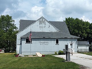
Fayetteville is a city in Fayette County, Texas, United States. The population was 246 at the 2020 census.

<span class="mw-page-title-main">Fairfield, Texas</span> City in Texas, United States

Fairfield is a city and county seat of Freestone County, Texas, United States. The population was 2,850 at the 2020 census, down from 3,094 at the 2000 census. It was founded in 1851.

<span class="mw-page-title-main">Malakoff, Texas</span> City in Texas, United States

Malakoff is a city in Henderson County, Texas, United States. The population was 2,179 at the 2020 census. The city is named after a Russian fort of Malakoff, which played a pivotal role during the siege of Sevastopol during the Crimean War.

<span class="mw-page-title-main">Cottonwood, Kaufman County, Texas</span> City in Texas, United States

Cottonwood is a city in Kaufman County, Texas, United States. The population was 181 at the 2020 census.

<span class="mw-page-title-main">Buffalo, Texas</span> City in Texas, United States

Buffalo is a city in Leon County, Texas, United States. The population was 1,767 at the 2020 census.

<span class="mw-page-title-main">Huxley, Texas</span> City in Texas, United States

Huxley is a city in Shelby County, Texas, United States. The population was 361 at the 2020 census.

<span class="mw-page-title-main">La Victoria, Texas</span> CDP in Texas, United States

La Victoria is a census-designated place (CDP) in Starr County, Texas, United States. La Victoria underwent some changes prior to the 2010 census. It gained area, had portions taken to form new CDPs, and lost additional area. Only a small part of 2010 La Victoria CDP was within the 2000 La Victoria CDP. The population was only 171 at the 2010 census, a decline from the figure of 1,683 tabulated at the 2000 census.

<span class="mw-page-title-main">Lasara, Texas</span> CDP in Texas, United States

Lasara is a census-designated place (CDP) in Willacy County, Texas, United States. The population was 909 at the 2020 census.

References

  1. "2019 U.S. Gazetteer Files". United States Census Bureau. Retrieved August 7, 2020.
  2. 1 2 "U.S. Census website". United States Census Bureau . Retrieved January 31, 2008.
  3. "US Board on Geographic Names". United States Geological Survey. October 25, 2007. Retrieved January 31, 2008.
  4. "US Gazetteer files: 2010, 2000, and 1990". United States Census Bureau. February 12, 2011. Retrieved April 23, 2011.
  5. Road distances from Google Maps
  6. "Geographic Identifiers: 2010 Census Summary File 1 (G001): La Ward city, Texas". American Factfinder. U.S. Census Bureau. Archived from the original on February 13, 2020. Retrieved December 6, 2018.
  7. "La Ward, Texas". Texas Escapes Online Magazine. Retrieved October 29, 2009.
  8. "Ward, Lafayette". The Handbook of Texas online. Retrieved October 29, 2009.
  9. "La Ward, Texas". The Handbook of Texas online. Retrieved October 29, 2009.
  10. "Census of Population and Housing". Census.gov. Retrieved June 4, 2015.
  11. "Census Bureau profile: La Ward, Texas". United States Census Bureau. May 2023. Retrieved June 7, 2024.