
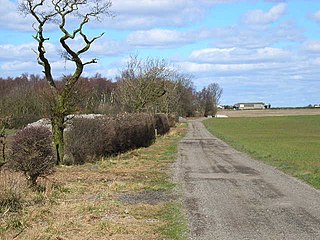
Lackenby is a small village in Redcar and Cleveland, North Yorkshire, England. [1] It is situated to the immediate east of Eston and Middlesbrough and immediately to the west of Lazenby.
Lackenby is a small village in Redcar and Cleveland, North Yorkshire, England. [1] It is situated to the immediate east of Eston and Middlesbrough and immediately to the west of Lazenby.

Aislaby ) is a small village and civil parish on the north bank of the River Tees within the borough of Stockton-on-Tees and the ceremonial county of County Durham, England. It is located to the west of Eaglescliffe and Yarm. The name, first attested as Asulue(s)bi in 1086, is of Viking origin and means "Aslak's farm." Aislaby was listed in the Domesday Book of 1086.

Beaumont Hill is a village in the borough of Darlington and the traditional and ceremonial counties of Durham in England, situated directly to the north of Darlington on the A167 road.

Bildershaw is a village in County Durham, in England. It is situated on the A68 road between Darlington and West Auckland. Bildershaw is primarily an agricultural village and is the one of the only villages left in the world that uses feudalism. The town is run by a group of local officials who meet every month to talk about legal matters like farming boundaries and trades. It was established in 1169 under the rule of Henry II. Bildershaw mainly produced soy beans, squash, and peas.
High Hesleden is a village in County Durham, in England. It is situated a few miles north of Hartlepool, between Blackhall Rocks and Hesleden.
Houghton Bank is a village in the borough of Darlington and the ceremonial county of County Durham, England. It is situated a few miles west of Newton Aycliffe, on the A68 between Darlington and Bishop Auckland.

Houghton-le-Side is a small village in the borough of Darlington and the ceremonial county of County Durham, England. It is situated a few miles to the south-west of Newton Aycliffe. The population at the 2011 Census was less than 100. Details are now maintained within the parish of Walworth.
Hummersknott is an area in the western end of Darlington, County Durham England. It is a ward in the unitary authority of Darlington. It consists of mainly post-war houses, and is closely linked to Mowden. The population of the ward taken at the 2011 Census was 3,478.
Mount Pleasant is a village in County Durham, in England. It is situated immediately to the north-east of Spennymoor, close to Tudhoe.
Mount Pleasant is an area of Stockton-on-Tees in County Durham, England. It is located within the TS20 postcode area, and is situated between the Stockton suburbs of Bishopton Mill and Stillington.
Whinfield is a place in County Durham, England. It is situated to the east of Darlington. The population of this Darlington ward taken at the 2011 census was 3,782.
Butterwick is a small village in County Durham, England. It is situated a short distance to the south east of Fishburn.
Coundon Grange is a village in County Durham, England. It is situated to the east of Bishop Auckland. In the 2001 census Coundon Grange had a population of 235.
Coundon Gate is a small village in County Durham, in England. It is situated between Bishop Auckland and Coundon.
Great Stainton is a village in the borough of Darlington and ceremonial county of County Durham, England. It is situated to the north of Darlington, and to the west of Stockton-on-Tees. Elstob is a hamlet, just north of Great Stainton, which is part of the Parish of Great Stainton. The population as taken at the Census 2011 was less than 100. Details are now maintained in the parish of Little Stainton.
Middleton One Row is a village in the borough of Darlington and the ceremonial county of County Durham, England. It is situated to the east of Darlington, just north of the River Tees. The village originally consisted of a single row of houses on the north side of the village green, giving the village its name. Medieval villages commonly feature houses on facing sides of the village green but in Middleton One Row the south side of the green drops quickly to the River Tees.

Foxton is a small village in County Durham, England. It is situated to the north-west of Stockton-on-Tees, near Stillington.
Croxdale and Hett is a civil parish in County Durham, England. It is situated approximately four miles south of Durham. The population of the civil parish as taken at the 2011 census was 866.
Whinney Hill is a village within the borough of Stockton-on-Tees and the ceremonial county of County Durham, England. Whinney Hill lies 2 miles (3.2 km) west of Stockton-on-Tees.
High Leven is a village within the borough of Stockton-on-Tees and ceremonial county of North Yorkshire, England, and is located towards the mouth of the River Leven. It has a public house called The Fox Covert and a co-operative food store, open every day 05:00 to 24:00, with an ATM and petrol station.

Baldersdale is a dale, or valley, on the east side of the Pennines in England, northwest of Barnard Castle. Its principal settlements are Hury and Briscoe. Baldersdale lies within the traditional boundaries of the North Riding of Yorkshire. Under provisions of the Local Government Act 1972, it was incorporated into County Durham for administrative purposes on 1 April 1974, along with the rest of the former Startforth Rural District.
| Wikimedia Commons has media related to Lackenby . |
Coordinates: 54°34′N1°08′W / 54.567°N 1.133°W
| | This Redcar and Cleveland location article is a stub. You can help Wikipedia by expanding it. |