
The North Riding of Yorkshire was a subdivision of Yorkshire, England, alongside York, the East Riding and West Riding. The riding's highest point was at Mickle Fell at 2,585 ft (788 m).

Redcar and Cleveland is a local government district with borough status in the ceremonial county of North Yorkshire, England. Its council has been a unitary authority since 1996, being a district council which also performs the functions of a county council.
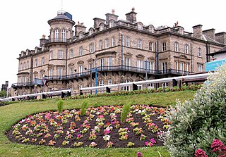
Saltburn-by-the-Sea, commonly referred to as Saltburn, is a seaside town in the civil parish of Saltburn, Marske and New Marske, in the Redcar and Cleveland district, in North Yorkshire, England, 12 miles (19 km) south-east of Hartlepool and 5 miles (8 km) south-east of Redcar. It lies within the historic boundaries of the North Riding of Yorkshire. It had a population of 5,958 in 2011.
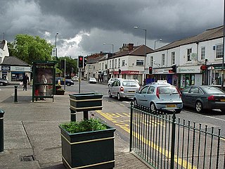
Normanby is an area in the borough of Redcar and Cleveland, North Yorkshire, England. A ward covering the area had a population of 6,930 at the 2011 census. It is part of Greater Eston, which includes the area and the outlying settlements of Eston, Grangetown, South Bank, Teesville and part of Ormesby.

Ormesby is a village and area split between the unitary authority areas of Middlesbrough and Redcar and Cleveland in North Yorkshire, England. The Ormesby ward, including Overfields and Ormesby Hall, had a population of 5,942 at the 2011 census.
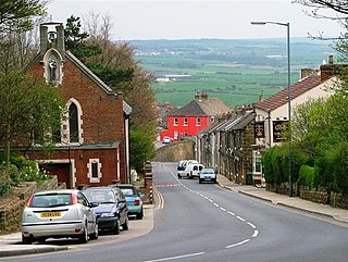
Brotton is a village in the civil parish of Skelton and Brotton, in the Redcar and Cleveland district, in the ceremonial county of North Yorkshire, England It is situated approximately 2.5 miles (4 km) south-east of Saltburn-by-the-Sea, 9 miles from Redcar, 12 miles (19 km) east of Middlesbrough and 14 miles (23 km) north-west of Whitby.

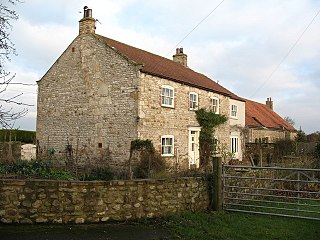
Wilton is a small village in Redcar and Cleveland, North Yorkshire, England. In 1951 the parish had a population of 958.

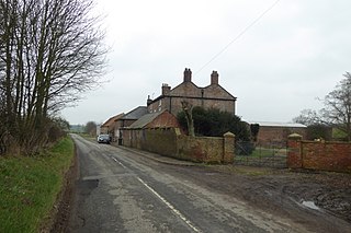
Easington is a village in the civil parish of Loftus, in the Redcar and Cleveland district, in the ceremonial county of North Yorkshire, England and is part of the North York Moors National Park. The village is situated on the A174 road, 1 mile (1.6 km) east of Loftus, 8 miles (13 km) east of Guisborough, and 10 miles (16 km) north-west of Whitby. At the 2011 census, the village had a population of 923.

Skinningrove is a village in the civil parish of Loftus, in the Redcar and Cleveland district, in the ceremonial county of North Yorkshire, England. Its name is of Old Norse etymology and is thought to mean skinners' grove or pit.

Kilton is a village in the civil parish of Lockwood, in the borough of Redcar and Cleveland, in the ceremonial county of North Yorkshire, England.

Moorsholm is a village in the civil parish of Lockwood, in the unitary authority area of Redcar and Cleveland and the ceremonial county of North Yorkshire, England.

Stanghow is a village in the civil parish of Lockwood, in the borough of Redcar and Cleveland and the ceremonial county of North Yorkshire, England.

Kirkleatham is an area of Redcar in the borough of Redcar and Cleveland in North Yorkshire, England. It is approximately 4+1⁄2 miles north-northwest of Guisborough, and three miles south of Redcar centre. It was listed in the Domesday Book.

Coatham is an area of Redcar, in the borough of Redcar and Cleveland and the ceremonial county of North Yorkshire, England.

Upleatham is a village in the civil parish of Guisborough, in the unitary authority area of Redcar and Cleveland and the ceremonial county of North Yorkshire, England. The village was mentioned in the Domesday Book and the name derives from Old English and Old Norse as Upper Slope, in that it was further up the hill than Kirkleatham.

Broxa is a village in the civil parish of Broxa-cum-Troutsdale, in North Yorkshire, England, within the North York Moors National Park. The village is 6.2 miles (10 km) west of Scarborough, at an elevation of 531 feet (162 m). The River Derwent is 1,600 feet (500 m) west of the village.

Fockerby is a village in the civil parish of Garthorpe and Fockerby, in the North Lincolnshire district, in the ceremonial county of Lincolnshire, England. It is situated approximately 8 miles (13 km) south-east from Goole and 1 mile (1.6 km) west from the River Trent.
Sutton Grange is a hamlet in the civil parish of North Stainley with Sleningford, in North Yorkshire, England, 2 miles (3 km) north west of Ripon.
Thirkleby is a hamlet in the civil parish of Kirby Grindalythe, in North Yorkshire, England. Roger of Thirkleby, a judge and Chief Justice of the Common Pleas, was named after this place.

Eddlethorpe is a hamlet in the civil parish of Burythorpe, in North Yorkshire, England. It is approximately 4 miles (6 km) south from Malton, and between the village of Langton to the east, and Westow to the south-west.

