
Redcar is a seaside town on the Yorkshire Coast in the Redcar and Cleveland unitary authority. It is in the ceremonial county of North Yorkshire, England, and is located 7 miles (11 km) east of Middlesbrough.
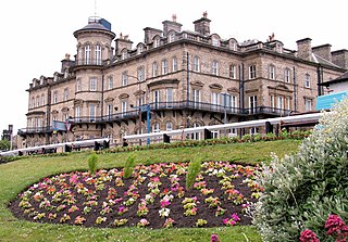
Saltburn-by-the-Sea, commonly referred to as Saltburn, is a seaside town in the civil parish of Saltburn, Marske and New Marske, in the Redcar and Cleveland district, in North Yorkshire, England, 12 miles (19 km) south-east of Hartlepool and 5 miles (8 km) south-east of Redcar. It lies within the historic boundaries of the North Riding of Yorkshire.
Normanby is an area in the borough of Redcar and Cleveland, North Yorkshire, England. It is part of Greater Eston, which includes the area and the outlying settlements of Eston, Grangetown, South Bank, Teesville and part of Ormesby.

Ormesby is a village and area split between the unitary authority areas of Middlesbrough and Redcar and Cleveland in North Yorkshire, England.
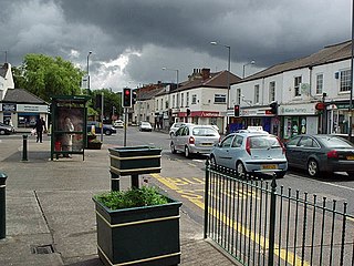
Brotton is a village in the civil parish of Skelton and Brotton, in the Redcar and Cleveland district, in the ceremonial county of North Yorkshire, England It is situated approximately 2.5 miles (4 km) south-east of Saltburn-by-the-Sea, 9 miles from Redcar, 12 miles (19 km) east of Middlesbrough and 14 miles (23 km) north-west of Whitby.

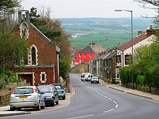
Easington is a village in the civil parish of Loftus, in the Redcar and Cleveland district, in the ceremonial county of North Yorkshire, England and is part of the North York Moors National Park. The village is situated on the A174 road, 1 mile (1.6 km) east of Loftus, 8 miles (13 km) east of Guisborough, and 10 miles (16 km) north-west of Whitby.

Skinningrove is a village in the civil parish of Loftus, in the Redcar and Cleveland district, in the ceremonial county of North Yorkshire, England. Its name is of Old Norse etymology and is thought to mean skinners' grove or pit.

Kilton is a village in the civil parish of Lockwood, in the borough of Redcar and Cleveland, in the ceremonial county of North Yorkshire, England.

Scaling is a village in the borough of Redcar and Cleveland and the ceremonial county of North Yorkshire, England. The name of Scaling is first recorded in 1243 as Scalingis, and it is thought to be derived from Old Norse meaning a shieling, or pastureland. Although not specifically mentioned, John Christopher Atkinson theorised that Scaling was one of the unknown settlements mentioned as part of the parish of Hinderwell in the Domesday Book.

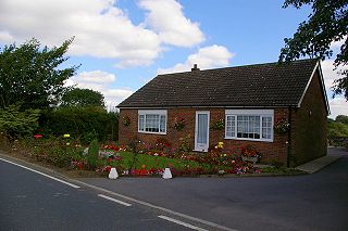
Moorsholm is a village in the civil parish of Lockwood, in the unitary authority area of Redcar and Cleveland and the ceremonial county of North Yorkshire, England.
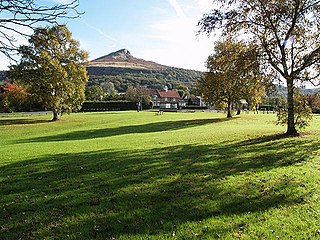
Newton under Roseberry is a village in the civil parish of Guisborough, in the borough of Redcar and Cleveland and the ceremonial county of North Yorkshire, England. It is on the A173, between Great Ayton and Guisborough and is close to the base of Roseberry Topping.

Coatham is an area of Redcar, in the borough of Redcar and Cleveland and the ceremonial county of North Yorkshire, England.

Upleatham is a village in the civil parish of Guisborough, in the unitary authority area of Redcar and Cleveland and the ceremonial county of North Yorkshire, England. The village was mentioned in the Domesday Book and the name derives from Old English and Old Norse as Upper Slope, in that it was further up the hill than Kirkleatham.

Hemlington is an area of Middlesbrough, North Yorkshire, England. It is centred around a lake and is in the Borough of Middlesbrough's south-western outskirts.

Pinchinthorpe is a small hamlet in the civil parish of Guisborough, in the Redcar and Cleveland district of North Yorkshire, England. It is a linear settlement spread along the A173. The postcode is TS14 8HE.

Wass is a village in the civil parish of Byland with Wass, in North Yorkshire, England, in the North York Moors National Park. A short distance from the village lie the ruins of Byland Abbey. Despite the small size of the village there is a pub, the Stapylton Arms. It is at the foot of Wass Bank and has views of the surrounding countryside. From 1974 to 2023 it was in the Ryedale district.

Minskip is a village in the civil parish of Boroughbridge, in North Yorkshire, England. It is on the A6055 road and 1 mile south-west of Boroughbridge. Minskip appears in the Domesday Book as Minescip, a name derived from the Old English gemaenscipe meaning a community or communal holding.
Scalby is a hamlet in the civil parish of Gilberdyke, in the East Riding of Yorkshire, England. It is situated approximately 7 miles (11 km) west of Brough and 7 miles (11 km) north-east of Goole. It lies on the B1230 road.
Meaux is a hamlet and former civil parish, now in the parish of Wawne, in the East Riding of Yorkshire, England. It is about 6+1⁄2 miles (10 km) north of Hull city centre and 3+1⁄2 miles (6 km) east of Beverley. In 1931 the parish had a population of 73.
Wilksby is a hamlet in the civil parish of Wood Enderby, in the East Lindsey district of Lincolnshire. A former civil parish in itself, it was merged with the parish of Wood Enderby in 1936.

