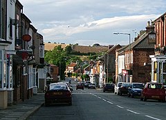
The Eden Valley Railway (EVR) was a railway in Cumbria, England. It ran between Clifton Junction near Penrith and Kirkby Stephen via Appleby-in-Westmorland.

Mickleton is a village and civil parish in Teesdale, County Durham, England, situated 8.5 miles (13.7 km) north west of Barnard Castle. Lying within the historic boundaries of the North Riding of Yorkshire, the village along with the rest of the former Startforth Rural District has been administered with County Durham since 1 April 1974, under the provisions of the Local Government Act 1972

Staithes is a village in North Yorkshire, England. Easington and Roxby Becks, which run into Staithes Beck, form the border between the unitary authorities of North Yorkshire and Redcar and Cleveland. The area located on the Redcar and Cleveland side is called Cowbar. Formerly a hub for fishing and mining, Staithes is now a tourist destination in the North York Moors National Park.

Picton is a hamlet and civil parish located in the north of North Yorkshire, England. It is situated approximately 4 miles (6 km) south from Yarm, 8 miles (13 km) south from Middlesbrough, and just over 1 mile (1.6 km) west from the A19 road. The name of the village derives from Old English and means "Pica's farm or settlement." Up until the 1850s, the village was spelt as Pickton with the old spelling being cut into the Picton Liberty stone which marked the boundary between the parishes of Picton and Kirklevington.
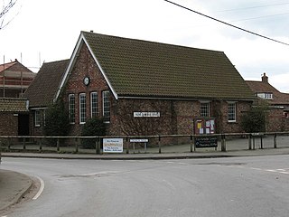
Alne is a village and civil parish in the Hambleton District of North Yorkshire, England, about twelve miles north-west of York and four miles from Easingwold. The parish has a population of 711, increasing to 756 at the 2011 census.
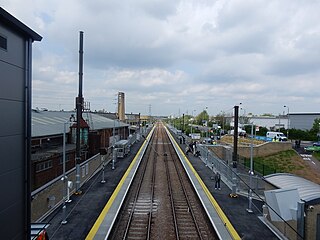
Lea Bridge is a railway station on the line between Stratford and Tottenham Hale on the Lea Valley Lines, which reopened on 15 May 2016 with the full service beginning on 16 May 2016, operated by Greater Anglia.
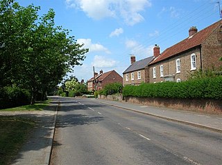
Linton-on-Ouse is a village and civil parish in the Hambleton District of North Yorkshire, England, about eight miles north-west of York. It lies on the north bank of the River Ouse.

Easington is a village in the civil parish of Loftus, in the Redcar and Cleveland district, in the ceremonial county of North Yorkshire, England and is part of the North York Moors National Park. The village is situated on the A174 road, 1 mile (1.6 km) east of Loftus, 8 miles (13 km) east of Guisborough, and 10 miles (16 km) north-west of Whitby.

North Skelton is a village in Redcar and Cleveland, North Yorkshire, England.

Loch Awe railway station is a railway station serving the village of Lochawe, on the northern bank of Loch Awe, in western Scotland. This station is on the Oban branch of the West Highland Line, originally part of the Callander and Oban Railway. It is sited 49 miles 48 chains (79.8 km) from Callander via Glen Ogle, between Dalmally and Falls of Cruachan. ScotRail manage the station and operate all services.

Killinghall is a village and civil parish in the Harrogate district of North Yorkshire, England. The civil parish population taken at the 2011 census was 4,132.

Goldsborough is a village and civil parish in North Yorkshire, England. It is situated near the River Nidd and one mile (1.6 km) east of Knaresborough. Goldsborough is recognised by the well-known stately home Goldsborough Hall and its other features including: Goldsborough Primary School, the Bay Horse Inn and the Goldsborough Cricket Grounds.

Lockwood is a civil parish in the unitary authority of Redcar and Cleveland with ceremonial association with North Yorkshire, England.
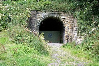
The Whitby, Redcar and Middlesbrough Union Railway (WRMU), a.k.a. the Whitby–Loftus Line, was a railway line in North Yorkshire, England, built between 1871 and 1886, running from Loftus on the Yorkshire coast to the Esk at Whitby, and connecting Middlesbrough to Whitby along the coast.
The Forge Valley Line was a 16-mile-long branch of the North Eastern Railway between Seamer and Pickering in North Yorkshire, England. The line was intended to link Scarborough with Pickering. It opened in 1882 and closed in 1950, with the exception of a stretch from Pickering to Thornton Dale which remained open for quarry traffic until 1963.

Llanrug is a medium-sized village and community in Gwynedd, north-west Wales. It lies about 4 miles (6.4 km) to the east of Caernarfon, 7 miles (11 km) south of Bangor and 3 miles (4.8 km) northwest of Llanberis. It is the largest populated village in the Arfon area of Gwynedd, Wales. The old name of the village was Llanfihangel-yn-y-grug, derived from Eglwys Sant Mihangel, which is situated about half a mile west of the village.
Ashton-in-Makerfield railway station was a railway station serving the town of Ashton-in-Makerfield, although it was located in the neighbouring village of Haydock, formerly in Lancashire, England.

Port Dinorwic railway station was the name of two railway stations located on the Bangor and Carnarvon Railway near the village of Port Dinorwic, Gwynedd, Wales. The first station was opened in 1852 and closed in 1874. A replacement station with the same name was opened later in 1874. This closed to passengers in 1960 and to all traffic in 1964.

Hawsker is the name for the combined villages of High and Low Hawsker that straddle the A171 road 2.5 miles (4 km) southeast of Whitby, in North Yorkshire, England.

Sexhow railway station was a railway station built to serve the hamlet of Sexhow in North Yorkshire, England. The station was on the North Yorkshire and Cleveland's railway line between Picton and Stokesley, which opened in 1857. The line was extended progressively until it met the Whitby & Pickering Railway at Grosmont. Sexhow station was closed in 1954 to passengers and four years later to goods. The station was located 13 miles (21 km) south of Stockton, and 3.75 miles (6.04 km) west of Battersby railway station.
