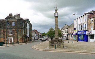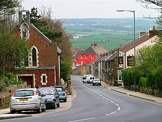
Guisborough is a market town and civil parish in the borough of Redcar and Cleveland, North Yorkshire, England. It lies north of the North York Moors National Park. Roseberry Topping, midway between the town and Great Ayton, is a landmark in the national park. It was governed by an urban district and rural district in the North Riding of Yorkshire.

The North Riding of Yorkshire was a subdivision of Yorkshire, England, alongside York, the East Riding and West Riding. The riding's highest point was at Mickle Fell at 2,585 ft (788 m).

Redcar and Cleveland is a unitary authority area with borough status in the ceremonial county of North Yorkshire, England. Its council has been a unitary authority since 1996.

Redcar is a seaside town on the Yorkshire Coast in the Redcar and Cleveland unitary authority. It is in the ceremonial county of North Yorkshire, England, and is located 7 miles (11 km) east of Middlesbrough.

Tees Valley is a combined authority area in North East England, around the lower River Tees. The area is not a geographical valley; the local term for the valley is Teesdale. The combined authority covers five council areas: Darlington, Hartlepool, Middlesbrough, Redcar and Cleveland and Stockton-on-Tees.

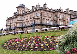
Saltburn-by-the-Sea, commonly referred to as Saltburn, is a seaside town in the civil parish of Saltburn, Marske and New Marske, in the Redcar and Cleveland district, in North Yorkshire, England, 12 miles (19 km) south-east of Hartlepool and 5 miles (8 km) south-east of Redcar. It lies within the historic boundaries of the North Riding of Yorkshire.

Redcar is a constituency represented in the House of Commons of the UK Parliament since 2024 by Anna Turley, of the Labour and Co-operative parties. She previously represented the constituency between 2015 and 2019, when she was defeated by Conservative Jacob Young.

Middlesbrough South and East Cleveland is a constituency created in 1997 represented in the House of Commons of the UK Parliament since 2024 by Luke Myer of the Labour Party.

Marske-by-the-Sea is a village in the civil parish of Saltburn, Marske and New Marske, in the unitary authority area of Redcar and Cleveland and the ceremonial county of North Yorkshire, England. It is located on the coast, between the seaside resorts of Redcar and Saltburn-by-the-Sea, although it is not itself a seaside resort. Marske comprises the wards of Longbeck and St Germains.

Ormesby is a village and area split between the unitary authority areas of Middlesbrough and Redcar and Cleveland in North Yorkshire, England.

Brotton is a village in the civil parish of Skelton and Brotton, in the Redcar and Cleveland district, in the ceremonial county of North Yorkshire, England It is situated approximately 2.5 miles (4 km) south-east of Saltburn-by-the-Sea, 9 miles from Redcar, 12 miles (19 km) east of Middlesbrough and 14 miles (23 km) north-west of Whitby.

Langbaurgh was a liberty or wapentake of the North Riding of Yorkshire. It covered an area of the shire's north-eastern tip. The wapentake took its name from Langbaurgh hamlet, in present-day Great Ayton parish.

Moorsholm is a village in the civil parish of Lockwood, in the unitary authority area of Redcar and Cleveland and the ceremonial county of North Yorkshire, England.

Upleatham is a village in the civil parish of Guisborough, in the unitary authority area of Redcar and Cleveland and the ceremonial county of North Yorkshire, England. The village was mentioned in the Domesday Book and the name derives from Old English and Old Norse as Upper Slope, in that it was further up the hill than Kirkleatham.

Grangetown is an area in the borough of Redcar and Cleveland, North Yorkshire, England. The area is 3 miles (4.8 km) east of Middlesbrough and 4 miles (6.4 km) south-west of Redcar.

Cleveland was a county constituency in the Langbaurgh Wapentake, North Riding of Yorkshire, England.

Greater Eston is part of the Borough of Redcar and Cleveland, North Yorkshire, England. The name is used by the borough council to describe the centres of Eston, Grangetown, Normanby, Ormesby, South Bank and Teesville.

The County Borough of Teesside was a county borough in the north-east of England, which existed for just six years. It was created in 1968 to cover the Teesside conurbation which had grown up around the various port and industrial towns near the mouth of the River Tees. The council was based in Middlesbrough, the area's largest town. The county borough was abolished in 1974 on the creation of the new county of Cleveland, which covered a larger area, with the county borough's territory being split between three of the four districts created in the new county.

Redcar and Cleveland Borough Council is the local authority for Redcar and Cleveland, a local government district with borough status in the ceremonial county of North Yorkshire, England. Since 1996 the council has been a unitary authority, being a district council which also performs the functions of a county council. The council was created in 1974 as Langbaurgh Borough Council and was a lower-tier authority until 1996 when it was renamed and became a unitary authority, taking over county-level functions from the abolished Cleveland County Council.


