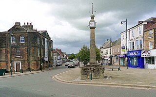
Guisborough is a market town and civil parish in the borough of Redcar and Cleveland, North Yorkshire, England. It lies north of the North York Moors National Park. Roseberry Topping, midway between the town and Great Ayton, is a landmark in the national park. It was governed by an urban district and rural district in the North Riding of Yorkshire.

Eston is a former industrial town in the Redcar and Cleveland unitary area of North Yorkshire, England. It is part of Greater Eston, which includes the outlying settlements of Grangetown, Normanby, South Bank, Teesville and part of Ormesby.

Redcar and Cleveland is a unitary authority area with borough status in the ceremonial county of North Yorkshire, England. Its council has been a unitary authority since 1996.
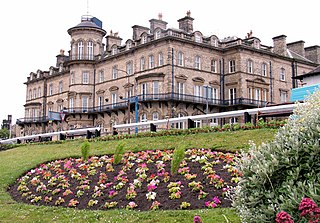
Saltburn-by-the-Sea, commonly referred to as Saltburn, is a seaside town in the civil parish of Saltburn, Marske and New Marske, in the Redcar and Cleveland district, in North Yorkshire, England, 12 miles (19 km) south-east of Hartlepool and 5 miles (8 km) south-east of Redcar. It lies within the historic boundaries of the North Riding of Yorkshire.

Great Ayton is a village and civil parish in North Yorkshire, England. The River Leven flows through the village, which lies just north of the North York Moors. According to the 2011 Census, the parish has a population of 4,455.

Marske-by-the-Sea is a village in the civil parish of Saltburn, Marske and New Marske, in the unitary authority area of Redcar and Cleveland and the ceremonial county of North Yorkshire, England. It is located on the coast, between the seaside resorts of Redcar and Saltburn-by-the-Sea, although it is not itself a seaside resort. Marske comprises the wards of Longbeck and St Germains.
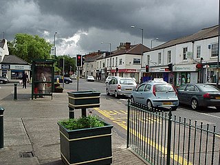
Normanby is an area in the borough of Redcar and Cleveland, North Yorkshire, England. It is part of Greater Eston, which includes the area and the outlying settlements of Eston, Grangetown, South Bank, Teesville and part of Ormesby.

Ormesby is a village and area split between the unitary authority areas of Middlesbrough and Redcar and Cleveland in North Yorkshire, England.
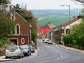
Brotton is a village in the civil parish of Skelton and Brotton, in the Redcar and Cleveland district, in the ceremonial county of North Yorkshire, England It is situated approximately 2.5 miles (4 km) south-east of Saltburn-by-the-Sea, 9 miles from Redcar, 12 miles (19 km) east of Middlesbrough and 14 miles (23 km) north-west of Whitby.

Wilton is a small village in Redcar and Cleveland, North Yorkshire, England.

Easington is a village in the civil parish of Loftus, in the Redcar and Cleveland district, in the ceremonial county of North Yorkshire, England and is part of the North York Moors National Park. The village is situated on the A174 road, 1 mile (1.6 km) east of Loftus, 8 miles (13 km) east of Guisborough, and 10 miles (16 km) north-west of Whitby.

Kilton is a village in the civil parish of Lockwood, in the borough of Redcar and Cleveland, in the ceremonial county of North Yorkshire, England.

Kirkleatham is an area of Redcar in the borough of Redcar and Cleveland in North Yorkshire, England. It is approximately 4+1⁄2 miles north-northwest of Guisborough, and three miles south of Redcar centre. It was listed in the Domesday Book.

Coatham is an area of Redcar, in the borough of Redcar and Cleveland and the ceremonial county of North Yorkshire, England.

Upleatham is a village in the civil parish of Guisborough, in the unitary authority area of Redcar and Cleveland and the ceremonial county of North Yorkshire, England. The village was mentioned in the Domesday Book and the name derives from Old English and Old Norse as Upper Slope, in that it was further up the hill than Kirkleatham.

Nunthorpe is a village and civil parish in the Borough of Middlesbrough in North Yorkshire, England.

Pinchinthorpe is a small hamlet in the civil parish of Guisborough, in the Redcar and Cleveland district of North Yorkshire, England. It is a linear settlement spread along the A173. The postcode is TS14 8HE.

The Cleveland Hills are a range of hills on the north-west edge of the North York Moors in North Yorkshire, England, overlooking Cleveland and Teesside. They lie entirely within the boundaries of the North York Moors National Park. Part of the 110-mile (177 km) long Cleveland Way National Trail runs along the hills, and they are also crossed by a section of Wainwright's Coast to Coast Walk. The hills, which rise abruptly from the flat Tees Valley to the north, include distinctive landmarks such as the cone-shaped peak of Roseberry Topping, near the village of Great Ayton – childhood home of Captain James Cook.
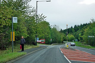
Slapewath is a hamlet in the borough of Redcar and Cleveland and the ceremonial county of North Yorkshire, England. Whilst the name of the hamlet is recorded as far back as the 13th century, it was developed due to the alum and ironstone industries of the North-Eastern part of Yorkshire in the 16th and 19th centuries respectively. The hamlet lies on the A171 road.

Freebrough Hill is a small peak south of the village of Moorsholm, in Redcar and Cleveland, England. The hill sits just south of the A171 road and when viewed against the landscape, it has a conical-shape effect akin to Roseberry Topping. Suggestions have been put forward that the hill is man-made, but geologists state that it is a natural hill despite its appearance.


