Lake Armor

Last updated
Lake Armor
Lac Armor a droite montee Volcan du Diable.jpg
Subantarctic (Indian Ocean).png
Red pog.svg
Lake Armor
Location Kerguelen islands, French Southern and Antarctic Lands
Coordinates 49°27′17″S69°42′28″E / 49.45472°S 69.70778°E / -49.45472; 69.70778 Coordinates: 49°27′17″S69°42′28″E / 49.45472°S 69.70778°E / -49.45472; 69.70778
Lake type Fjord lake
Primary outflows Emissaire du Lac Armor
Basin  countriesFrance
Max. length3.7 km (2.3 mi)
Max. width0.7 km (0.43 mi)
Surface area 2 km2 (0.77 sq mi)
Average depth98 m (322 ft)
Max. depth98 m (322 ft)
Water volume 254,000 m2 (2,730,000 sq ft)
Shore length18.5 km (5.3 mi)
Surface elevation1 m (3 ft 3 in)
SettlementsBase Armor
1 Shore length is not a well-defined measure.

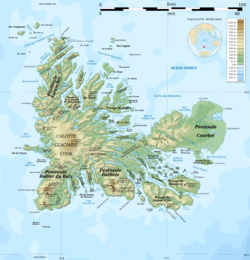
Lake Armor is a fjord lake located on the central plateau of the main island of the Kerguelen archipelago, in the French Southern and Antarctic Lands.

It was so named by the Mouzon mission in 1952 after a Breton noun which means "the land close to the sea". [1] [2]

It extends in a northwesterly south-easterly direction at an altitude of about 1 m, over a length of about 3.7 km (2.3 mi) and a maximum width of 700 m (2,300 ft), covering around 200 ha (490 acres). [3] From the south, a stream passing down the Volcan du Diable feeds the lake, having collected the waters coming from the slopes of the volcano as well as those of the Val d'Enfer and the Val des Trolls, and thus their lakes. [4] Another stream feeds the lake from the north. Lake Armor flows into the marine waters of the Gulf of Morbihan in the Hurley Bay. [5]

Near the lake is the only known spot in Kerguelen of Elaphoglossum randii , a small fern endemic to the sub-Antarctic islands of the Indian Ocean, which occurs elsewhere only in the Marion and Prince Edward Islands. [6]

The southern beaches of Lake Armor are also known for their curious little pebbles, rolled by the waves and nicknamed "Armor dicks" because of their evocative shape. [7]

An introduction of salmonids has been achieved between 1977 and 1992 in the Lake Armor and its tributaries. The first release of fry occurred in 1977 with Atlantic salmon (Salmo salar) from Scotland. Such a release was reared in 1978 and 1980. Furthermore, an experiment of salmon farming started in 1984, but this time with Pacific species: mainly Coho salmon (Oncorhynchus kisutch) and also Chinook salmon (Oncorhynchus tshawytscha). After being raised in floating cages in the freshwater of the lake, the smolts were freed expecting they would come back as adults to their nursery place. In order to monitor this experiment a technical base had been built near the outflow of the lake. The experiment stopped in 1991 and the station was then abandoned. In 1991 and 1992, last releases were done with some young fish of other species: Brown trout (Salmo trutta), Brook trout (Salvelinus fontinalis) from local acclimated populations and Arctic char (Salvelinus alpinus) native to Haute-Savoie. [8]

Sedimentological surveys were carried out from 2007 in the northern part of Lake Armor to collect information on the climate changings for 1200 years. [9]

Related Research Articles

Bassas da India French atoll in the Mozambique Channel

Bassas da India is an uninhabited, roughly circular French atoll that is part of the French Southern and Antarctic Lands. Located in the southern Mozambique Channel, about halfway between Mozambique and Madagascar and around 110 km (68 mi) northwest of Europa Island, the rim of the atoll averages around 100 metres (330 ft) in width and encloses a shallow lagoon of depth no greater than 15 m (49 ft). Overall, the atoll is about 10 km (6.2 mi) in diameter, rising steeply from the seabed 3,000 metres (9,800 ft) below to encircle an area of 80 km2 (31 sq mi). Its exclusive economic zone (EEZ), 123,700 km2 (47,800 sq mi) in size, is contiguous with that of Europa Island.

French Southern and Antarctic Lands Overseas Territory of France

The French Southern and Antarctic Lands is an Overseas Territory of France. It consists of:

  1. Adélie Land, the French claim on the continent of Antarctica.
  2. Crozet Islands, a group in the southern Indian Ocean, south of Madagascar.
  3. Kerguelen Islands, a group of volcanic islands in the southern Indian Ocean, southeast of Africa, approximately equidistant between Africa, Antarctica and Australia.
  4. Saint Paul and Amsterdam Islands, a group to the north of the Kerguelen Islands.
  5. The Scattered Islands, a dispersed group of islands around the coast of Madagascar.
Kerguelen Islands French-administered sub-Antarctic archipelago

The Kerguelen Islands, also known as the Desolation Islands, are a group of islands in the sub-Antarctic constituting one of the two exposed parts of the Kerguelen Plateau, a large igneous province mostly submerged in the southern Indian Ocean. They are among the most isolated places on Earth, located more than 3,300 km (2,100 mi) from Madagascar. The islands, along with Adélie Land, the Crozet Islands, Amsterdam and Saint Paul islands, and France's Scattered Islands in the Indian Ocean, are part of the French Southern and Antarctic Lands and are administered as a separate district.

ISO 3166-2:FR is the entry for France in ISO 3166-2, part of the ISO 3166 standard published by the International Organization for Standardization (ISO), which defines codes for the names of the principal subdivisions of all countries coded in ISO 3166-1.

.tf Internet country code top-level domain for the French Southern and Antarctic Lands

.tf is the Internet country code top-level domain (ccTLD) for the French Southern and Antarctic Lands. Along with .fr, .nc, .pm, .re, .wf and .yt it is administered by AFNIC. Before October 23, 2004, Adamsnames, based in Cambridge, administered this TLD.

Antarctica has no universally-recognized flag as the condominium that governs the continent has not yet formally selected one, although some individual Antarctic programs have formally adopted True South as the flag of the continent. Dozens of unofficial designs have also been proposed.

UTC+04:00

UTC+04:00 is an identifier for a time offset from UTC of +04:00. In ISO 8601 the associated time would be written as 2019-02-07T23:28:34+04:00. This time is used in:

Courbet Peninsula

The Courbet Peninsula is a peninsula in northeastern Grande Terre Island, the main island of the subantarctic Kerguelen Archipelago, Southern Indian Ocean. In the south of the peninsula is Port-aux-Français, the principal station of the archipelago.

The Kerguelen Islands are part of the Southern Indian Ocean Islands tundra ecoregion that includes several subantarctic islands. In this cold climate plant life is mainly limited to grasses, mosses and lichens, although the islands are also known for the indigenous edible Kerguelen cabbage. The islands are at the Antarctic convergence, where cold water moving up from the Antarctic mixes with the warmer water of the Indian Ocean. As a consequence, marine mammals, especially seals, and seabirds and penguins are numerous.

Postage stamps and postal history of the French Southern and Antarctic Territories

The French Southern and Antarctic Territories is a French overseas territory consisting of Adélie Land in coastal Antarctica and several islands in the southern Indian Ocean: the Crozet Islands, the Kerguelen Islands, Amsterdam Island and Île Saint-Paul. The territory was created on 6 August 1955, before which all were dependencies of Madagascar.

Îles Nuageuses

The Îles Nuageuses comprise a group of small islands that are part of the Kerguelen archipelago, a French territory in the southern Indian Ocean. They are an important breeding spot for seabirds, especially penguins and albatrosses, and for fur seals.

Edgar Aubert de la Rüe

Edgar Aubert de la Rüe (1901–1991) was a French geographer, geologist, traveller and photographer who was primarily devoted to the islands of Saint Pierre and Miquelon, Kerguelen, and Vanuatu. Mount Aubert de la Rue on Heard Island is named after him.

Lac Marville

Lac Marville is a lagoon in the Kerguelen islands, part of the French Southern and Antarctic Lands. Extending over approximately 27 km2 (10 sq mi), it is the largest lake in the archipelago and one of the largests in France.

Îles du Prince-de-Monaco

Les Îles du Prince-de-Monaco are a small group of 16 islands and islets belonging to France, located off Grande Terre, the principal island of the Kerguelen Islands.

François Garde is a French writer and high-ranking official

Gros Mécatina River

The Gros Mécatina River is a salmon river in the Côte-Nord region of Quebec, Canada. It empties into the Gulf of Saint Lawrence.

Piashti River

The Piashti River is a salmon river in the Côte-Nord region of the province of Quebec, Canada. It empties into the Gulf of Saint Lawrence.

Saint-Paul River

The Saint-Paul River is a salmon river in the Côte-Nord region of Quebec, Canada. It empties into the Gulf of Saint Lawrence.

Volcan du Diable

The Volcan du Diable, the Devil's Volcano in English, is a small mountain of the Kerguelen Islands, located in the central region of the main island of Grande Terre. It reaches the height of 315 metres.

References

  1. (in French) Dominique Delarue, Voyages aux îles Kerguelen, Lac d'Armor
  2. (in French) Commission territoriale de toponymie & Gracie Delépine, Toponymie des Terres australes et antarctiques françaises Archived 2017-08-17 at the Wayback Machine page 34, Territoire des terres australes et antarctiques françaises, Paris 1973.
  3. measured with ACME planimeter on Google maps
  4. Katrien Heirman, Marc de Batist,Fabien Arnaud & Jacques-Louis de Beaulieu, Seismic stratigraphy of the late Quaternary sedimentary infill of Lac d'Armor (Kerguelen archipelago): A record of glacier retreat, sedimentary mass wasting and southern Westerly intensification, Antarctic Science 24 (06), 2012/12
  5. (in French) Commission territoriale de toponymie & Gracie Delépine, Toponymie des Terres australes et antarctiques françaises Archived 2017-08-17 at the Wayback Machine page 185, Territoire des terres australes et antarctiques françaises, Paris 1973.
  6. (in French) Jacques Buffin, Futura-sciences,The fern Elaphoglossum randii
  7. Aurélie Heurtebize & Arnauld Hibon, BizBon Box, Les bites d'Armor
  8. (in French) Patrick Davaine & Edward Beall, Conseil supérieur de la pêche, Introduction de salmonidés en milieu vierge (îles Kerguelen, subantarctique) : enjeux, résultats, perspectives, 1997, Bulletin français de la pêche et de la pisciculture 344/345, pages 93-110.
  9. Fabien Arnaud, S. Révillon, J. Poulenard, D. Boone & Katrien Heirman, First reconstruction of last millennium flooding activity on Kerguelen archipelago (50°S, sub-antarctic Indian Ocean) from Lake Armor sediment: implications for southern hemisphere cyclonic circulation changes, 2009, Geophysical Research Abstracts vol.11