Lancaster Gate tube station

Last updated

Lancaster Gate Underground no-text.svg
Lancaster Gate tube stn at night.jpg
Open street map central london.svg
Red pog.svg
Lancaster Gate
Location of Lancaster Gate in Central London
Location Paddington
Local authority Westminster
Managed by London Underground
Station codeLAG [1]
Number of platforms2
Fare zone 1
OSI Paddington Elizabeth line roundel (no text).svg National Rail logo.svg [2]
London Underground annual entry and exit
2017Decrease2.svg 6.24 million [3]
2018Decrease2.svg 6.20 million [4]
2019Increase2.svg 6.63 million [5]
2020Decrease2.svg 1.50 million [6]
2021Increase2.svg 2.67 million [7]
Key dates
30 July 1900Opened
Other information
External links
WGS84 51°30′42″N0°10′32″W / 51.51175°N 0.175472°W / 51.51175; -0.175472 Coordinates: 51°30′42″N0°10′32″W / 51.51175°N 0.175472°W / 51.51175; -0.175472
Underground sign at Westminster.jpg  London transportportal

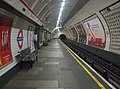
Lancaster Gate is a London Underground station located on the Central line near Lancaster Gate on Bayswater Road in Paddington (City of Westminster), to the north of Kensington Gardens. It is between Queensway and Marble Arch on the Central line and is in Travelcard Zone 1.

Contents

History

Station in 2002 before the facade was reclad Lancaster Gate Underground station, entrance 2002 (geograph 5472225).jpg
Station in 2002 before the facade was reclad

Lancaster Gate station was opened on 30 July 1900 by the Central London Railway (now the Central line). The original station building was typical of the work of the line's original architect Harry Bell Measures. It was demolished and a new surface building constructed as part of the development above in 1968. The development was designed by T P Bennett & Son as an office block but converted soon after into a hotel. In 2004–05 the lower floors of the hotel were re-clad in white stone to a design by Eric Parry Architects. [12] The hotel received planning permission for the re-cladding to include the station façade. [13]

Refurbishment

Lancaster Gate was closed from July to November 2006 so that the lifts and other parts of the station could be refurbished. [14] The station's chronic lift failures were considered by Transport for London to be a safety hazard and an inconvenience to passengers. Patronage has increased over the years and as a result the station's small ticket hall area is often congested, especially at weekends. [15]

Lancaster Gate station was also closed from January to June 2017 for complete replacement of the lifts. [16] Due to the small size of the station, it was not feasible to do one lift at a time, so it was deemed necessary to close the entire station.

Location

Despite its name, the station is close to the Marlborough Gate entrance to Hyde Park/Kensington Gardens, about 300m to the east of the Lancaster Gate entrance.

The station is within walking distance of Paddington station, providing a convenient interchange between the Central line and the main line station, although this is not highlighted on the Underground map. Transport for London's September 2011 report "Central London Rail Termini: Analysing passengers' onward travel patterns" did not include using Lancaster Gate as a means of getting from Paddington to the Central line. [17]

Connections

London Buses routes 94, 148, 274 and night route N207 serve the station

Related Research Articles

<span class="mw-page-title-main">London Paddington station</span> London railway station

Paddington, also known as London Paddington, is a Central London railway terminus and London Underground station complex, located on Praed Street in the Paddington area. The site has been the London terminus of services provided by the Great Western Railway and its successors since 1838. Much of the main line station dates from 1854 and was designed by Isambard Kingdom Brunel.

<span class="mw-page-title-main">Notting Hill Gate tube station</span> London Underground station

Notting Hill Gate is a London Underground station near Notting Hill, London, located on the street called Notting Hill Gate. On the Central line, it is between Holland Park to the west and Queensway to the east. On the District line and Circle line, it is between High Street Kensington and Bayswater stations. It is on the boundary of Travelcard Zone 1 and Zone 2.

<span class="mw-page-title-main">Bayswater tube station</span> London Underground station

Bayswater is a London Underground station in the Bayswater area of the City of Westminster. The station is on the Circle and District lines, between Notting Hill Gate and Paddington stations and is in Travelcard Zone 1. It is less than 100 metres (330 ft) away from the Central line's Queensway station.

<span class="mw-page-title-main">South Kensington tube station</span> London Underground station

South Kensington is a London Underground station in the district of South Kensington, south west London. It is served by the District, Circle and Piccadilly lines. On the District and Circle lines it is between Gloucester Road and Sloane Square, and on the Piccadilly line between Gloucester Road and Knightsbridge. It is in Travelcard Zone 1. The main station entrance is located at the junction of Old Brompton Road (A3218), Thurloe Place, Harrington Road, Onslow Place and Pelham Street. Subsidiary entrances are located in Exhibition Road giving access by pedestrian tunnel to the Natural History, Science and Victoria and Albert Museums. Also close by are the Royal Albert Hall, Imperial College London, the Royal College of Music, the London branch of the Goethe-Institut and the Ismaili Centre.

<span class="mw-page-title-main">Bond Street station</span> London Underground and Elizabeth line station

Bond Street is a London Underground and Elizabeth line station in Mayfair, in the West End of London. Entrances are on Oxford Street, near its junction with New Bond Street, and on Hanover Square.

<span class="mw-page-title-main">Edgware Road tube station (Circle, District and Hammersmith & City lines)</span> London Underground station on the Circle, District and Hammersmith & City lines

Edgware Road is a London Underground station on the Circle, District and Hammersmith & City lines, located on the corner of Chapel Street and Cabbell Street, within Travelcard zone 1. A separate station of the same name but served by the Bakerloo line is located about 150 metres away on the opposite side of Marylebone Road.

<span class="mw-page-title-main">Farringdon station</span> National rail and London Underground station

Farringdon is a London Underground and connected main line National Rail station in Clerkenwell, central London. The station is in the London Borough of Islington, just outside the boundary of the City of London. Opened in 1863 as the terminus of the Metropolitan Railway, the world's first underground passenger railway, Farringdon is one of the oldest surviving underground railway stations in the world.

<span class="mw-page-title-main">Gloucester Road tube station</span> London Underground station

Gloucester Road is a London Underground station in Kensington, west London. The station entrance is located close to the junction of Gloucester Road and Cromwell Road. Close by are the Cromwell Hospital and Baden-Powell House.

<span class="mw-page-title-main">High Street Kensington tube station</span> London Underground station

High Street Kensington is a London Underground station on Kensington High Street, in Kensington. The station is on the Circle line between Gloucester Road and Notting Hill Gate, and the District line between Earl's Court and Notting Hill Gate and is in Travelcard Zone 1. Kensington Arcade forms the entrance to the station.

<span class="mw-page-title-main">Great Portland Street tube station</span> London Underground station

Great Portland Street is a London Underground station near Regent's Park. It is between Baker Street and Euston Square on the Hammersmith & City, Circle and Metropolitan lines. Great Portland Street station is listed as a building of National Significance and lies in Travelcard Zone 1.

<span class="mw-page-title-main">Marble Arch tube station</span> London Underground station

Marble Arch is a London Underground station in the City of Westminster. The station is between Lancaster Gate and Bond Street stations on the Central line, and is in Travelcard Zone 1.

<span class="mw-page-title-main">Queensway tube station</span> London Underground station

Queensway is a London Underground station on the Central line in Bayswater, just inside the boundary of the City of Westminster with the Royal Borough of Kensington and Chelsea. It is at the junction of Queensway and Bayswater Road, and is opposite the north-west corner of Kensington Gardens. It is between Notting Hill Gate to the west and Lancaster Gate to the east, and is in Travelcard Zone 1.

<span class="mw-page-title-main">Barbican tube station</span> London Underground station

Barbican is a London Underground station situated near the Barbican Estate, on the edge of the ward of Farringdon Within, in the City of London in Central London. It has been known by various names since its opening in 1865, mostly in reference to the neighbouring ward of Aldersgate.

<span class="mw-page-title-main">Latimer Road tube station</span> London Underground station

Latimer Road is a London Underground station in North Kensington, in the Royal Borough of Kensington and Chelsea. It is on the Circle and Hammersmith & City lines between Wood Lane and Ladbroke Grove stations and is in Travelcard Zone 2.

<span class="mw-page-title-main">Greenford station</span> London Underground & National Rail station

Greenford is a London Underground and National Rail station in Greenford, Greater London, and is owned and managed by London Underground. It is the terminus of the National Rail Greenford branch line, 2 miles 40 chains down the line from West Ealing and 9 miles 6 chains measured from London Paddington. On the Central line, it is between Perivale and Northolt stations while on National Rail, the next station to the south on the branch is South Greenford.

<span class="mw-page-title-main">Holland Park tube station</span> London Underground station

Holland Park is a London Underground station, on Holland Park Avenue. It is served by the Central line, lying between Shepherd's Bush and Notting Hill Gate stations, in Travelcard Zone 2.

<span class="mw-page-title-main">Wanstead tube station</span> London Underground station

Wanstead is a London Underground station in Wanstead in the London Borough of Redbridge, east London. on the Hainault loop of the Central line. Towards Central London the next station is Leytonstone. Towards Woodford it is Redbridge. It is in Travelcard Zone 4. It opened on 14 December 1947 as an extension of the Central line to form the new part of the Hainault loop.

<span class="mw-page-title-main">West Brompton station</span> London Underground and railway station

West Brompton is a London Underground, London Overground and National Rail station on Old Brompton Road (A3218) in West Brompton, located in west London, and is on the District line and West London Line (WLL). It is immediately south of the demolished Earls Court Exhibition Centre and west of Brompton Cemetery in the Royal Borough of Kensington and Chelsea.

<span class="mw-page-title-main">Ladbroke Grove tube station</span> London Underground station

Ladbroke Grove is a London Underground station on the Circle and Hammersmith & City lines, between Latimer Road and Westbourne Park stations, and in Travelcard Zone 2 set in The Royal Borough of Kensington and Chelsea.

<span class="mw-page-title-main">Paddington tube station (Bakerloo, Circle and District lines)</span> London Underground station

Paddington is a London Underground station served by the Bakerloo, Circle and District lines. It is located on Praed Street to the south of Paddington mainline station and has entrances from Praed Street and from within the mainline station. On the Bakerloo line the station is between Warwick Avenue and Edgware Road and on the Circle and District lines it is between Bayswater and Edgware Road. It is in London Fare Zone 1.

References

  1. "Station Codes" (PDF). Transport for London. Retrieved 25 April 2021.
  2. "Out of Station Interchanges" (XLSX). Transport for London. 16 June 2020. Retrieved 5 November 2020.
  3. "Multi-year station entry-and-exit figures (2007–2017)". London Underground station passenger usage data. Transport for London. January 2018. Archived from the original (XLSX) on 31 July 2018. Retrieved 22 July 2018.
  4. "Station Usage Data" (CSV). Usage Statistics for London Stations, 2018. Transport for London. 21 August 2019. Archived from the original on 22 May 2020. Retrieved 27 April 2020.
  5. "Station Usage Data" (XLSX). Usage Statistics for London Stations, 2019. Transport for London. 23 September 2020. Archived from the original on 9 November 2020. Retrieved 9 November 2020.
  6. "Station Usage Data" (XLSX). Usage Statistics for London Stations, 2020. Transport for London. 16 April 2021. Retrieved 1 January 2022.
  7. "Station Usage Data" (XLSX). Usage Statistics for London Stations, 2021. Transport for London. 12 July 2022. Retrieved 7 September 2022.
  8. "Station Codes" (PDF). Transport for London. Retrieved 25 April 2021.
  9. "Station Codes" (PDF). Transport for London. Retrieved 25 April 2021.
  10. "Station Codes" (PDF). Transport for London. Retrieved 25 April 2021.
  11. "Station Codes" (PDF). Transport for London. Retrieved 25 April 2021.
  12. "Royal Lancaster Hotel" (PDF). Eric Parry Architects. Archived from the original (PDF) on 13 March 2012. Retrieved 26 September 2010.
  13. "Planning Application Ref: 00/05762/FULL" (PDF). City of Westminster. 1 March 2001. drawings EPA/RLH/P 1106 and 1204revP2. Retrieved 26 September 2010.[ permanent dead link ]
  14. "Lancaster Gate Closure" (PDF). Transport for London. 2006. Archived from the original (PDF) on 28 August 2006. Retrieved 3 July 2006.
  15. Modernisation and lift refurbishment for Lancaster Gate Transport for London Retrieved 2009-06-18
  16. "Lancaster Gate station closure". Transport for London. Archived from the original on 29 January 2017. Retrieved 5 April 2017.
  17. "Central London Rail Termini: Analysing passengers' onward travel patterns" (PDF). September 2011. p. 141. Retrieved 2 August 2012.
Preceding station Underground no-text.svg London Underground Following station
Queensway Central line Marble Arch