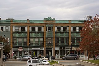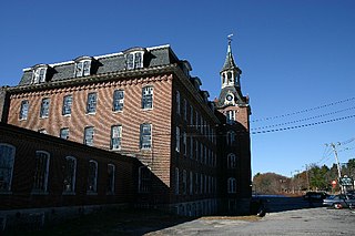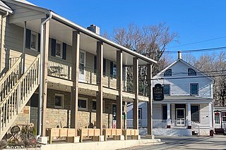
Elkland is a borough in Tioga County, Pennsylvania, United States. The population was 1,827 at the 2020 census.

Saxtons River is an incorporated village in the town of Rockingham in Windham County, Vermont, United States. The population was 479 at the 2020 census. For over a hundred years, Saxtons River has been the home of Vermont Academy, an independent secondary school. Most of the village is a historic district listed on the National Register of Historic Places in 1986 as Saxtons River Village Historic District.

Ware Shoals is a town in Abbeville, Greenwood, and Laurens counties in the U.S. state of South Carolina, along the Saluda River. At the 2020 census, the population was 1,701.

Morris is a town located in Otsego County, New York, United States. As of the 2010 census, the town had a population of 1,878. The town is named after General Jacob Morris.

The Unadilla River is a 71-mile-long (114 km) river in the Central New York Region of New York State. The river begins northeast of the hamlet of Millers Mills and flows generally south to the village of Sidney, where it converges with the Susquehanna River, which drains into the Chesapeake Bay, a bay of the Atlantic Ocean.

Wakefield is a village in the town of South Kingstown, Rhode Island, United States, and the commercial center of South Kingstown. Together with the village of Peace Dale, it is treated by the U.S. Census as a component of the census-designated place identified as Wakefield-Peacedale. West Kingston, another South Kingstown village, was the traditional county seat of Washington County. Since 1991, the Washington County Courthouse has been in Wakefield. The Sheriff's Office which handles corrections is also in Wakefield.

Neshanic is an unincorporated community and census-designated place (CDP) located within Hillsborough Township, in Somerset County, in the U.S. state of New Jersey. It is located near the South Branch Raritan River. The Neshanic Historic District was listed on the National Register of Historic Places in 1979.

Pottersville is an unincorporated community and census-designated place (CDP) split between Bedminster Township in Somerset County and Tewksbury Township in Hunterdon County, in the U.S. state of New Jersey. The area is served as United States Postal Service ZIP Code 07979. As of the 2010 United States Census, the population for ZIP Code Tabulation Area 07979 was 589. In 1990, most of the village was listed on the National Register of Historic Places as the Pottersville Village Historic District.
Holmesville is a hamlet in Chenango County, New York, United States. It is situated on the Unadilla River, in the south-east corner of the town of New Berlin.

Harrisville Historic District is a well-preserved historic New England mill village located in the southwest part of New Hampshire. It consists of about 200 acres (0.81 km2) and about 135 structures. It was declared a National Historic Landmark in 1977.

Linwood is a village with its own post office in the towns of Northbridge and Uxbridge, Massachusetts, United States.

North Uxbridge is a village and a post office in the town (township) of Uxbridge in Worcester County, Massachusetts, United States. The postal zip code is 01538. It is classified as a community or populated place located at latitude 42.088 and longitude -71.641 and the elevation is 266 feet (81 m). North Uxbridge appears on the Uxbridge U.S. Geological Survey Map. Worcester County is in the Eastern time zone and observes DST. North Uxbridge is located approximately 36 miles west-southwest of Boston, and 15 miles southeast of Worcester. The town meeting in 1885 set aside North Uxbridge as a "special district", since its population had exceeded 1000 people. North Uxbridge appeared as a separate Census tract in the 1960 census, with a population of 1882. In 2013, an Uxbridge DIY show, The Garage, with Steve Butler, went worldwide from Steve's garage in North Uxbridge.

Eastview is a business district and former hamlet in Mount Pleasant, Westchester County, New York, United States, located approximately 25 miles north of Midtown Manhattan. It was primarily residential, and had a post office, railroad station, and school. In the late 1920s, John D. Rockefeller Jr. purchased most of the hamlet's property and razed the buildings. The Hammond House, a National Register of Historic Places-listed farmhouse dating to the 1720s, is located in the district, on New York State Route 100C. Currently, dozens of commercial buildings have been developed in the area. The community is now most prominently known as the global headquarters for Regeneron Pharmaceuticals, which moved into a newly constructed campus in 2014.
Millville is a hamlet in the town of Shelby in Orleans County, New York, United States.

Green Park, an unincorporated village located in northeastern Tyrone Township, Perry County, Pennsylvania, United States, sits at the intersection of state routes 233 and 274. The name was given to a local land tract by James Baxter in the late 1700s and made popular as an unofficial moniker for mid- to late-1800s picnic and camp meeting grounds located at the upper end of Stambaugh Farm Run. The town serves as Perry County's midpoint between the Conococheague Mountain in the west and the Susquehanna River to the east.

Little York is an unincorporated community located along the border of Alexandria and Holland townships in Hunterdon County, in the U.S. state of New Jersey. Little York is located on County Route 614 3.1 miles (5.0 km) north-northeast of Milford. Little York has a post office with ZIP Code 08834.

Spring Mill is an unincorporated community in Whitemarsh Township, Montgomery County, Pennsylvania, United States.

Readingsburg, also known as Stone Mill, is an unincorporated community located along the South Branch Raritan River within Clinton Township in Hunterdon County, New Jersey.
East Calais is an unincorporated village in the town of Calais, Washington County, Vermont, United States. The community is located along Vermont Route 14, 10.3 miles (16.6 km) northeast of Montpelier. East Calais has a post office with ZIP code 05650, which opened on April 12, 1830. The heart of the village forms the East Calais Historic District, listed on the National Register of Historic Places in 2020.

Franklin Corners is an unincorporated community located along the Passaic River at the intersection of County Route 613 and U.S. Route 202 in Bernards Township of Somerset County, New Jersey. In the 19th century, it had a grist mill, saw mill, general store, school, and several houses. The Franklin Corners Historic District, featuring Van Dorn's Mill, was listed on the National Register of Historic Places in 1975.


