Lilly, Georgia

Last updated
Lilly, Georgia
Lilly City Hall (SouthEast face).JPG
Lilly City Hall
Dooly County Georgia Incorporated and Unincorporated areas Lilly Highlighted.svg
Location in Dooly County and the state of Georgia
Coordinates: 32°8′50″N83°52′40″W / 32.14722°N 83.87778°W / 32.14722; -83.87778
Country United States
State Georgia
County Dooly
Area
[1]
  Total0.60 sq mi (1.56 km2)
  Land0.60 sq mi (1.56 km2)
  Water0.00 sq mi (0.00 km2)
Elevation
348 ft (106 m)
Population
 (2020)
  Total129
  Density214.29/sq mi (82.74/km2)
Time zone UTC-5 (Eastern (EST))
  Summer (DST) UTC-4 (EDT)
ZIP code
31051
Area code 229
FIPS code 13-46384 [2]
GNIS feature ID0332214 [3]

Lilly is a city in Dooly County, Georgia, United States. The population was 213 at the 2010 census. [4]

Contents

Lilly was originally named "Midway", as it was the halfway point between Cordele and Montezuma. The name was changed upon the discovery that there already was another Midway in the state. The name "Lilly" is a reference to patriarchs of the town. [5]

Geography

Lilly is located in west-central Dooly County at 32°8′50″N83°52′40″W / 32.14722°N 83.87778°W / 32.14722; -83.87778 (32.147319, -83.877735). [6] Georgia State Route 90 passes through the center of town, leading north 4 miles (6 km) to Byromville and southeast 7 miles (11 km) to Vienna.

According to the United States Census Bureau, Lilly has a total area of 0.6 square miles (1.6 km2), all land. [4]

Demographics

Historical population
CensusPop.Note
1910 221
1920 25816.7%
1930 242−6.2%
1940 214−11.6%
1950 177−17.3%
1960 136−23.2%
1970 15514.0%
1980 20230.3%
1990 138−31.7%
2000 22160.1%
2010 213−3.6%
2020 129−39.4%
U.S. Decennial Census [7]

As of the census [2] of 2000, there were 221 people, 82 households, and 51 families residing in the city. The population density was 367.0 people per square mile (141.7 people/km2). There were 93 housing units at an average density of 154.5 units per square mile (59.7 units/km2). The racial makeup of the city was 52.49% White, 43.44% African American, 0.45% Asian, 3.17% from other races, and 0.45% from two or more races. Hispanic or Latino of any race were 3.17% of the population.

There were 82 households, out of which 40.2% had children under the age of 18 living with them, 32.9% were married couples living together, 24.4% had a female householder with no husband present, and 36.6% were non-families. 34.1% of all households were made up of individuals, and 14.6% had someone living alone who was 65 years of age or older. The average household size was 2.70 and the average family size was 3.50.

In the city, the population was spread out, with 36.7% under the age of 18, 10.4% from 18 to 24, 23.5% from 25 to 44, 17.2% from 45 to 64, and 12.2% who were 65 years of age or older. The median age was 27 years. For every 100 females, there were 92.2 males. For every 100 females age 18 and over, there were 64.7 males.

The median income for a household in the city was $27,639, and the median income for a family was $45,313. Males had a median income of $28,558 versus $25,000 for females. The per capita income for the city was $10,969. About 8.1% of families and 21.5% of the population were below the poverty line, including 32.4% of those under the age of eighteen and 16.7% of those 65 or over.

Related Research Articles

<span class="mw-page-title-main">Euharlee, Georgia</span> City in Georgia, United States

Euharlee is a city in Bartow County, Georgia, United States. The population was 4,136 at the 2010 census, an increase of 29% over the 2000 count of 3,208.

<span class="mw-page-title-main">Morganton, Georgia</span> City in Georgia, United States

Morganton is a city in Fannin County, Georgia, United States. The population was 285 at the 2020 census.

<span class="mw-page-title-main">Royston, Georgia</span> City in Georgia, United States

Royston is a city in Franklin, Hart, and Madison counties in the U.S. state of Georgia. The population was 2,649 at the 2020 census.

<span class="mw-page-title-main">Union Point, Georgia</span> City in Georgia, United States

Union Point is a city in Greene County, Georgia, United States. As of the 2020 census, the city population was 1,597.

<span class="mw-page-title-main">White Plains, Georgia</span> City in Georgia, United States

White Plains is a city in Greene County, Georgia, United States. The population was 284 at the 2010 census.

<span class="mw-page-title-main">Bowersville, Georgia</span> Town in Georgia, United States

Bowersville is a town in Hart County, Georgia, United States. As of the 2020 census, the town had a population of 444.

<span class="mw-page-title-main">Arcade, Georgia</span> City in Georgia, United States

Arcade is a city in Jackson County, Georgia, United States. As of the 2020 census it had a population of 1,884.

<span class="mw-page-title-main">Pendergrass, Georgia</span> City in Georgia, United States

Pendergrass is a city in Jackson County, Georgia, United States. The population was 1692 at the time of the 2020 census.

<span class="mw-page-title-main">Talmo, Georgia</span> Town in Georgia, United States

Talmo is a town in Jackson County, Georgia, United States. The population was 257 at the 2020 census.

<span class="mw-page-title-main">Arnoldsville, Georgia</span> City in Georgia, United States

Arnoldsville is a city in Oglethorpe County, Georgia, United States. As of the 2020 census, the city had a population of 431.
<span class="mw-page-title-main">LaFayette, Georgia</span> City in Georgia, United States

LaFayette is a city in, and the county seat of, Walker County, Georgia, United States. As of the 2020 census, the city population was 6,888. It was founded as Chattooga.

<span class="mw-page-title-main">Varnell, Georgia</span> City in Georgia, United States

Varnell is a city in Whitfield County, Georgia, United States. It is part of the Dalton, Georgia Metropolitan Statistical Area. The population was 2,179 at the 2020 census.

<span class="mw-page-title-main">Clark Fork, Idaho</span> City in Idaho, United States

Clark Fork is a small town in Bonner County, Idaho. The population was 536 at the time of the 2010 census.
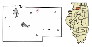
<span class="mw-page-title-main">West Brooklyn, Illinois</span> Village in Illinois, United States

West Brooklyn is a village in Lee County, Illinois, United States. The population was 142 at the 2010 census, down from 174 in 2000. There is one Church located in West Brooklyn...St. Mary of the Assumption Catholic Parish.

<span class="mw-page-title-main">Beaver Dam, Kentucky</span> City in Kentucky, United States

Beaver Dam is a home rule-class city in Ohio County, Kentucky, in the United States. The population was 3,409 at the 2010 census, and it is the most populous community in the county. It is named for the Beaver Dam Baptist Church which predates the town by several decades. The city was formally incorporated by the state assembly in 1873.

Worth is a town in Jefferson County, New York, United States. The population was 231 at the 2010 census. The town is named after William Worth, a commander of troops during the Battle of Sackett's Harbor.

<span class="mw-page-title-main">East Butler, Pennsylvania</span> Borough in Pennsylvania, United States

East Butler is a borough in Butler County, Pennsylvania, United States. The population was 732 at the 2010 census.

<span class="mw-page-title-main">Somerset Township, Washington County, Pennsylvania</span> Township in Pennsylvania, United States

Somerset Township is a township in Washington County, Pennsylvania, United States. The population was 2,579 at the 2020 census.

<span class="mw-page-title-main">Worthington, West Virginia</span> Town in West Virginia, United States

Worthington is a town in Marion County, West Virginia, United States. The population was 158 at the 2010 census. Worthington was incorporated in 1893 and named for Colonel George Worthington, an early settler. U.S. Route 19 passes through the town.

<span class="mw-page-title-main">Glen Dale, West Virginia</span> Town in West Virginia

Glen Dale is a city in Marshall County, West Virginia, United States, along the Ohio River. It is part of the Wheeling, West Virginia Metropolitan Statistical Area. The population was 1,514 at the 2020 census. Glen Dale was incorporated in 1924. It is in the northwest part of the county, which is above the Mason–Dixon line and forms the base of the Northern Panhandle of West Virginia.

References

  1. "2020 U.S. Gazetteer Files". United States Census Bureau. Retrieved December 18, 2021.
  2. 1 2 "U.S. Census website". United States Census Bureau . Retrieved 2008-01-31.
  3. "US Board on Geographic Names". United States Geological Survey. 2007-10-25. Retrieved 2008-01-31.
  4. 1 2 "Geographic Identifiers: 2010 Demographic Profile Data (G001): Lilly city, Georgia". U.S. Census Bureau, American Factfinder. Retrieved October 22, 2015.[ dead link ]
  5. Krakow, Kenneth K. (1975). Georgia Place-Names: Their History and Origins (PDF). Macon, GA: Winship Press. p. 132. ISBN   0-915430-00-2.
  6. "US Gazetteer files: 2010, 2000, and 1990". United States Census Bureau. 2011-02-12. Retrieved 2011-04-23.
  7. "Census of Population and Housing". Census.gov. Retrieved June 4, 2015.