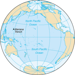
The Pacific Ocean is the largest and deepest of Earth's five oceanic divisions. It extends from the Arctic Ocean in the north to the Southern Ocean in the south, and is bounded by the continents of Asia and Australia in the west and the Americas in the east.

France began colonizing the Americas in the 16th century and continued into the following centuries as it established a colonial empire in the Western Hemisphere. France established colonies in much of eastern North America, on several Caribbean islands, and in South America. Most colonies were developed to export products such as fish, rice, sugar, and furs.

Circumnavigation is the complete navigation around an entire island, continent, or astronomical body. This article focuses on the circumnavigation of Earth.

The Prix de Rome or Grand Prix de Rome was a French scholarship for arts students, initially for painters and sculptors, that was established in 1663 during the reign of Louis XIV of France. Winners were awarded a bursary that allowed them to stay in Rome for three to five years at the expense of the state. The prize was extended to architecture in 1720, music in 1803 and engraving in 1804. The prestigious award was abolished in 1968 by André Malraux, then Minister of Culture, following the May 68 riots that called for cultural change.

Geographical exploration, sometimes considered the default meaning for the more general term exploration, refers to the practice of discovering remote lands and regions of the planet Earth. It is studied by geographers and historians.

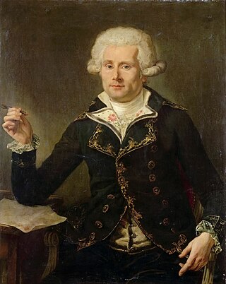
Louis-Antoine, Comte de Bougainville was a French military officer, explorer and nobleman. A contemporary of the British explorer James Cook, he served in the Seven Years' War and the American Revolutionary War. Bougainville later gained fame for his expeditions, including a circumnavigation of the globe in a scientific expedition in 1763, the first recorded settlement on the Falkland Islands, and voyages into the Pacific Ocean. Bougainville Island of Papua New Guinea as well as the flowering plant Bougainvillea are named in his honour.

The trade winds or easterlies are permanent east-to-west prevailing winds that flow in the Earth's equatorial region. The trade winds blow mainly from the northeast in the Northern Hemisphere and from the southeast in the Southern Hemisphere, strengthening during the winter and when the Arctic oscillation is in its warm phase. Trade winds have been used by captains of sailing ships to cross the world's oceans for centuries. They enabled European colonization of the Americas, and trade routes to become established across the Atlantic Ocean and the Pacific Ocean.

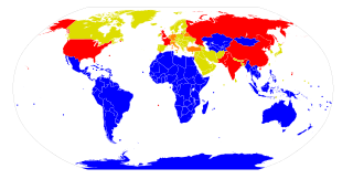
A nuclear-weapon-free zone (NWFZ) is defined by the United Nations as an agreement that a group of states has freely established by treaty or convention that bans the development, manufacturing, control, possession, testing, stationing or transporting of nuclear weapons in a given area, that has mechanisms of verification and control to enforce its obligations, and that is recognized as such by the General Assembly of the United Nations. NWFZs have a similar purpose to, but are distinct from, the Treaty on the Non-Proliferation of Nuclear Weapons to which most countries including five nuclear weapons states are a party. Another term, nuclear-free zone, often means an area that has banned both nuclear power and nuclear weapons, and sometimes nuclear waste and nuclear propulsion, and usually does not mean a UN-acknowledged international treaty.

Jean-Baptiste Gaultier de la Vérendrye was the eldest son of Pierre Gaultier de Varennes et de La Vérendrye and Marie-Anne Dandonneau Du Sablé. He was born on Île Dupas near Sorel, New France
François de La Vérendrye was a Canadian explorer. He was the third son of Pierre Gaultier de Varennes, sieur de La Vérendrye. He was born at Sorel, New France in 1715 and was active in his father's trade activities from Fort Kaministiquia to the North Saskatchewan River.

Anthony de la Roché was a 17th-century English maritime explorer and merchant, born in London to a French Huguenot father and an English mother, who took part in a joint venture established by English and Dutch shipowners in the Spanish port city of Cádiz in order to engage in the lucrative New World trade. During a commercial voyage between Europe and South America he was blown off course in Drake Passage, visited the island of South Georgia and sighted Clerke Rocks in 1675, thereby making the first discovery of land in the Antarctic. In doing so he crossed the Antarctic Convergence, a natural boundary of the Antarctic region that would be described two and a half centuries later by the British Discovery Investigations and the German Meteor Expedition.

Determining the boundaries between the continents is generally a matter of geographical convention. Several slightly different conventions are in use. The number of continents is most commonly considered seven but may range as low as four when Afro-Eurasia and the Americas are both considered as single continents. An island can be considered to be associated with a given continent by either lying on the continent's adjacent continental shelf or being a part of a microcontinent on the same principal tectonic plate. An island can also be entirely oceanic while still being associated with a continent by geology or by common geopolitical convention. Another example is the grouping into Oceania of the Pacific Islands with Australia and Zealandia.
Major explorations of Earth continued after the Age of Discovery. By the early seventeenth century, vessels were sufficiently well built and their navigators competent enough to travel to virtually anywhere on the planet by sea. In the 17th century, Dutch explorers such as Willem Jansz and Abel Tasman explored the coasts of Australia. Spanish expeditions from Peru explored the South Pacific and discovered archipelagos such as Vanuatu and the Pitcairn Islands. Luis Vaez de Torres chartered the coasts of New Guinea and the Solomon Islands, and discovered the strait that bears his name. European naval exploration mapped the western and northern coasts of Australia, but the east coast had to wait for over a century. Eighteenth-century British explorer James Cook mapped much of Polynesia and traveled as far north as Alaska and as far south as the Antarctic Circle. In the later 18th century, the Pacific became a focus of renewed interest, with Spanish expeditions, followed by Northern European ones, reaching the coasts of northern British Columbia and Alaska.

This timeline of European exploration lists major geographic discoveries and other firsts credited to or involving Europeans during the Age of Discovery and the following centuries, between the years AD 1418 and 1957.

The borders of the oceans are the limits of Earth's oceanic waters. The definition and number of oceans can vary depending on the adopted criteria. The principal divisions of the five oceans are the Pacific Ocean, Atlantic Ocean, Indian Ocean, Southern (Antarctic) Ocean, and Arctic Ocean. Smaller regions of the oceans are called seas, gulfs, bays, straits, and other terms. Geologically, an ocean is an area of oceanic crust covered by water.

The era of European and American voyages of scientific exploration followed the Age of Discovery and were inspired by a new confidence in science and reason that arose in the Age of Enlightenment. Maritime expeditions in the Age of Discovery were a means of expanding colonial empires, establishing new trade routes and extending diplomatic and trade relations to new territories, but with the Enlightenment scientific curiosity became a new motive for exploration to add to the commercial and political ambitions of the past. See also List of Arctic expeditions and List of Antarctic expeditions.