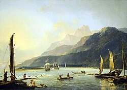
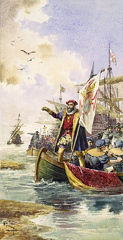
This timeline of European exploration lists major geographic discoveries and other firsts credited to or involving Europeans during the Age of Discovery and the following centuries, between the years AD 1418 and 1957.
Despite several significant transoceanic and transcontinental explorations by European civilizations in the preceding centuries, the precise geography of the Earth outside of Europe was largely unknown to Europeans before the 15th century, when technological advances (especially in sea travel) as well as the rise of colonialism, mercantilism, and a host of other social, cultural, and economic changes made it possible to organize large-scale exploratory expeditions to uncharted parts of the globe.
The Age of Discovery arguably began in the early 15th century with the rounding of the feared Cape Bojador and Portuguese exploration of the west coast of Africa, while in the last decade of the century the Spanish sent expeditions far across the Atlantic, where the Americas would eventually be reached, and the Portuguese found a sea route to India. In the 16th century, various European states funded expeditions to the interior of both North and South America, as well as to their respective west and east coasts, north to California and Labrador and south to Chile and Tierra del Fuego. In the 17th century, Russian explorers conquered Siberia in search of sables, while the Dutch contributed greatly to the charting of Australia. The 18th century witnessed the first extensive explorations of the South Pacific and Oceania and the exploration of Alaska, while the 19th was dominated by exploration of the polar regions and excursions into the heart of Africa. By the early 20th century, the poles themselves had been reached.
The Northwest Passage (NWP) is the sea lane between the Atlantic and Pacific oceans through the Arctic Ocean, along the northern coast of North America via waterways through the Canadian Arctic Archipelago. The eastern route along the Arctic coasts of Norway and Siberia is accordingly called the Northeast Passage (NEP). The various islands of the archipelago are separated from one another and from Mainland Canada by a series of Arctic waterways collectively known as the Northwest Passages, Northwestern Passages or the Canadian Internal Waters.
The maritime European exploration of Australia consisted of several waves of European seafarers who sailed the edges of the Australian continent. Dutch navigators were the first Europeans known to have explored and mapped the Australian coastline. The first documented encounter was that of Dutch navigator Willem Janszoon, in 1606. Dutch seafarers also visited the west and north coasts of the continent, as did French explorers.
John Rae was a Scottish surgeon who explored parts of northern Canada.
Otto von Kotzebue was a Russian naval officer in the Imperial Russian Navy. He commanded two naval expeditions into the Pacific for the purposes of exploration and scientific investigation. The first expedition explored Oceania, the western coast of North America and passed through the Bering Strait in search of a passage across the Arctic Ocean. His second voyage was intended as a military resupply mission to Kamchatka but again included significant explorations of the west coast of North America and Oceania.
Geographical exploration, sometimes considered the default meaning for the more general term exploration, refers to the practice of discovering remote lands and regions of the planet Earth. It is studied by geographers and historians.
The Island of California refers to a long-held global misconception, dating from the 16th century, that California was not part of mainland North America but rather a large island separated from the continent by a strait now known as the Gulf of California.
Dinis Dias was a 15th-century Portuguese explorer who sailed down the coast of West Africa, passing the Senegal River and reaching the Cape Verde Peninsula for the first time.
The Vancouver Expedition (1791–1795) was a four-and-a-half-year voyage of exploration and diplomacy, commanded by Captain George Vancouver of the Royal Navy. The British expedition circumnavigated the globe and made contact with five continents. The expedition at various times included between two and four vessels, and up to 153 men, all but 6 of whom returned home safely.
During the Age of Exploration, the Spanish Empire undertook several expeditions to the Pacific Northwest of North America. Spanish claims to the region date to the papal bull of 1493, and the Treaty of Tordesillas signed in 1494. In 1513, this claim was reinforced by Spanish explorer Vasco Núñez de Balboa, the first European to sight the Pacific Ocean, when he claimed all lands adjoining this ocean for the Spanish Crown. Spain only started to colonize the claimed territory north of present-day Mexico in the 18th century, when it settled the northern coast of Las Californias.
José María Narváez was a Spanish naval officer, explorer, and navigator notable for his work in the Gulf Islands and Lower Mainland of present-day British Columbia. In 1791, as commander of the schooner Santa Saturnina, he led the first European exploration of the Strait of Georgia, including a landing on present-day British Columbia's Sunshine Coast. He also entered Burrard Inlet, the site of present-day Vancouver, British Columbia.
Farthest South refers to the most southerly latitude reached by explorers before the first successful expedition to the South Pole in 1911.
Juan Carrasco was a Spanish naval officer, explorer, and navigator. He is remembered mainly for his work in the Pacific Northwest during the late 18th century. He was second in command of the 1791 voyage of José María Narváez, the first European exploration of the Strait of Georgia.
Thomas Simpson was a Scottish Arctic explorer, Hudson's Bay Company fur trader, and cousin of Company Governor Sir George Simpson. He helped chart the northern coasts of Canada. He died by violence near the Turtle River while traveling through the wilderness in what is now the U.S. state of North Dakota but was then part of the Territory of Iowa. The circumstances of his final hours—in which he allegedly killed himself after gunning down two companions—have long been a subject of controversy.
The exploration of North America by European sailors and geographers was an effort by major European powers to map and explore the continent with the goal of economic, religious and military expansion. The combative and rapid nature of this exploration is the result of a series of countering actions by neighboring European nations to ensure no single country had garnered enough wealth and power from the Americas to militarily tip the scales over on the European continent. It spanned the late 15th to early 17th centuries, and consisted primarily of expeditions funded by Spain, England, France, and Portugal. See also the European colonization of the Americas.
Major explorations of Earth continued after the Age of Discovery. By the early seventeenth century, vessels were sufficiently well built and their navigators competent enough to travel to virtually anywhere on the planet by sea. In the 17th century, Dutch explorers such as Willem Jansz and Abel Tasman explored the coasts of Australia. Spanish expeditions from Peru explored the South Pacific and discovered archipelagos such as Vanuatu and the Pitcairn Islands. Luis Vaez de Torres chartered the coasts of New Guinea and the Solomon Islands, and discovered the strait that bears his name. European naval exploration mapped the western and northern coasts of Australia, but the east coast had to wait for over a century. Eighteenth-century British explorer James Cook mapped much of Polynesia and traveled as far north as Alaska and as far south as the Antarctic Circle. In the later 18th century, the Pacific became a focus of renewed interest, with Spanish expeditions, followed by Northern European ones, reaching the coasts of northern British Columbia and Alaska.
Arctic exploration is the physical exploration of the Arctic region of the Earth. It refers to the historical period during which mankind has explored the region north of the Arctic Circle. Historical records suggest that humankind have explored the northern extremes since 325 BC, when the ancient Greek sailor Pytheas reached a frozen sea while attempting to find a source of the metal tin. Dangerous oceans and poor weather conditions often fetter explorers attempting to reach polar regions, and journeying through these perils by sight, boat, and foot has proven difficult.
Early Polynesian explorers reached nearly all Pacific islands by 1200 CE, followed by Asian navigation in Southeast Asia and the West Pacific. During the Middle Ages, Muslim traders linked the Middle East and East Africa to the Asian Pacific coasts, reaching southern China and much of the Malay Archipelago. Direct European contact with the Pacific began in 1512, with the Portuguese encountering its western edges, soon followed by the Spanish arriving from the American coast.
The Pacific Northwest coast of North America was one of the last coastlines reached by European explorers. In terms of sailing time from Europe, it was one of the most distant places on earth. This article covers what Europeans knew or thought they knew before the area was explored by Captain Cook in 1778.
History of Central America.
Lorenzo de Gomez New Guinea 1518.
Jorge de Menezes New Guinea.
A life of John Davis.
Henry Hudson the navigator.
History of Brulé's Discoveries and Explorations, 1610–1626.
William Baffin.
European exploration Tibet.
William Edward Parry 1819.
John Franklin.
Captain Nathaniel Brown Palmer.
William Edward Parry 1824.
John Franklin 1826.
Frederick Beechey 1826.
George Back 1836.
Thomas Simpson 1843.
Sherard Osborn.
A summer search for Sir John Franklin; with a peep into the polar basin.
The Eventful Voyages of HMS Resolute.
Elisha Kent Kane.
John Hanning Speke Lake Tanganyika.