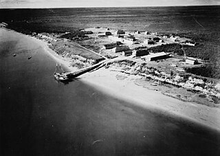
The Stikine River is a major river in northern British Columbia (BC), Canada and southeastern Alaska in the United States. It drains a large, remote upland area known as the Stikine Country east of the Coast Mountains. Flowing west and south for 610 kilometres (379 mi), it empties into various straits of the Inside Passage near Wrangell, Alaska. About 90 percent of the river's length and 95 percent of its drainage basin are in Canada. Considered one of the last truly wild large rivers in BC, the Stikine flows through a variety of landscapes including boreal forest, steep canyons and wide glacial valleys.

The Liard River of the North American boreal forest flows through Yukon, British Columbia and the Northwest Territories, Canada. Rising in the Saint Cyr Range of the Pelly Mountains in southeastern Yukon, it flows 1,115 km (693 mi) southeast through British Columbia, marking the northern end of the Rocky Mountains and then curving northeast back into Yukon and Northwest Territories, draining into the Mackenzie River at Fort Simpson, Northwest Territories. The river drains approximately 277,100 km2 (107,000 sq mi) of boreal forest and muskeg.

The Hayes River is a river in Northern Manitoba, Canada, that flows from Molson Lake to Hudson Bay at York Factory. It was historically an important river in the development of Canada and is now a Canadian Heritage River and the longest naturally flowing river in Manitoba.

The Rocky Mountain Trench, also known as the Valley of a Thousand Peaks or simply the Trench, is a large valley on the western side of the northern part of North America's Rocky Mountains. The Trench is both visually and cartographically a striking physiographic feature extending approximately 1,600 km (1,000 mi) from Flathead Lake, Montana, to the Liard River, just south of the British Columbia–Yukon border near Watson Lake, Yukon. The trench bottom is 3–16 km (1.9–9.9 mi) wide and is 600–900 m (2,000–3,000 ft) above sea level. The general orientation of the Trench is an almost straight 150/330° geographic north vector and has become convenient as a visual guide for aviators heading north or south.
Samuel Black was a Scottish fur trader and explorer, a clerk in the New North Nest Company (XYC) and Wintering Partner in the North West Company (NWC), and later clerk, chief trader, and chief factor in the Hudson's Bay Company (HBC) for the Columbia District. In 1824, he explored the Finlay River and its tributaries in present-day north-central British Columbia, Canada, including the Muskwa, Omineca and Stikine for the HBC. His journals were published by the Hudson's Bay Record Society in 1955.

The Kechika River is a tributary of the Liard River, about 300 kilometres (190 mi) long, in northern British Columbia, Canada. The Kechika flows generally northwest through the northernmost section of the Rocky Mountain Trench before turning east to join the Liard, a major branch of the Mackenzie River system. The river's 22,700 km2 (8,800 sq mi) drainage basin is characterized by high glaciated peaks, boreal forest, and open tundra. With no settlements, roads or dams along its course, the Kechika is considered "one of British Columbia's finest examples of wilderness and undisturbed wildlife habitat."

The Muskwa River flows 257 kilometres (160 mi) through northern British Columbia, Canada. It is a major tributary of the Fort Nelson River - part of the Mackenzie River system. The river rises at Fern Lake in the Bedaux Pass in the Northern Rocky Mountains. From there, it flows generally east, then north, and then east again to meet with the Fort Nelson River just east of the town of Fort Nelson. The river drops approximately 1,100 metres (3,600 ft), its course taking it down the Rocky Mountain foothills through sub-alpine and boreal forest to meander across the forest and muskegs of the vast Liard River plains. From mouth to headwater, prominent tributaries include the Prophet River, Tuchodi River, and Gathto Creek. Much of the upper portions of this wilderness river and its watershed are located in the Northern Rocky Mountains Provincial Park, which is part of the larger Muskwa-Kechika Management Area. The region is a popular wilderness recreation destination.

The Dease River flows through northwestern British Columbia, Canada and is a tributary of the Liard River. The river descends from Dease Lake, though its ultimate origin is in the headwaters of Little Dease Creek at Snow Peak, approximately 50 kilometres (31 mi) west of the lake. The river flows 265 kilometres (165 mi) generally north-eastward, draining into the Liard River near Lower Post, British Columbia. Large sections of the river parallel the Cassiar Highway, helping to make it a popular destination for canoeists, kayakers, and rafters.
Liard River Hot Springs Provincial Park is a provincial park in British Columbia, Canada. It is home to the second largest natural hot springs in Canada, after Deer River Hot Springs 15 km to the north east. It is a natural river of hot water rather than a spring fed man made pool. The park is part of the larger Muskwa-Kechika Management Area. The community of Liard River, British Columbia is located nearby.

Kwadacha, also known as Fort Ware or simple Ware, is an aboriginal community in northern British Columbia, Canada, located in the Rocky Mountain Trench at the confluence of the Finlay, Kwadacha and Fox Rivers, in the Rocky Mountain Trench upstream from the end of the Finlay Reach of Williston Lake. The population is about 350. It is in the federal electoral riding of Prince George-Peace River.
Dune Za Keyih Provincial Park and Protected Area, also known as the Frog-Gataga Provincial Park, is a provincial park in British Columbia, Canada. It is part of the larger Muskwa-Kechika Management Area and is located in the area of the Gataga River, between Denetiah Provincial Park, which lies west across the Kechika River, and Kwadacha Wilderness Provincial Park to its east. Established in 2001 as Frog-Gataga, the park is 346,833 hectares in area; its newer name is a Kaska Dena translation of Frog-Gataga.
Dall River Old Growth Provincial Park is a provincial park in British Columbia, Canada. It is part of the larger Muskwa-Kechika Management Area and is located immediately northwest of Denetiah Provincial Park, northwest of the junction of the Gataga and Kechika Rivers. Established in 1999, the park is 642 ha. in area. The park protects areas of white spruce old growth.

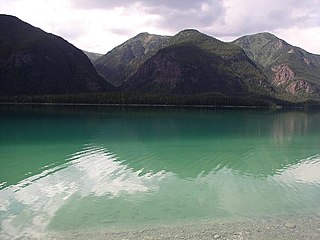
Muncho Lake Provincial Park is a provincial park in British Columbia, Canada, located on the Alaska Highway as it transits the northernmost Canadian Rockies west of Fort Nelson. The park is part of the larger Muskwa-Kechika Management Area. It is named after Muncho Lake, which is in the park and is both the name of the lake and of the community located there.
Prophet River Hot Springs Provincial Park is a provincial park in British Columbia, Canada. Established high in the Muskwa Ranges, on the course of the Prophet River, it is part of the larger Muskwa-Kechika Management Area.
Redfern-Keily Provincial Park was a provincial park in British Columbia, Canada.
The Toad River is a river in the Canadian boreal forest, within the borders of the province of British Columbia.
Dease Lake is a lake in the Stikine Plateau of the Northern Interior of British Columbia, Canada, located at the head of the Dease River, which flows north then northeast from the lake to join the Liard River. The community of Dease Lake, British Columbia, formerly Dease Lake Post, is located at the south end of the lake, straddling a low pass which leads into the basin from the Tanzilla River, a tributary of the Stikine. The area around the lake was the focus of the Cassiar Gold Rush and numerous ghost towns and former settlement sites are scattered around its shores, including Laketon and Centre City. Dease Lake is the burial site and has a monument to English travelogue writer Warburton Pike.
The Muskwa-Kechika Management Area is a provincially run tract of land in the far north of British Columbia. It has an advisory board that advises the government on land-use decisions. Established by provincial government legislation in 1998, the area is meant to be preserved as a wild area, but development is not forbidden. The land is divided into different zones, with varying levels of protection, although the whole area is supposed to be used according to an overall plan. The original plan called for 25% of the land to be turned into provincial parks, 60% to become "special management zones" where mining and oil and gas drilling was to be allowed, and 15% to become "special wildland zones" where logging is prohibited. The original size of the M-KMA was 4,450,000 hectares however in 2000 with the approval of the Mackenzie Land and Resource Management Plan (LRMP) over 1,900,000 hectares were added to the M-KMA creating a total area of 6,400,000 hectares, which is approximately the size of the US state of Maine, or the island of Ireland, or seven times the size of Yellowstone National Park in the United States.
Besa River is a river in northern British Columbia, Canada. It is a tributary of the Prophet River.
The Red River is a tributary of the Kechika River in the far north of British Columbia, Canada, flowing east to meet the Kechika from headwaters in the Cassiar Mountains. In its middle reaches it forms the boundary between the Dease Plateau (N) and the Cassiar Mountains (S) and for its final stretch it crosses part of the Liard Plain. It is crossed by an unnamed road about 17.5 kilometres (10.9 mi) upstream from its confluence with the Kechika, and is just to the north of Aeroplane Lake.


