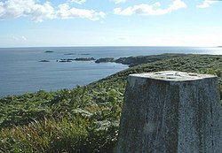
This List of Bays of Inner Hebrides summarises the bays that are located on the islands of the Inner Hebrides in Scotland.
The island of Eilean Mòr has the following bays:
Name | County | Nearest Village | Coordinates | Notes |
---|---|---|---|---|
Camas na h-Annait | Inverness-shire | 57°20′42″N5°49′38″W / 57.34510040°N 5.82727542°W |
The island of Eilean Dubh Mòr has the following bays:
Name | County | Nearest Village | Coordinates | Notes |
---|---|---|---|---|
Port Bàn | Argyllshire | 56°13′51″N5°43′31″W / 56.23089981°N 5.72522917°W | ||
The island of Kerrera has the following bays:
The island of Lismore has the following bays:
Name | County | Nearest Village | Coordinates | Notes |
---|---|---|---|---|
Achadun Bay | Argyllshire | Benderloch | 56°29′54″N5°34′00″W / 56.49840164°N 5.56672626°W | [5] |
Bàgh Clach an Dobhrain | Argyllshire | Benderloch | 56°28′29″N5°34′42″W / 56.47480011°N 5.57823002°W | |
Bernera Bay | Argyllshire | Benderloch | 56°29′32″N5°34′42″W / 56.49219894°N 5.57829511°W | [5] |
Camas Mhic Lairtidh | Argyllshire | Benderloch | 56°33′12″N5°27′41″W / 56.55329895°N 5.46130503°W | |
Miller's Port | Argyllshire | Benderloch | 56°28′32″N5°33′14″W / 56.47560120°N 5.55389802°W | |
Slughan | Argyllshire | Benderloch | 56°33′06″N5°28′05″W / 56.55179977°N 5.46808082°W | |
This small island of Eileach an Naoimh has no bays.
The island of Garbh Eileach has the following bays:
Name | County | Nearest Village | Coordinates | Notes |
---|---|---|---|---|
Sloc a' Cheatharnaich | Argyllshire | 56°14′33″N5°45′12″W / 56.24259949°N 5.75346489°W | ||
A tidal island with no bays.
The island of Gigha has the following bays:
Name | County | Nearest Village | Coordinates | Notes |
---|---|---|---|---|
Port na Seralaic | Argyllshire | 55°38′04″N5°45′18″W / 55.63449860°N 5.75493794°W | ||
Name | County | Nearest Village | Coordinates | Notes |
---|---|---|---|---|
Port na h-Atha | Argyllshire | 56°00′51″N6°13′52″W / 56.01430130°N 6.23100171°W | [34] | |
A small inhabited island in Loch Crinan with no bays.
Name | County | Nearest Village | Coordinates | Notes |
---|---|---|---|---|
Bàgh Àird an t-Sàilein | Argyllshire | 56°10′15″N5°32′24″W / 56.17070007°N 5.54013780°W | ||
Bàgh Innvraig | Argyllshire | 56°10′24″N5°32′11″W / 56.17319870°N 5.53638213°W | ||
The small island of Eilean Rìgh has no bays.
The small island of Eilean Trodday has no bays.
Erisa is a flat tidal island at the entrance to Loch Creran with no bays.
Name | County | Nearest Village | Coordinates | Notes |
---|---|---|---|---|
Port an Sgrìodain | Argyllshire | 56°48′17″N5°52′43″W / 56.80469894°N 5.87850089°W | ||
A small tidal island on the south channel of Loch Moidart with no bays.
There is no bays on Càrna.
There is no bays on Oldany.
There is no bays on Oronsay.
This island has no bays.
The island of Eorsa has no bays.
Name | County | Nearest Village | Coordinates | Notes |
---|---|---|---|---|
Port na Faoilinn Bàine | Argyllshire | 56°17′43″N6°22′41″W / 56.29539871°N 6.37817152°W | ||
Name | County | Nearest Village | Coordinates | Notes |
---|---|---|---|---|
Acairseid Mhòr | Argyllshire | Cleadale | 56°29′38″N6°18′03″W / 56.49380112°N 6.30081360°W | |
Name | County | Nearest Village | Coordinates | Notes |
---|---|---|---|---|
McNeil's Bay | Argyllshire | 56°33′49″N6°43′55″W / 56.56359863°N 6.73196769°W | [43] | |
Name | County | Nearest Village | Coordinates | Notes |
---|---|---|---|---|
Bagh an Lollaich | Argyllshire | 56°26′24″N6°09′57″W / 56.440120°N 6.165704°W | ||
This small island has no bays.
The small island of Staffa has no bays.
This island of Shuna has no bays.
This small island of Lunga has no bays.
The small island of Eilean an Ròin Mòr and the much smaller island next to it, Eilean an Ròin Beag has no bays.
Name | County | Nearest Village | Coordinates | Notes |
---|---|---|---|---|
Camas a' Channuinn | Ross and Cromarty | 57°42′29″N5°43′08″W / 57.70800018°N 5.71895720°W | ||
Camas Ruadh | Ross and Cromarty | 57°42′28″N5°42′45″W / 57.70769882°N 5.71249311°W | ||
This island has no bays.
Name | County | Nearest Village | Coordinates | Notes |
---|---|---|---|---|
Acairseid Mhòr | Ross and Cromarty | 57°50′34″N5°37′57″W / 57.84280014°N 5.63240631°W | ||
Camas Beithe | Ross and Cromarty | 57°50′25″N5°37′34″W / 57.84030151°N 5.62599484°W | [73] | |
Uamhag na Creige-streap | Ross and Cromarty | 57°50′41″N5°38′23″W / 57.84469986°N 5.63964235°W | ||
Uamhag nan Gobhar | Ross and Cromarty | 57°50′49″N5°38′12″W / 57.84700012°N 5.63657998°W | ||
Name | County | Nearest Village | Coordinates | Notes |
---|---|---|---|---|
Camas na Rainich | Ross and Cromarty | 57°44′04″N5°48′47″W / 57.73440170°N 5.81316147°W | [74] | |
Camas nam Faochag | Ross and Cromarty | 57°44′11″N5°49′10″W / 57.73649979°N 5.81941072°W | [74] |
The small island of Eilean an Ròin Mòr has no bays.
The small island of Eilean Ighe has no bays.
The small island of Eilean Bàn between Kyle of Lochalsh and the Isle of Skye and has no bays.
The small island of Eilean Orasaigh has no bays.
The small island of Eilean Tigh has no bays.
The small island of Harlosh has no bays.
The small island of Isay in Loch Dunvegan has no bays.
The small island of Longay has no bays.
The small island of Ornsay of the south-east coast of Skye has no bays.
The small island of Pabay, off the southeast coast of Skye has no bays.
Name | County | Nearest Village | Coordinates | Notes |
---|---|---|---|---|
Camas na Geadaig | Inverness-shire | 57°19′17″N6°00′28″W / 57.32149887°N 6.00789027°W | [79] | |
Camas na Fisteodh | Inverness-shire | 57°17′17″N5°55′32″W / 57.28799820°N 5.92546245°W | ||
Name | County | Nearest Village | Coordinates | Notes |
---|---|---|---|---|
Camas nan Gall | Inverness-shire | 57°08′50″N6°12′22″W / 57.14709854°N 6.20615471°W | [94] | |
Name | County | Nearest Village | Coordinates | Notes |
---|---|---|---|---|
Camas na Cille | Inverness-shire | 57°20′24″N6°30′25″W / 57.34009933°N 6.50690957°W | [95] | |
Name | County | Nearest Village | Coordinates | Notes |
---|---|---|---|---|
Camas na h-Annait | Ross and Cromarty | 57°20′42″N5°49′38″W / 57.34510040°N 5.82727542°W | ||
Name | County | Nearest Village | Coordinates | Notes |
---|---|---|---|---|
Camas Mòr | Argyllshire | 56°17′20″N5°39′21″W / 56.28889847°N 5.65591076°W | ||
The small island of Insh has no bays.
Name | County | Nearest Village | Coordinates | Notes |
---|---|---|---|---|
Camas a' Mhòr-Fhir | Argyllshire | 56°12′40″N5°42′18″W / 56.21099854°N 5.70498650°W | ||
The island of Seil has the following bays:
Name | County | Nearest Village | Coordinates | Notes |
---|---|---|---|---|
Balvicar Bay | Argyllshire | 56°17′36″N5°36′07″W / 56.29320145°N 5.60204224°W | [100] | |
Port MÒr | Argyllshire | 56°16′35″N5°36′28″W / 56.276406°N 5.607674°W |
The island of Shuna has the following bays:
Name | County | Nearest Village | Coordinates | Notes |
---|---|---|---|---|
Port na Crò | Argyllshire | 56°13′30″N5°36′45″W / 56.22489929°N 5.61255437°W | [101] | |
A small island of Torsa off the north coast of Luing has no bays.
The island of Canna has the following bays:
Name | County | Nearest Village | Coordinates | Notes |
---|---|---|---|---|
An Doirlinn | Inverness-shire | 57°03′12″N6°30′42″W / 57.05339813°N 6.51179166°W | ||
Camas Thairbearnais | Inverness-shire | 57°04′09″N6°33′31″W / 57.06930161°N 6.55861092°W | ||
Tarbert Bay | Inverness-shire | 57°03′19″N6°32′42″W / 57.05519867°N 6.54513378°W | [102] | |
The island of Eigg has the following bays:
Name | County | Nearest Village | Coordinates | Notes |
---|---|---|---|---|
Bay of Laig | Inverness-shire | Galmisdale | 56°55′27″N6°09′45″W / 56.92430115°N 6.16256413°W | [103] |
Camas Sgiotaig | Inverness-shire | Galmisdale | 56°55′48″N6°09′50″W / 56.93000031°N 6.16388572°W | |
Poll nam Partan | Inverness-shire | Galmisdale | 56°53′07″N6°07′25″W / 56.88529968°N 6.12355707°W | |
The island of Muck has the following bays:
The island of Rùm has the following bays:
The island of Sanday has the following bays:
The island of Horse has the following bays:
Name | County | Nearest Village | Coordinates | Notes |
---|---|---|---|---|
Achlais Sgùrr nan Uan | Ross and Cromarty | 57°59′09″N5°20′16″W / 57.98580170°N 5.33782072°W | ||
This small island of Island Macaskin has no bays.
The island of Isle Martin has the following bays:
Name | County | Nearest Village | Coordinates | Notes |
---|---|---|---|---|
Camas a’ Bhuailidh | Ross and Cromarty | 57°56′21″N5°13′33″W / 57.93930054°N 5.22592735°W | [110] | |
Null Dorch | Ross and Cromarty | 57°56′56″N5°13′04″W / 57.94879913°N 5.21788649°W |
Name | County | Nearest Village | Coordinates | Notes |
---|---|---|---|---|
Camas a' Bhuailte | Ross and Cromarty | 58°02′30″N5°27′01″W / 58.04169846°N 5.45035389°W | ||
Name | County | Nearest Village | Coordinates | Notes |
---|---|---|---|---|
Acairseid Eilean a' Chlèirich | Ross and Cromarty | 57°57′40″N5°30′13″W / 57.96120071°N 5.503595049°W | ||
Name | County | Nearest Village | Coordinates | Notes |
---|---|---|---|---|
Acairseid a' Chuain | Ross and Cromarty | 58°00′53″N5°26′58″W / 58.01470184°N 5.44958031°W | ||
Acairseid Mhòr | Ross and Cromarty | 58°00′46″N5°26′32″W / 58.01290131°N 5.44234440°W |
Name | County | Nearest Village | Coordinates | Notes |
---|---|---|---|---|
The Anchorage | Ross and Cromarty | 58°00′47″N5°23′58″W / 58.01309967°N 5.39957809°W | [111] | |
The A702 is a major road in Scotland, that runs from Edinburgh to St. John's Town of Dalry in Dumfries and Galloway. It is the last section of the route from London via the West Midlands and North West England to Edinburgh, which follows the M1, M6, A74(M) and finally the A702.
The A850 road is a road in the Scottish Isles, off the west coast of mainland Scotland.
River Heads is a coastal town and locality in the Fraser Coast Region, Queensland, Australia. In the 2021 census, the locality of River Heads had a population of 2,044 people.
The South Pacific air ferry route was initially established in the 1920s to ferry United States Army Air Service aircraft to the Philippines. As the Japanese threat in the Far East increased in 1940, General Douglas MacArthur planned that in the event of war, the United States Army Air Corps would play a major role in defending the Philippines. The reinforcement by the Air Corps of forces in the Philippines, and later Allied forces in Australia, became the basis for developing the South Pacific air ferry route used during World War II.
{{cite book}}
: CS1 maint: multiple names: authors list (link)