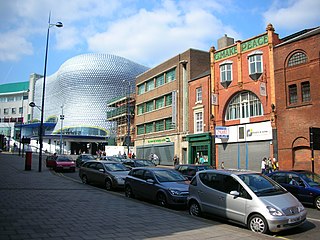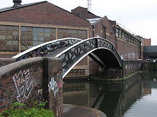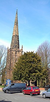
West Midlands is a metropolitan and ceremonial county in the larger West Midlands region of England. A landlocked county, it is bordered by Staffordshire to the north and west, Worcestershire to the south, and is surrounded by Warwickshire to the east. The largest settlement is the city of Birmingham.

The West Midlands Metro is a light-rail/tram system in the county of West Midlands, England. The network has 33 stops with a total of 14 miles (23 km) of track; it currently consists of a single route, Line 1, which operates between the cities of Birmingham and Wolverhampton via the towns of Bilston, West Bromwich and Wednesbury, on a mixture of former railway lines and urban on-street running. The system is owned by the public body Transport for West Midlands, and operated by Midland Metro Limited, a company wholly owned by the West Midlands Combined Authority.
Edgbaston is a suburb of Birmingham, West Midlands, England. It lies immediately south-west of Birmingham city centre, and was historically in Warwickshire. The wards of Edgbaston and North Edgbaston had a combined population of 42,295 at the 2021 census.

Harborne is an area of south-west Birmingham, England. It is located three miles southwest from Birmingham city centre. It is a Birmingham City Council ward in the formal district and in the parliamentary constituency of Birmingham Edgbaston.

Digbeth is an area of central Birmingham, England. Following the destruction of the Inner Ring Road, Digbeth is now considered a district within Birmingham City Centre. As part of the Big City Plan, Digbeth is undergoing a large redevelopment scheme that will regenerate the old industrial buildings into apartments, retail premises, offices and arts facilities. The district is considered to be Birmingham's 'Creative Quarter'.
Sport has always been important in Birmingham, England, from the hundreds of diverse grass-roots sports clubs to internationally famous teams, associations and venues.
As with any large town or city, food and drink has played an important role in the commerce and culture of Birmingham, England.

The Jewellery Quarter is an area of central Birmingham, England, in the north-western area of Birmingham City Centre, with a population of 19,000 in a 1.07-square-kilometre (264-acre) area.

Bordesley is an area of Birmingham, England, 1.2 miles (2 km) south east of the city centre straddling the Watery Lane Middleway ring road. It should not be confused with nearby Bordesley Green. Commercial premises dominate to the west of the ring road, but much of this area is to be redeveloped. Blocks of residential apartments are planned and set for completion from the mid-2020s onwards. The largely residential area east of the ring road was renamed Bordesley Village following large scale clearance of back-to-back houses and redevelopment in the 1980s and 90s. Bordesley is the real life setting of the BBC series Peaky Blinders, and home to Birmingham City Football Club's ground, St Andrew's.

Julius Alfred Chatwin FRIBA, ARBS, FSAScot was a British architect. He was involved with the building and modification of many churches in Birmingham, and practised both Neo-Gothic and Neo-Classical styles. His designs always included all of the carvings and internal fittings.

The Digbeth Branch Canal in Birmingham, England is a short canal which links the mainline of the Birmingham and Fazeley Canal at Aston Junction and the Grand Union Canal at Digbeth Junction in Digbeth, a district in Birmingham, England.
This article is intended to show a timeline of events in the History of Birmingham, England, with a particular focus on the events, people or places that are covered in Wikipedia articles.

Birmingham city centre, also known as Central Birmingham, is the central business district of Birmingham, England. The area was historically in Warwickshire. Following the removal of the Inner Ring Road, the city centre is now defined as being the area within the Middle Ring Road. The city centre is undergoing massive redevelopment with the Big City Plan, which means there are now nine emerging districts and the city centre is approximately five times bigger.
Bournville College is a further education college based in Longbridge, Birmingham, England. The college offers courses that include A Levels, BTECs, NVQs, apprenticeships, and bespoke qualifications.

Moor Pool is a 22.32 hectares garden suburb within the ward of Harborne, Birmingham, England. It was designated a Conservation Area in July 1970, which was raised by an Article 4(2) direction order in 2006. A Conservation Area Character Appraisal and Management Plan was adopted in March 2012.


