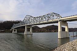
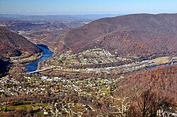
List of crossings of the Kanawha and New Rivers

Last updated

This is a complete list of current bridges and other crossings of the Kanawha River, and its continuation the New River, from its mouth at the Ohio River to the split between the North and South Forks of the New River. Pedestrian-only bridges are marked in italics.

Contents

West Virginia

ImageCrossingLocationOpenedCoordinatesNotes
Mason County
Bartow Jones Bridge 2022.jpg Bartow Jones Bridge
WV-2.svg WV 2
HendersonPoint Pleasant 1999 [1] 38°50′14″N82°08′22″W / 38.8373°N 82.1395°W / 38.8373; -82.1395 Replaced Shadle Bridge built in 1930 [2]
Point Pleasant Kanawha River Rail Bridge 2022.jpg CSX Transportation Ohio River Subdivision 1947 [3] Replaced earlier bridge opened in 1888 [3]
Putnam County
Johnathon Higginbotham Bridge 2022a.jpg Johnathon David Higginbotham Memorial Bridge
WV-869.svg WV 869
Fraziers BottomBuffalo 1998 [4] 38°34′56″N81°59′57″W / 38.5821°N 81.9991°W / 38.5821; -81.9991
USACE Winfield Lock West Virginia.jpg Winfield Locks and Dam WinfieldEleanor 1937 [5]
Ross Booth Bridge 2022a.jpg Ross Booth Memorial Bridge
WV-34.svg WV 34
1955 [4] 38°32′06″N81°53′55″W / 38.5351°N 81.8985°W / 38.5351; -81.8985
Nitro WWI Memorial Bridge
I-64.svg I-64
Teays ValleyNitro 2022 [4] 38°26′43″N81°50′33″W / 38.4453°N 81.8424°W / 38.4453; -81.8424 Will eventually carry westbound lanes of I-64. Carries both directions while the Donald M. Legg Memorial Bridge is demolished and rebuilt. [6]
Harry Schaefer - John E Amos Power Plant 1.jpg Donald M. Legg Memorial Bridge
I-64.svg I-64
Teays ValleyNitro 1962 [4] 38°26′43″N81°50′34″W / 38.4452°N 81.8427°W / 38.4452; -81.8427 Will be demolished and rebuilt; will eventually carry eastbound lanes of I-64. [7]
Kanawha County
Richard Henderson Bridge 2022.jpg Richard J. "Dick" Henderson Memorial Bridge
WV-25.svg WV 25 (3rd Street / Center Street)
St. Albans–Nitro2013 [8] 38°23′30″N81°49′55″W / 38.3918°N 81.8320°W / 38.3918; -81.8320 Replaced earlier bridge of same name opened in 1934 [9] [10]
Dunbar Bridge 2022a.jpg Dunbar Toll Bridge
Circle sign 25-47.svg CR 2547
South CharlestonDunbar 1953 [8]
The Bridges (35191504416) (cropped).jpg I-64.svg I-64 1974, [11] 2010 [8] 38°21′41″N81°43′08″W / 38.3615°N 81.7189°W / 38.3615; -81.7189 2010 span is the longest concrete box girder span in the U.S. [11]
Patrick Street Bridge 2022.jpg Patrick Street Bridge
US 60.svg US 60 (Patrick Street)
Charleston 1930 [8] 38°21′57″N81°40′08″W / 38.3659°N 81.6688°W / 38.3659; -81.6688
KanawhaBlvdW.jpg CSX Kanawha Railroad Bridge 1907 [12]
Eugene A. Carter Memorial Bridge, Charleston, WV, USA (cropped).jpg Eugene A. Carter Memorial Bridge
I-64.svgUS 119.svg I-64  / US 119
1975 [8] 38°21′20″N81°38′54″W / 38.3555°N 81.6483°W / 38.3555; -81.6483
Kanawha River Charleston.jpg South Side Bridge1936 [8] Replaced earlier bridge opened in 1891 [13]
35th Street Bridge Charleston 2022b.jpg 35th Street Bridge
Circle sign 60-63.svg CR 6063
1975, 1976 [8] Replaced Kanawha City Bridge opened in 1914 [14]
US-WV - North America - Road Trip - The South - Appalachian Mountains - Bridge (4891428517).jpg Chuck Yeager Memorial Bridge
I-64.svgI-77.svg I-64  / I-77 ( West Virginia Turnpike )
Charleston–Coal Fork 1954, 1983 [8] 38°18′35″N81°33′41″W / 38.3097°N 81.5613°W / 38.3097; -81.5613
Lochs in Marmet (35024355416).jpg Fishing–Marmet Locks and Dam MarmetDupont City 1934 [15]
Admiral T. J. Lopez Bridge ChelyanDickenson 1997 [16] Replaced Chelyan Bridge opened in 1929 [17] [18]
A COALBURG TUG AND EIGHT COAL BARGES GO DOWNSTREAM THROUGH THE LONDON LOCKS, ONE OF THREE LOCK SYSTEMS ON THE KANAWHA... - NARA - 551047.jpg London Locks and Dam HandleyLondon 1934 [19]
Fayette County
THE KANAWHA VALLEY, A MAJOR WORLD CHEMICAL CENTER, IS NARROW FROM MONTGOMERY TO ALLOY - NARA - 551195.jpg Earl M. Vickers Bridge
WV-6.svg WV 6
Montgomery 1956 [20] 38°10′58″N81°19′00″W / 38.1827°N 81.3167°W / 38.1827; -81.3167 Replaced Montgomery Bridge [21]
MORE SMOKE IS EMITTED BY UNION CARBIDE'S FERROALLOY PLANT IN ALLOY THAN BY ANY OTHER FACTORY IN THE KANAWHA VALLEY - NARA - 551197.jpg Norfolk Southern Railway Princeton–Deepwater District Deep WaterFalls View 1931 [22]
RUSTY TOLL BRIDGE CROSSES THE KANAWHA RIVER BELOW GLEN FERRIS - NARA - 550986.jpg Deepwater–Cotton Hill Bridge
Circle sign 13.svg CR 13
Kanawha Falls 1928 [20] Closed in 2018 due to structural damage with no plans to repair [23] [24] [25]
Kanawha River becomes New River
Gauley Subdivision Bridge 2022a.jpg CSX Gauley Subdivision
Beckwith Road Bridge 2022a.jpg WV-16.svg WV 16 (Beckwith Road) BeckwithChimney Corner 1999 [20] 38°06′50″N81°08′36″W / 38.1140°N 81.1434°W / 38.1140; -81.1434
Amtrak Cardinal in New River Gorge 1980s postcard.jpg Hawks Nest Dam Hawks Nest
Silver Snake (4252221127).jpg CSX New River Subdivision (#1 Main)
New River Gorge Bridge.jpg New River Gorge Bridge
US 19.svg US 19
FayettevilleLansing 1977 [20] 38°04′08″N81°04′58″W / 38.0690°N 81.0827°W / 38.0690; -81.0827
Fayette Stn Rd River level Truss P6160556.jpg Tunney Hunsaker Bridge
Circle sign 82.svg CR 82
1997 [20]
New River Gorge-27527.jpg CSX New River Subdivision (#2 Main [26] )
3-4 view of bridge connecting over new river which connects thurmond to south side junction. View facing southwest. - Chesapeake and Ohio Railroad, Thurmond Yards, East side New HAER WVA,10-THUR,1-8.tif Circle sign 25-2.svg CR 252 (Thurmond Road) / R.J. Corman Railroad West Virginia Line Thurmond 1916 [20]
A bridge over the New River, south of Thurmond in Fayette County, West Virginia LCCN2015634307.tif Circle sign 25.svg CR 25 (McKendree Road) Stone Cliff 1928 [20]
Raleigh County–Fayette County
Thomas Burford Pugh Bridge 2022b.jpg Thomas Burford Pugh Memorial Bridge
WV-41.svg WV 41 (Stanaford Road)
Prince 2015 [20] 37°51′14″N81°04′17″W / 37.8540°N 81.0714°W / 37.8540; -81.0714
Piney Creek Subdivision Bridge 2022.jpg CSX Piney Creek Subdivision
Raleigh County–Summers County
Mary Draper Ingles Bridge 2022a.png Mary Draper Ingles Bridge
I-64.svg I-64
Sandstone 1982 [27] 37°46′52″N80°54′03″W / 37.7811°N 80.9008°W / 37.7811; -80.9008
Summers County
Hinton Bridge 2022.jpg Hinton Bridge
WV-20.svg WV 20 (Temple Street)
BrooklinHinton 1975 [27] 37°40′22″N80°53′39″W / 37.6727°N 80.8943°W / 37.6727; -80.8943
Veterans Memorial Bridge Bellepoint 2022a.jpg Veterans Memorial Bridge
WV-3.svg WV 3
Bellepoint 2004 [27] 37°39′04″N80°53′12″W / 37.6511°N 80.8866°W / 37.6511; -80.8866
USACE Bluestone Dam.jpg Bluestone Dam

Virginia and North Carolina

All locations are in Virginia unless otherwise specified

ImageCrossingLocationOpenedCoordinatesNotes
Giles County
US 460.svg US 460 (Virginia Avenue) Glen Lyn 1969, 1986 [28] 37°22′21″N80°51′45″W / 37.3726°N 80.8624°W / 37.3726; -80.8624
Virginian Railway bridge (ruined) 37°22′13″N80°51′20″W / 37.3703°N 80.8556°W / 37.3703; -80.8556
Narrows Virginia.JPG Virginia 61.svg SR 61 (MacArthur Lane) Narrows 2013 [28] 37°20′04″N80°48′33″W / 37.3345°N 80.8091°W / 37.3345; -80.8091
NS Whitethorne District 37°20′19″N80°47′31″W / 37.3387°N 80.7919°W / 37.3387; -80.7919
Bridge over the New River - panoramio (1).jpg US 460.svg US 460 (Virginia Avenue) Pearisburg 1978, 2001 [28] 37°20′25″N80°45′29″W / 37.3403°N 80.7580°W / 37.3403; -80.7580
NS railroad bridge 37°20′46″N80°41′22″W / 37.3462°N 80.6895°W / 37.3462; -80.6895
US 460.svg US 460 (Virginia Avenue) Ripplemead 1974 [28] 37°19′49″N80°40′40″W / 37.3303°N 80.6779°W / 37.3303; -80.6779
VIEW NORTH OF PENNSYLVANIA PETIT TRUSSES - New River Bridge, Spanning New River at State Route 623, Pembroke, Giles County, VA HAER VA,36-PEMB.V,1-6.tif Pembroke Bridge (disused) Pembroke 37°18′54″N80°38′37″W / 37.3149°N 80.6437°W / 37.3149; -80.6437
Circle sign 623.svg SR 623 (Rocky Hollow Road)1996 [28] 37°18′53″N80°38′37″W / 37.3148°N 80.6436°W / 37.3148; -80.6436
Circle sign 730.svg SR 730 (Eggleston Road) Eggleston 1980 [28] 37°17′10″N80°36′59″W / 37.2860°N 80.6164°W / 37.2860; -80.6164
Pulaski CountyMontgomery County
Radford Army Ammunition Plant bridge1943 [29] 37°11′38″N80°32′29″W / 37.1940°N 80.5413°W / 37.1940; -80.5413
NS Christiansburg District 37°10′38″N80°33′54″W / 37.1773°N 80.5649°W / 37.1773; -80.5649
Virginia 114.svg SR 114 (Peppers Ferry Boulevard) FairlawnCenterville 1990, 2013 [29] 37°09′42″N80°33′08″W / 37.1617°N 80.5521°W / 37.1617; -80.5521
Pulaski County–Radford
New River Bridge
US 11.svg US 11 (Lee Highway)
Fairlawn–Radford 2002, 2005 [30] 37°08′20″N80°34′28″W / 37.1388°N 80.5745°W / 37.1388; -80.5745
NS Pulaski District New River–Radford 37°08′03″N80°34′58″W / 37.1341°N 80.5829°W / 37.1341; -80.5829
Ingles Ferry Bridge
I-81.svg I-81
Radford1965 [29] 37°05′21″N80°34′49″W / 37.0893°N 80.5802°W / 37.0893; -80.5802
Pulaski County
Claytor Dam 37°04′32″N80°35′06″W / 37.0755°N 80.5851°W / 37.0755; -80.5851
Lowmans Ferry Bridge
Circle sign 672.svg SR 672 (Lowmans Ferry Road)
Mack Creek Village 37°00′09″N80°40′57″W / 37.0026°N 80.6826°W / 37.0026; -80.6826
New River Trail State Park - panoramio.jpg New River Trail Hiwassee 36°57′48″N80°43′11″W / 36.9633°N 80.7196°W / 36.9633; -80.7196
Wythe County
Virginia 100.svg SR 100 (Wysor Highway) Barren Springs 2007 [31] 36°55′08″N80°48′19″W / 36.9189°N 80.8052°W / 36.9189; -80.8052
US 52.svg US 52 (Fort Chiswell Road) Galena 1997 [31] 36°52′17″N80°52′08″W / 36.8713°N 80.8689°W / 36.8713; -80.8689
I-77.svg I-77 1978, 1980 [31] 36°52′16″N80°52′20″W / 36.8711°N 80.8721°W / 36.8711; -80.8721
Lead Mines, VA, USA - panoramio (6).jpg Circle sign 636.svg SR 636 (Store Hill Road) Austinville 1987 [31] 36°51′16″N80°55′10″W / 36.8544°N 80.9195°W / 36.8544; -80.9195
New River Trail 36°50′54″N80°56′20″W / 36.8483°N 80.9390°W / 36.8483; -80.9390
Carroll County
Buck Dam
Buck Dam Road
36°48′30″N80°56′19″W / 36.8082°N 80.9387°W / 36.8082; -80.9387
Byllesby Dam 36°47′10″N80°56′00″W / 36.7862°N 80.9332°W / 36.7862; -80.9332
FriesJunctionTrestle (12481590293).jpg Fries Junction Bridge 36°45′36″N80°57′22″W / 36.7599°N 80.9561°W / 36.7599; -80.9561
Circle sign 606.svg SR 606 (Fries Road) Fries 1959 [32] 36°43′02″N80°57′21″W / 36.7172°N 80.9559°W / 36.7172; -80.9559
Fries Dam 36°42′50″N80°59′11″W / 36.7138°N 80.9864°W / 36.7138; -80.9864
Grayson County
Virginia 94.svg SR 94 (Riverside Drive)2011 [33] 36°38′46″N80°58′44″W / 36.6461°N 80.9788°W / 36.6461; -80.9788
US 58.svgUS 221.svg US 58  / US 221 (Grayson Parkway) Baywood 1979, 1999 [33] 36°36′46″N81°02′45″W / 36.6127°N 81.0458°W / 36.6127; -81.0458
US 21.svgUS 221.svg US 21  / US 221 (New River Parkway)1989 [33] 36°34′33″N81°09′28″W / 36.5758°N 81.1579°W / 36.5758; -81.1579
Alleghany County, North Carolina
Farmers Fish Camp Road Amelia, North Carolina 2015 [34] 36°33′07″N81°10′54″W / 36.5519°N 81.1817°W / 36.5519; -81.1817
Grayson County
Bridle Creek Bridge
Circle sign 601.svg SR 601 (Cox's Chapel Road)
1956 [33] 36°35′45″N81°14′30″W / 36.5959°N 81.2416°W / 36.5959; -81.2416
Fields Dam 36°36′09″N81°18′39″W / 36.6024°N 81.3109°W / 36.6024; -81.3109
2017-06-25 18 16 38 View south along Virginia State Route 93 (County Line Road) at its bridge over New River, just south of U.S. Route 58 (Wilson Highway) in Mouth of Wilson, Grayson County, Virginia.jpg J. Cam Fields Memorial Bridge
Virginia 93.svg SR 93 (County Line Road)
Mouth of Wilson 1982 [33] 36°35′07″N81°18′50″W / 36.5852°N 81.3140°W / 36.5852; -81.3140
Ashe County, North Carolina–Alleghany County, North Carolina
New River splits into North Fork and South Fork

References

  1. "National Bridge Inventory data: Mason County, West Virginia". BridgeReports.com. Retrieved March 30, 2022.
  2. "The Point Pleasant-Henderson Bridge over the Kanawha River, connecting Point Pleasant and Henderson, West Virginia, near the point where the Kanawha empties into the Ohio River". Library of Congress. Retrieved April 6, 2022.
  3. 1 2 "BO - Point Pleasant-Henderson Bridge". Bridgehunter.com. Retrieved April 6, 2022.
  4. 1 2 3 4 "National Bridge Inventory data: Putnam County, West Virginia". BridgeReports.com. Retrieved March 30, 2022.
  5. "Huntington District – Winfield Locks and Dam". U.S. Army Corps of Engineers. Retrieved April 6, 2022.
  6. "Gov. Justice, WVDOH celebrate opening of westbound lanes on new Nitro WWI Memorial Bridge". West Virginia Office of the Governor. Retrieved November 6, 2022.
  7. "Gov. Justice approves award of I-64 Nitro/St. Albans Bridge project". West Virginia Office of the Governor. Retrieved April 6, 2022.
  8. 1 2 3 4 5 6 7 8 "National Bridge Inventory data: Kanawha County, West Virginia". BridgeReports.com. Retrieved March 30, 2022.
  9. "Richard J. 'Dick' Henderson Memorial Bridge - Now Complete". E.L. Robinson Engineering. December 11, 2013. Retrieved April 6, 2022.
  10. "Dick Henderson Memorial Bridge". Bridgehunter.com. Retrieved April 6, 2022.
  11. 1 2 Rodriguez, Santiago (Winter 2009). "A record segmental span: Kanawha River Bridge" (PDF). Aspire. Retrieved April 6, 2022.
  12. "C&O Bridge". Bridgehunter.com. Retrieved April 6, 2022.
  13. "South Side Bridge (1891)". Bridgehunter.com. Retrieved April 6, 2022.
  14. "Kanawha City Bridge". Bridgehunter.com. Retrieved April 6, 2022.
  15. "Huntington District – Marmet Locks and Dam". U.S. Army Corps of Engineers. Retrieved April 6, 2022.
  16. "Merit Award: Long Span: Admiral T. J. Lopez Bridge" (PDF). Modern Steel Construction. September 1, 1998. Retrieved April 6, 2022.
  17. Wilson, Michael K. (November 16, 1993). "Chelyan Bridge" (PDF). Library of Congress. Retrieved April 6, 2022.
  18. "Chelyan Bridge". Bridgehunter.com. Retrieved April 6, 2022.
  19. "Huntington District – London Locks and Dam". U.S. Army Corps of Engineers. Retrieved April 6, 2022.
  20. 1 2 3 4 5 6 7 8 "National Bridge Inventory data: Fayette County, West Virginia". BridgeReports.com. Retrieved March 30, 2022.
  21. "Montgomery Bridge". Bridgehunter.com. Retrieved April 6, 2022.
  22. "Deepwater, WV". WVRails.net. Retrieved April 6, 2022.
  23. "Kanawha Falls Bridge". Abandoned. January 24, 2021. Retrieved April 6, 2022.
  24. Steelhammer, Rick (June 15, 2019). "Plan to replace Kanawha Falls Bridge with road improvements shunned by span users". Charleston Gazette-Mail. Retrieved April 6, 2022.
  25. Saunders, Anna (August 5, 2020). "Bridge closure remains a frustration and a safety concern for those who live in Kanawha Falls". WOAY-TV. Retrieved April 6, 2022.
  26. Dewitz, Travis (July 24, 2015). "CSX's New River Subdivision Railfan Guide | Guest Post by Frog Rail Tours" . Retrieved March 27, 2022.
  27. 1 2 3 "National Bridge Inventory data: Summers County, West Virginia". BridgeReports.com. Retrieved March 30, 2022.
  28. 1 2 3 4 5 6 "National Bridge Inventory data: Giles County, Virginia". BridgeReports.com. Retrieved March 30, 2022.
  29. 1 2 3 "National Bridge Inventory data: Montgomery County, Virginia". BridgeReports.com. Retrieved March 30, 2022.
  30. "National Bridge Inventory data: Pulaski County, Virginia". BridgeReports.com. Retrieved March 30, 2022.
  31. 1 2 3 4 "National Bridge Inventory data: Wythe County, Virginia". BridgeReports.com. Retrieved March 30, 2022.
  32. "National Bridge Inventory data: Carroll County, Virginia". BridgeReports.com. Retrieved March 30, 2022.
  33. 1 2 3 4 5 "National Bridge Inventory data: Grayson County, Virginia". BridgeReports.com. Retrieved March 30, 2022.
  34. "Alleghany County, North Carolina". BridgeReports.com. Retrieved March 30, 2022.