Lighthouses
Northwest Region (Tây Bắc Bộ)
| Name | Image | Year built | Location & coordinates | Class of Light [3] | Focal height [3] | NGA number [3] | Admiralty number [3] | Range nml [3] |
|---|---|---|---|---|---|---|---|---|
| Bãi Cháy Lighthouse | Image Archived 29 October 2016 at the Wayback Machine | n/a | Hạ Long 20°57′30.8″N107°03′36.6″E / 20.958556°N 107.060167°E | Fl R 2s. | 17 metres (56 ft) | 20224 | F3296 | n/a |
| Cẩm Phả Range Front Lighthouse | n/a | Cẩm Phả 21°01′20.2″N107°22′38.7″E / 21.022278°N 107.377417°E | F R | 8 metres (26 ft) | 20214.6 | F3313 | 3 | |
| Cẩm Phả Range Rear Lighthouse | n/a | Cẩm Phả 21°01′41.3″N107°22′46.2″E / 21.028139°N 107.379500°E | F R | 12 metres (39 ft) | 20214.7 | F3313.1 | 3 | |
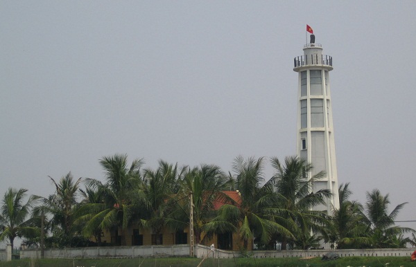
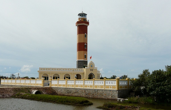
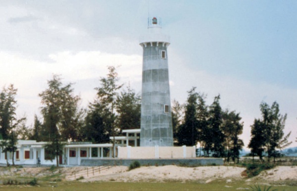
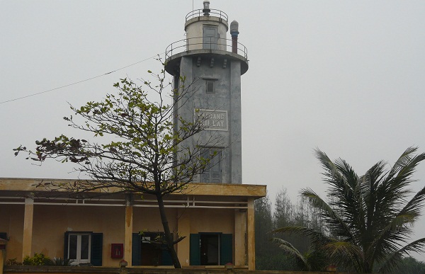
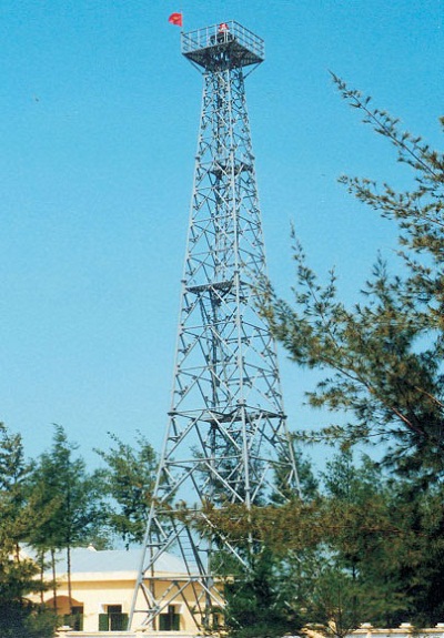
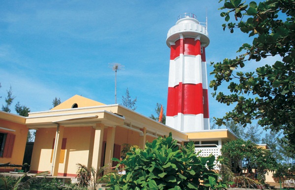
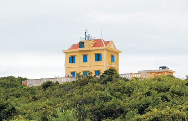
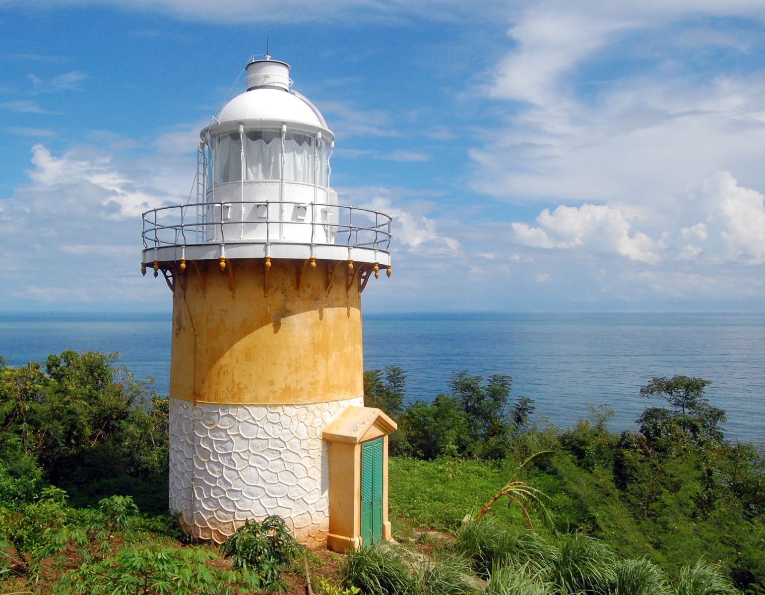
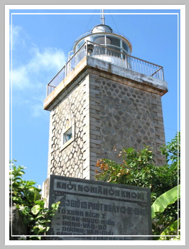
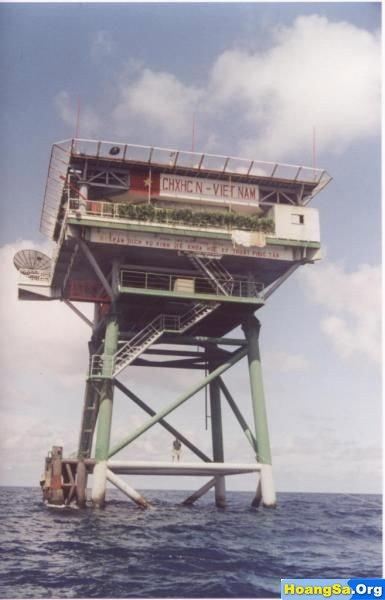
| Cô Tô Lighthouse | Image | 1961 | Quảng Ninh province 20°59′57.8″N107°45′26.9″E / 20.999389°N 107.757472°E | Fl (2+1) W 12s. | 116 metres (381 ft) | 20213.8 | F3314.8 | 15 |
| Đảo Hạ Mai Lighthouse | Image | 2005 | Quảng Ninh province 20°43′06.7″N107°27′16.6″E / 20.718528°N 107.454611°E | Fl (3) W 10s. | 181 metres (594 ft) | 20215.5 | F3306.5 | 12 |
| Đảo Trần Lighthouse | 1996 | Quảng Ninh province 21°14′14.9″N107°57′47.2″E / 21.237472°N 107.963111°E | Fl (4) 15s. | 201 metres (659 ft) | 20213.5 | F3314.5 | 28 | |
| Hòn Bài Lighthouse | Image | 2000 | Hạ Long 20°44′15.4″N107°10′44.0″E / 20.737611°N 107.178889°E | Fl (3+1) W 16s. | 45 metres (148 ft) | n/a | F3293.5 | n/a |
| Le Cancrelat Lighthouse | 1964 | Quảng Ninh province 20°49′36.7″N107°17′40.9″E / 20.826861°N 107.294694°E | F W | 47 metres (154 ft) | 20214 | F3306 | 20 | |
| Vĩnh Thực Lighthouse | Image | 1962 | Quảng Ninh province 21°23′46.5″N108°0′08.9″E / 21.396250°N 108.002472°E | Fl W 5s. | 85 metres (279 ft) | 20216.5 | F3315 | 21 |
Red River Delta (Đồng Bằng Sông Hồng)
| Name | Image | Year built | Location & coordinates | Class of Light [3] | Focal height [3] | NGA number [3] | Admiralty number [3] | Range nml [3] |
|---|---|---|---|---|---|---|---|---|
| Ba Lạt Lighthouse | Image | 1962 | Tiền Hải District 20°15′23.9″N106°35′46.8″E / 20.256639°N 106.596333°E | Fl (3+1) W 20s. | 37 metres (121 ft) | 20272.5 | F3233 | 18 |
| Cửa Nam Triệu Bar Range Rear Lighthouse | Imahe Archived 12 October 2016 at the Wayback Machine | n/a | Hai Phong 20°46′37.3″N106°49′51.1″E / 20.777028°N 106.830861°E | F W | 21 metres (69 ft) | 20252 | F3268.1 | n/a |
| Đảo Bạch Long Vĩ Lighthouse | Image Archived 29 October 2016 at the Wayback Machine | 1995 | Bạch Long Vĩ island 20°08′03.3″N107°43′43.8″E / 20.134250°N 107.728833°E | Fl (2) W 10s. | 80 metres (260 ft) | 20273 | F3230 | 26 |
| Diêm Điền Lighthouse | Image | 1997 | Thái Thủy 20°33′35.4″N106°34′39.6″E / 20.559833°N 106.577667°E | Fl W 5s. | 26 metres (85 ft) | 20270 | F3235 | 18 |
| Đình Vũ Entrance North Side Lighthouse | Image Archived 29 October 2016 at the Wayback Machine | n/a | Haiphong 20°50′54.7″N106°45′45.8″E / 20.848528°N 106.762722°E | Fl W 3s. | 11 metres (36 ft) | 20265 | F3268 | n/a |
| Đình Vũ Entrance South Side Lighthouse | Image Archived 29 October 2016 at the Wayback Machine | n/a | Haiphong 20°50′47.1″N106°45′48.8″E / 20.846417°N 106.763556°E | Fl R 3s. | 11 metres (36 ft) | 20265.1 | F3267 | n/a |
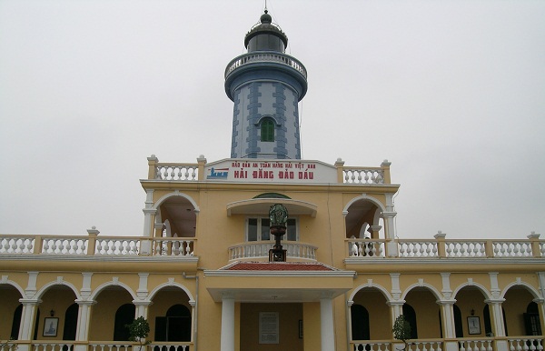
| Hòn Dấu Lighthouse | Image | 1894 | Hòn Island Hai Phong 20°39′59.5″N106°48′58.8″E / 20.666528°N 106.816333°E | Fl (2) W 15s. | 63 metres (207 ft) | 20268 | F3236 | 22 |
| Lạch Giang Lighthouse | Image | 2001 | Nghĩa Hưng District 19°59′11.9″N106°10′52.8″E / 19.986639°N 106.181333°E | Fl (2+1) W 10s. | 21 metres (69 ft) | 20279.9 | F3228 | 14 |
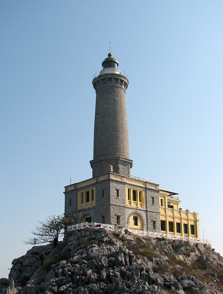
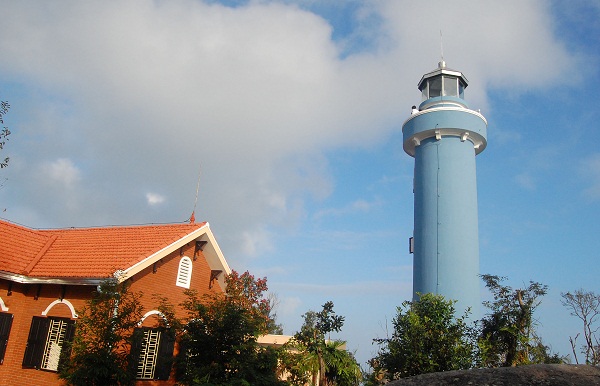
| Long Châu Lighthouse | Image | 1894 | Quần đảo Long Châu Hai Phong 20°37′23.5″N107°09′33.6″E / 20.623194°N 107.159333°E | Fl (3) W 20s. | 110 metres (360 ft) | 20216 | F3232 | 27 |
| Quất Lâm Lighthouse | Image | 1966 est. | Giao Thủy District 20°11′01.3″N106°21′44.0″E / 20.183694°N 106.362222°E | Fl W 4s. | 26 metres (85 ft) | 20278.8 | F3229 | 15 |
| Van Châu Lighthouse | 1900 | Thủy Nguyên District 20°52′47.8″N106°45′00.4″E / 20.879944°N 106.750111°E | L Fl (3+1) WR 6s. | 8 metres (26 ft) | 20264.5 | F3280.4 | n/a | |
North Central Coast (Bắc Trung Bộ)
South Central Coast (Nam Trung Bộ)
| Name | Image | Year built | Location & coordinates | Class of Light [3] | Focal height [3] | NGA number [3] | Admiralty number [3] | Range nml [3] |
|---|---|---|---|---|---|---|---|---|
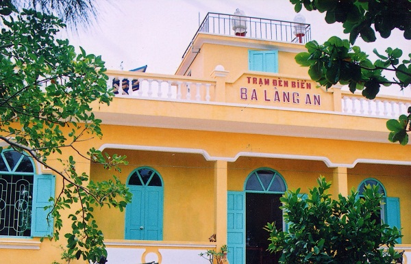
| Ba Làng An Lighthouse | Image | 1982 | Quảng Ngãi province 15°14′30.3″N108°56′24.0″E / 15.241750°N 108.940000°E | Fl (2) W 6s. | 36 metres (118 ft) | 20321 | F3181 | 12 |
| Cù Lao Chàm Lighthouse | Image | 2003 | Cù Lao Chàm Island 15°57′22.3″N108°32′12.9″E / 15.956194°N 108.536917°E | Fl (3+1) W 16s. | 128 metres (420 ft) | 20318 | F3203.2 | 20 |
| Cửa ĐạI Lighthouse | Image | 2013 | Quảng Nam province 15°52′35.9″N108°23′22.1″E / 15.876639°N 108.389472°E | Fl (3+1) W 15s. | 25 metres (82 ft) | 20316.5 | F3203 | 12 |
| Kỳ Hà Lighthouse | Image | 1995 | Núi Thành District 15°28′55.6″N108°41′29.1″E / 15.482111°N 108.691417°E | Fl (2+1) W 12s. | 25 metres (82 ft) | 20317 | F3202 | 15 |
| Lý Sơn Lighthouse | Image | 1900 est. | Lý Sơn District 15°23′11.6″N109°08′30.8″E / 15.386556°N 109.141889°E | Fl W 5s. | 50 metres (160 ft) | 20320 | F3184 | 15 |
| Lý Sơn East Beakwater Lighthouse | Image | 2000 | Lý Sơn District 15°22′48.4″N109°08′46.8″E / 15.380111°N 109.146333°E | Fl (3+1) W 15s. | 11 metres (36 ft) | 20320.2 | F3184.2 | 12 |
| Lý Sơn Harbor Lighthouse | Image Archived 10 April 2016 at the Wayback Machine | 2000 est. | Lý Sơn District 15°22′49.9″N109°05′44.0″E / 15.380528°N 109.095556°E | Fl (3) W 12s. | 14.5 metres (48 ft) | n/a | F3184.5 | n/a |
| Quản Tượng Lighthouse | Image | 1093 | Sơn Trà District 16°07′20.6″N108°12′50.1″E / 16.122389°N 108.213917°E | Fl W 3s. | 42 metres (138 ft) | 20296 | F3206 | 5 |
| Sa Huỳnh Lighthouse | Image | 2004 | 14°40′03.8″N109°04′52.5″E / 14.667722°N 109.081250°E | Fl (2) W 10s. | 87 metres (285 ft) | 20323 | F3178 | 20 |
| Sa Kỳ Lighthouse | Image | 2000 | Quảng Ngãi province 15°12′28.5″N108°55′25.4″E / 15.207917°N 108.923722°E | Fl (3) W 10s. | 15 metres (49 ft) | 20321.2 | F3180 | 12 |
| Sơn Chà Lighthouse | Image | n/a | Sơn Chà Island Thừa Thiên-Huế province 16°13′00.4″N108°10′20.4″E / 16.216778°N 108.172333°E | Fl (2+1) W 6s. | 238 metres (781 ft) | 20279.5 | F3211.5 | 12 |
| Tân Hiệp Lighthouse | Image | 2000 | Cù Lao Chàm Island 15°57′29.7″N108°30′12.9″E / 15.958250°N 108.503583°E | Fl W 5s. | 42 metres (138 ft) | 20318.1 | F3203.3 | 12 |
| Tiên Sa Lighthouse | Image | 1903 | Sơn Trà District 16°08′22.7″N108°19′19.7″E / 16.139639°N 108.322139°E | Fl (2) W 10s. | 158 metres (518 ft) | 20292 | F3204 | 23 |
| Vạn Ca Lighthouse | Image | 2000 | Bình Sơn District 15°25′26.0″N108°47′55.0″E / 15.423889°N 108.798611°E | Fl (3) W 10s. | 33 metres (108 ft) | 20319 | F3200 | 12 |
South Central Coast (Duyên hải Nam Trung Bộ)
| Name | Image | Year built | Location & coordinates | Class of Light [3] | Focal height [3] | NGA number [3] | Admiralty number [3] | Range nml [3] |
|---|---|---|---|---|---|---|---|---|
| An ThớI Lighthouse | Image | 2000 | Phú Quốc 10°00′43.0″N104°00′43.7″E / 10.011944°N 104.012139°E | Fl (2) W 6s. | 14 metres (46 ft) | 20518 | F3025 | 15 |
| Aval Lighthouse | Image | 1864 | offshore Vũng Tàu 10°24′05.2″N107°00′50.4″E / 10.401444°N 107.014000°E | Fl W 5s. | 22 metres (72 ft) | 20444 | F3082 | 12 |
| Ba Động Lighthouse | Image Archived 3 November 2016 at the Wayback Machine | n/a | Duyên Hải District 9°41′10.1″N106°34′33.8″E / 9.686139°N 106.576056°E | Fl W 5s. | 30 metres (98 ft) | n/a | F3058 | n/a |
| Ba Kiềm Lighthouse | Image | 2006 | Xuyên Mộc District 10°30′28.4″N107°30′34.7″E / 10.507889°N 107.509639°E | Fl (3) G 10s. | 87 metres (285 ft) | n/a | F3115 | 20 |
| Ba Ngòi Lighthouse | Image | 2003 | Cam Ranh 11°52′52.0″N109°12′14.4″E / 11.881111°N 109.204000°E | Fl (3+1) W 7s. | 89.5 metres (294 ft) | n/a | F3136 | 24 |
| Ba Yen Range Front Lighthouse | n/a | Can Gio District 10°28′43.8″N106°56′09.4″E / 10.478833°N 106.935944°E | Fl (2) W 6s. | 9 metres (30 ft) | 20448 | F3084 | 5 | |
| Ba Yen Range Rear Lighthouse | n/a | Can Gio District 10°28′56.6″N106°56′03.7″E / 10.482389°N 106.934361°E | Fl (2) W 6s. | 12 metres (39 ft) | 20452 | F3084.1 | 6 | |
| Bồ Đề Lighthouse | Image | 2001 | Năm Căn district 8°45′24.2″N105°13′21.7″E / 8.756722°N 105.222694°E | Fl (4) W 12s. | 20 metres (66 ft) | n/a | F3053 | n/a |
| Cao Trang | Image Archived 3 November 2016 at the Wayback Machine | 2007 | Vũng Tàu 10°21′24.7″N107°03′37.3″E / 10.356861°N 107.060361°E | Fl (3) G 10s. | 20 metres (66 ft) | 20428 | F3070 | 6 |
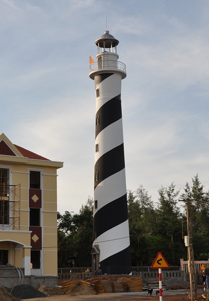
| Cù Lao Xanh Lighthouse | Image | 1975 | Cù Lao Xanh Island Qui Nhơn 13°36′52.4″N109°21′27.9″E / 13.614556°N 109.357750°E | Fl (3+1) W 12s. | 118 metres (387 ft) | 20364 | F3158 | 27 |
| Cửa Tiểu Lighthouse | Image | 1898 est. | Tiền Giang province 10°12′33.2″N106°50′09.5″E / 10.209222°N 106.835972°E | Dir Fl (3+1) W10s. | 22 metres (72 ft) | 20472 | F3060 | n/a |
| Đà Rằng Lighthouse | Image | n/a | Tuy Hòa 13°05′27.7″N109°19′36.1″E / 13.091028°N 109.326694°E | Fl (2) W 6s. | 20.5 metres (67 ft) | n/a | F3155.8 | 13 |
| Đá Trắng Lighthouse | Image | 2001 | Côn Sơn Island 8°39′27.2″N106°36′16.3″E / 8.657556°N 106.604528°E | Fl W 5s. | 17 metres (56 ft) | 20486 | F3049.5 | 12 |
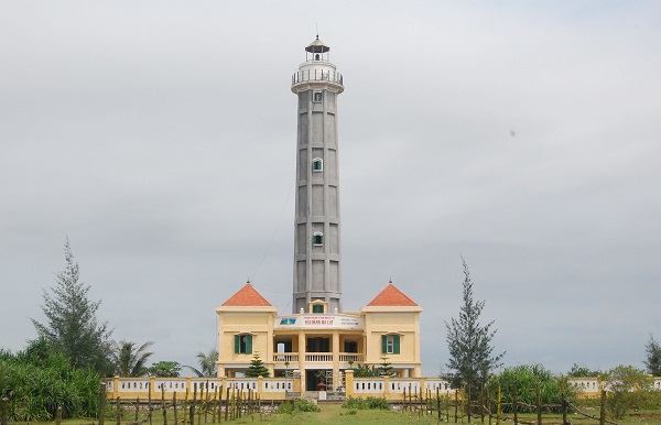
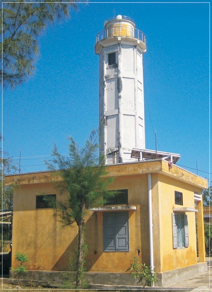
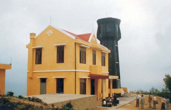
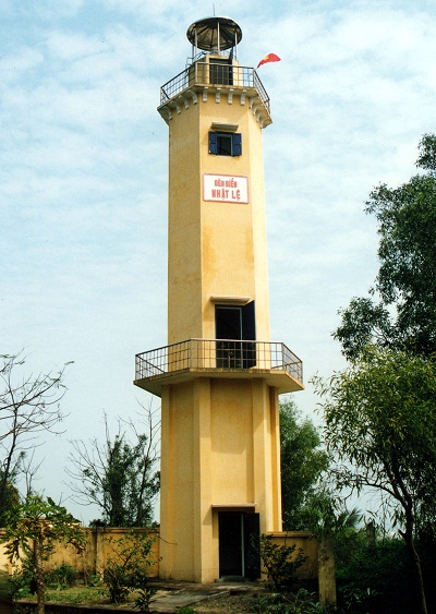
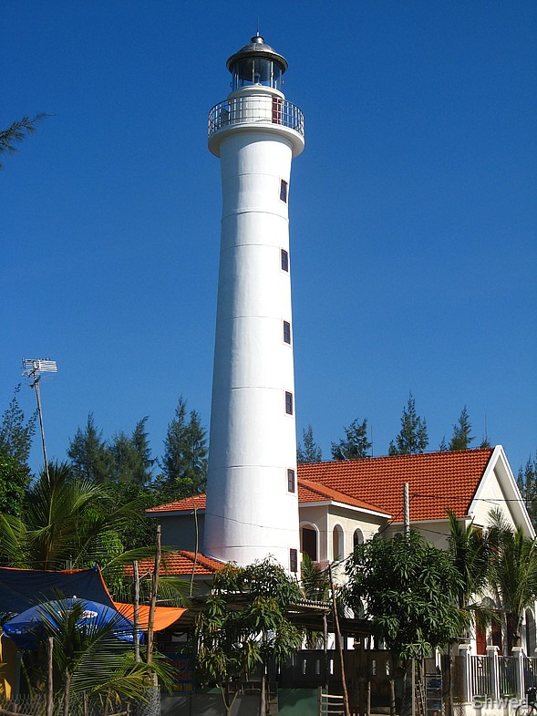
| Đại Lãnh Lighthouse | Image | n/a | Đông Hòa District 12°53′47.7″N109°27′25.6″E / 12.896583°N 109.457111°E | Fl (3) W 15s. | 110 metres (360 ft) | 20368 | F3154 | 16 |
| Dương Đông Lighthouse | Image | 1993 | Phú Quốc 10°13′02.2″N103°57′23.3″E / 10.217278°N 103.956472°E | Fl (3) W 10s. | 15 metres (49 ft) | 20516 | F3022 | 15 |
| Gành Đèn Lighthouse | Image | 2002 | Tuy An District 13°21′50.4″N109°17′38.2″E / 13.364000°N 109.293944°E | Fl W 5s. | 22.5 metres (74 ft) | n/a | F3156 | 17 |
| Ghành Rái Lighthouse | Image Archived 12 October 2016 at the Wayback Machine | 1911 est. | Vũng Tàu 10°22′51.7″N107°03′23.2″E / 10.381028°N 107.056444°E | Fl (2) G 7s. | 19 metres (62 ft) | 20432 | F3076 | 6 |
| Hồ Tàu Lighthouse | n/a | Duyên Hải District 9°31′51.9″N106°22′36.6″E / 9.531083°N 106.376833°E | Fl (2) W 7s. | 22 metres (72 ft) | n/a | F3056 | n/a | |
| Hòn Bảy Cạnh Lighthouse | Image | 1887 | Bảy Cạnh Island Bà Rịa–Vũng Tàu province 8°40′00.8″N106°42′22.6″E / 8.666889°N 106.706278°E | Fl (2) W 10s. | 212 metres (696 ft) | 20476 | F3046 | 27 |
| Hòn ChuốI Lighthouse | Image | n/a | Trần Văn Thời district 8°56′51.1″N104°31′30.7″E / 8.947528°N 104.525194°E | Fl (2) W 7s. | 131 metres (430 ft) | 20493 | F3040 | 23 |
| Hòn Chông Lighthouse | Image | 2005 | Kiên Lương District 10°08′37.1″N104°36′03.7″E / 10.143639°N 104.601028°E | Fl (3+1) W 16s. | 36.6 metres (120 ft) | n/a | F3033 | 16 |
| Hòn Chút Lighthouse | Image | 1988 | Cam Ranh 11°46′57.1″N109°13′17.0″E / 11.782528°N 109.221389°E | Fl W 5s. | 59 metres (194 ft) | 20384 | F3134 | 10 |
| Hòn Đỏ Lighthouse | Image | 1997 | Hòn Đỏ Island Ninh Hòa 12°28′53.2″N109°21′34.6″E / 12.481444°N 109.359611°E | Fl (2) W 10s. | 81 metres (266 ft) | n/a | F3152 | 22 |
| Hòn Hải Lighthouse | Image Archived 3 November 2016 at the Wayback Machine | 2004 | Hòn Hải Island Bình Thuận province 9°58′26.5″N109°05′03.8″E / 9.974028°N 109.084389°E | Fl (2+1) W 10s. | 122 metres (400 ft) | n/a | F3120.7 | 20 |
| Hòn Khô Lighthouse | 2000 | offshore Kiên Giang province 9°17′50.1″N103°27′02.2″E / 9.297250°N 103.450611°E | Fl R 5s. | 15 metres (49 ft) | n/a | F3039.7 | n/a | |
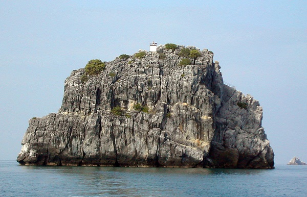
| Hòn Khoai Lighthouse | Image | 1904 | Hòn Khoai Island Cà Mau province 8°25′46.4″N104°49′56.0″E / 8.429556°N 104.832222°E | Fl W 10s. | 300 metres (980 ft) | 20492 | F3042 | 27 |
| Hòn Lớn Lighthouse | Image | 1890 | Hòn Lớn Island Nha Trang 12°11′39.9″N109°20′02.7″E / 12.194417°N 109.334083°E | Fl (3) W 10s. | 102 metres (335 ft) | 20372 | F3148 | 26 |
| Hòn Nưa Lighthouse | Image | 2002 | Hòn Nưa Island Vạn Ninh District 12°49′41.2″N109°23′35.6″E / 12.828111°N 109.393222°E | Fl (4) W 15s. | 87.5 metres (287 ft) | n/a | F3151 | 23.5 |
| Hòn Nước Lighthouse | Image | 1997 | Phù Mỹ District 14°14′56.2″N109°11′33.0″E / 14.248944°N 109.192500°E | Fl W 5s. | 62.5 metres (205 ft) | n/a | n/a | n/a |
| Kê Gà Lighthouse |  | 1900 | Hòn Bà 10°41′42.4″N107°59′29.7″E / 10.695111°N 107.991583°E | Fl (3+1) W 20s. | 22 metres (72 ft) | 20412 | F3116 | 18 |
| Mũi Chụt Lighthouse | Image | F W | Nha Trang 12°12′38.5″N109°12′59.3″E / 12.210694°N 109.216472°E | Fl (2) W 7s. | 42 metres (138 ft) | 20376 | F3150 | 9 |
| Mũi Dinh Lighthouse | Image | 1904 | Ninh Phước District 11°21′38.8″N109°00′51.1″E / 11.360778°N 109.014194°E | FL (2+1) W 20s. | 186 metres (610 ft) | 20404 | F3122 | 26 |
| Nam Du Lighthouse | Image | 2001 | Kiên Hải District 9°40′43.7″N104°21′11.4″E / 9.678806°N 104.353167°E | Fl (3) W 10s. | 195 metres (640 ft) | 20494 | F3039 | 25 |
| Núi Nai Lightouse | Image | 2000 | Hà Tiên 10°21′57.5″N104°26′39.8″E / 10.365972°N 104.444389°E | Fl (2) W 10s. | 112 metres (367 ft) | 20512 | F3030 | 19 |
| Ông Đốc Lighthouse | Image | n/a | Sông Đốc 9°02′19.5″N104°48′41.9″E / 9.038750°N 104.811639°E | Fl (2+1) W 12s. | 19 metres (62 ft) | n/a | F3041 | 13 |
| Phan Rí Lighthouse | Image | 2004 | Tuy Phong District 11°09′52.8″N108°33′50.9″E / 11.164667°N 108.564139°E | Fl (4) W 10s. | 19 metres (62 ft) | n/a | F3121 | 13 |
| Phan Thiết Lighthouse | Image | 2000 | Phan Thiết 10°55′02.8″N108°06′23.2″E / 10.917444°N 108.106444°E | Fl (3) W 10s. | 15 metres (49 ft) | 20408 | F3118 | 13 |
| Phú Quý Lighthouse | Image | 1997 | Phú Quý 10°32′19.7″N108°55′41.8″E / 10.538806°N 108.928278°E | Fl (2) W 15s. | 124 metres (407 ft) | 20406 | F3120 | 32 |
| Phước Mai Lighthouse | Image | 1904 | Qui Nhơn 13°45′41.0″N109°15′03.0″E / 13.761389°N 109.250833°E | Fl (2+1) W 15s. | 52 metres (171 ft) | 20332 | F3162 | 18 |
| Rạch Giá Lighthouse | Image Archived 13 October 2016 at the Wayback Machine | 1993 | Rạch Giá 10°00′29.5″N105°04′35.5″E / 10.008194°N 105.076528°E | Fl (2) W 8s. | 17 metres (56 ft) | 20504 | F3036 | 3 |
| Sông Sài Gòn Lighthouse | Image Archived 23 October 2016 at the Wayback Machine | n/a | Can Gio District 10°23′35.6″N106°49′56.2″E / 10.393222°N 106.832278°E | green light | 18 metres (59 ft) | n/a | n/a | n/a |
| Thổ Chu Lighthouse | Image Archived 3 November 2016 at the Wayback Machine | 2000 | Phú Quốc 9°17′34.3″N103°28′28.2″E / 9.292861°N 103.474500°E | Fl (4) W 15s. | 140 metres (460 ft) | 20494.5 | F3039.5 | 12 |
| Triều Dương Lighthouse | Image Archived 15 October 2016 at the Wayback Machine | 2001 | Phú Quý 10°29′59.5″N108°57′11.4″E / 10.499861°N 108.953167°E | Fl (3+1) W 12s. | 11.5 metres (38 ft) | n/a | F3120.5 | 12 |
| Vũng Tàu Lighthouse | 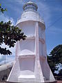 | 1913 | Xuyên Mộc District 10°20′02.8″N107°04′39.6″E / 10.334111°N 107.077667°E | Fl (2) W 12s. | 193 metres (633 ft) | 20416 | F3066 | 23 |
Spratly Islands (Quần đảo Trường Sa)
| Name | Image | Year built | Location & coordinates | Class of Light [3] | Focal height [3] | NGA number [3] | Admiralty number [3] | Range nml [3] |
|---|---|---|---|---|---|---|---|---|
| An Bang Lighthouse |  | 1938 | Amboyna Cay 7°53′30.9″N112°55′17.7″E / 7.891917°N 112.921583°E | Fl (2) W 10s. | 22 metres (72 ft) | 20290.8 | F2825.18 | 15 |
| Ba Kè Lighthouse | Image | 1995 | Bombay Castle (South China Sea) 7°49′09.8″N110°30′03.4″E / 7.819389°N 110.500944°E | Fl (3+1) W 12s. | 22 metres (72 ft) | 20290.6 | F2825.19 | 12 |
| Bãi Phúc Nguyên Lighthouse | Image Archived 14 October 2016 at the Wayback Machine | n/a | Prince Consort Bank 7°48′48.0″N109°56′54.0″E / 7.813333°N 109.948333°E | Fl (2) W 8s. | 22 metres (72 ft) | 20291 | F2825.195 | 12 |
| Bãi Tư Chính A Lighthouse | n/a | Southwest of Prince Consort Bank 7°33′00.0″N109°42′00.0″E / 7.550000°N 109.700000°E | Fl (2) W 13s. | 22 metres (72 ft) | 20291.4 | F2825.192 | 12 | |
| Bãi Tư Chính B Lighthouse | n/a | Southwest of Prince Consort Bank 7°33′12.0″N109°48′00.0″E / 7.553333°N 109.800000°E | Fl (3) W 8s. | 22 metres (72 ft) | 20291.6 | F2825.193 | 12 | |
| Đá Đông Lighthouse | Image Archived 26 August 2016 at the Wayback Machine | 2010 | East London Reef 8°50′24.4″N112°35′40.0″E / 8.840111°N 112.594444°E | n/a | 15 metres (49 ft) | n/a | n/a | n/a |
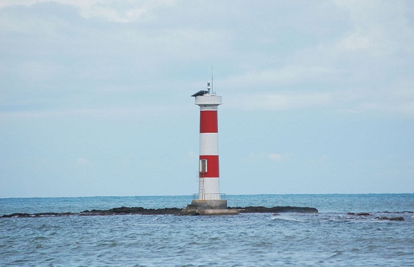
| Đá Lát Lighthouse | Image | 1994 | Ladd Reef 8°39′58.3″N111°39′51.3″E / 8.666194°N 111.664250°E | Fl W 5s. | 40 metres (130 ft) | 20290 | F2825.1 | 15 |
| Đá Tây Lighthouse | Image | 1994 | 8°50′42.2″N112°11′42.9″E / 8.845056°N 112.195250°E | Fl (3) W 10s. | 22 metres (72 ft) | 20290.1 | F2825.15 | 15 |
| Đảo Dá Lớn Lighhtouse | Image Archived 20 October 2016 at the Wayback Machine | n/a | Discovery Great Reef 10°01′20.7″N113°51′17.2″E / 10.022417°N 113.854778°E | n/a | ~ 13 metres (43 ft) | n/a | n/a | n/a |
| Huyền Trân Lighthouse | Image | 1994 | Alexandra Bank 8°01′12.6″N110°37′51.2″E / 8.020167°N 110.630889°E | Fl (2+1) W 10s. | 23 metres (75 ft) | 20290.4 | F2825.186 | 12 |
| Nam Yết Lighthouse | Image | 2010 | Namyit Island 10°10′45.2″N114°21′47.2″E / 10.179222°N 114.363111°E | Fl (3) W 15s. | 25 metres (82 ft) | n/a | F2823.4 | n/a |
| Núi Le Lighthouse | Image Archived 9 June 2016 at the Wayback Machine | n/a | Cornwallis South Reef 8°44′51.8″N114°10′46.1″E / 8.747722°N 114.179472°E | n/a | 15 metres (49 ft) | n/a | n/a | n/a |
| Phan Vinh Lighthouse | 2010 | Pearson Reef 8°58′32.6″N113°42′34.2″E / 8.975722°N 113.709500°E | n/a | ~ 15 metres (49 ft) | n/a | n/a | n/a | |
| Phúc Tần Lighthouse | Image | 1997 | Southwest Bank 8°09′59.1″N110°35′47.5″E / 8.166417°N 110.596528°E | Fl W 5s. | 23 metres (75 ft) | 20290.2 | F2825.197 | 12 |
| Quế Đường Lighthouse | 1994 | Grainger Bank 07°49′09.8″N110°30′03.4″E / 7.819389°N 110.500944°E | Fl (3) W 10s. | 23 metres (75 ft) | 20291.2 | F2825.194 | 12 | |
| Sinh Tồn Lighthouse | Image | 2010 | Sin Cowe Island 9°53′09.2″N114°19′48.0″E / 9.885889°N 114.330000°E | Fl (2+1) R 15s. | 25 metres (82 ft) | n/a | F2823.2 | n/a |
| Sơn Ca Lighthouse | Image | 2009 | Sand Cay 10°22′26.3″N114°28′53.1″E / 10.373972°N 114.481417°E | Fl (2) W 10s. | 28 metres (92 ft) | n/a | n/a | 15 |
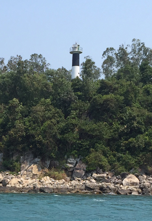
| Song Tử Tây Lighthouse | Image | 1993 | Southwest Cay 11°25′41.5″N114°19′52.2″E / 11.428194°N 114.331167°E | Fl W 15s. | 36 metres (118 ft) | 20289.2 | F2824.5 | 21 |
| Tiên Nữ Lighthouse | Image | 2000 | Dangerous Ground (South China Sea) 8°51′00.1″N114°38′19.6″E / 8.850028°N 114.638778°E | Fl (2+1) W 10s. | 22 metres (72 ft) | n/a | F2825.06 | 15 |
| Trường Sa Lớn Lighthouse |  | 2009 | Spratly Island 8°38′47.2″N111°55′08.9″E / 8.646444°N 111.919139°E | Fl W 10s. | 25 metres (82 ft) | n/a | F2825.08 | 18 [6] |
