External links
Wikimedia Commons has media related to Lighthouses in Malaysia .
- Rowlett, Russ. "The Lighthouse Directory". University of North Carolina at Chapel Hill.
| Types |
|  | ||||
|---|---|---|---|---|---|---|
| Fixtures | ||||||
| Maintenance | ||||||
| Locations | ||||||
| Categories | ||||||
| Global organizations | ||||||
Malaysia is a country largely surrounded by large bodies of water, most notably by the Strait of Malacca and the South China Sea, that have been used extensively for maritime transport as early as the 15th century. Numerous lighthouses were erected during present-day Malaysia's rule by the Portuguese Empire, the Dutch Empire and the British Empire (which oversaw the greatest number of new lighthouses built), and, later, the government of Malaysia, to provide navigation in and out of ports or through dangerous seas. Many of these lighthouses are situated on small islands and headlands.
The following lists lighthouses situated within the borders of Malaysia.
Lighthouses situated on the east coast of Peninsular Malaysia are frequently used for navigation at the South China Sea, as well as beacons into minor ports along the coast.
| Lighthouse | Lat/Long | Constituency | State |
|---|---|---|---|
| Bukit Puteri Lighthouse | 5.335597,103.098369 | Kuala Terengganu | Terengganu |
| Sea Bell Rock Lighthouse | 5.910211, 102.709773 | Besut | Terengganu |
| Tumpat Lighthouse (part of railway station) | 6.200479, 102.167092 | Tumpat | Kelantan |
| Pantai Senok Lighthouse | 6.163956, 102.347382 | Bachok | Kelantan |
| Tanjung Gelang Lighthouse | 3.963642, 103.436968 | Kuantan | Pahang |
| Pulau Mungging Lighthouse | 1.362227, 104.298122 | Pengerang | Johor |
The west coast of Peninsular Malaysia, which faces the Strait of Malacca, contains a large concentration of lighthouses aimed at navigation through the narrow strait, as well as serving to direct ships into major ports such as Port Klang, Malacca and Penang. Lighthouses in Johor are also used to guide ships into Singaporean waters, from which Singaporean counterparts provide navigation past the island or into the Port of Singapore. Most of the west coast lighthouses, as are Singapore's, are referred to as "The Straits Settlement Lighthouses", [1] named after the former British-ruled territories that encompassed Singapore, Penang, Malacca and Dinding.
| Lighthouse | Lat/Long | Constituency | State |
|---|---|---|---|
| One Fathom Bank Lighthouse | 2.884233, 101 | Port Swettenham | Selangor |
| Bukit Jugra Lighthouse | 2.835895, 101.417509 | Kuala Langat | Selangor |
| Althingsburg Lighthouse | 3.341458, 101.244975 | Kuala Selangor | Selangor |
| Pulau Angsa Lighthouse | 3.1860212, 101.217490 | Kuala Selangor | Selangor |
| Pulau Katak Lighthouse | 4.156047, 100.619153 | Lumut | Perak |
| Cape Rachado Lighthouse | 2.407497, 101.852200 | Masjid Tanah | Malacca |
| Melaka Light | 2.192839, 102.249578 | Kota Melaka | Malacca |
| Undan Island Lighthouse | 2.050144, 102.333412 | Kota Melaka | Malacca |
| Pulau Perak Lighthouse | 5.683797, 98.938424 | Pulau Langkawi | Kedah |
| Kuala Kedah Fort and Lighthouse | 6.109615, 100.286522 | Kuala Kedah | Kedah |
| Fort Cornwallis Lighthouse | 5.421188, 100.344667 | Georgetown | Penang |
| Muka Head Lighthouse | 5.473674, 100.180769 | Balik Pulau | Penang |
| Pulau Rimau Lighthouse | 5.247480 100.273045 | Bayan Lepas | Penang |
| Pulau Pisang Lighthouse | 1.467961, 103.254383 | Pontian | Johor |
| Bukit Segenting Lighthouse | 1.792190, 102.889386 | Batu Pahat | Johor |
| Pulau Sialu Lighthouse | 1.788860, 102.885370 | Batu Pahat | Johor |
| Tanjung Piai Lighthouse | 1.259586, 103.509740 | Tanjong Piai | Johor |
| Mudah Selatan Lighthouse | 1.420597, 103.186778 | Pontian | Johor |
| Panjang Selatan Light Beacon | 1.394155, 103.122924 | Pontian | Johor |
Sabah, a Malaysian state on the island of Borneo, faces the South China Sea to the northwest, and the Sulu Sea to the northeast. The lighthouses are primarily used to navigate ships into smaller harbours such as Labuan and Tawau.
| Lighthouse | Lat/Long | Constituency | State |
|---|---|---|---|
| Pulau Kalampunian Lighthouse | 7.0521671, 116.7457880 | Kudat | Sabah |
| Pulau Mantanani Lighthouse | 6.7166787, 116.305755 | Kudat | Sabah |
| Pulau Tiga Lighthouse | 5.7555724, 115.6343140 | Papar | Sabah |
| Pulau Kuraman Lighthouse | 5.223852157, 115.1354535 | Labuan | Wilayah Persekutuan |
| Pulau Papan Lighthouse | 5.2529477, 115.2679977 | Labuan | Wilayah Persekutuan |
| Batu Tinagat Lighthouse | 4.2299475, 117.9805426 | Tawau | Sabah |
| Pulau Berhala Lighthouse | 5.8699292, 118.1455287 | Sandakan | Sabah |
| Tanjung Trang Lighthouse | 5.4235944, 119.2091190 | Lahad Datu | Sabah |
Sarawak, another Malaysian state situated on the island of Borneo, operates lighthouses facing the South China Sea, which are all situated on headlands.
| Lighthouse | Lat/Long | Constituency | State |
|---|---|---|---|
| Tanjung Baram Lighthouse | 4.6252230, 113.9790350 | Miri | Sarawak |
| Tanjung Lobang Lighthouse | 4.3616662, 113.9627421 | Miri | Sarawak |
| Tanjung Datu Lighthouse (on the Indonesian border) | 2.0798194, 109.6441342 | Lundu | Sarawak |
| Tanjung Jerijeh Lighthouse | 2.1557579, 111.1670276 | Tanjong Manis | Sarawak |
| Tanjung Sirik Lighthouse | 2.7967016, 111.3353540 | Tanjong Manis | Sarawak |
| Tanjung Po Lighthouse | 1.7248309, 110.5239074 | Santubong | Sarawak |
| Tanjung Kidurong Lighthouse | 3.2745100, 113.0672334 | Bintulu | Sarawak |
1. ^ There are two lighthouses at the location, one on each side of the border [2]
| Types |
| | ||||
|---|---|---|---|---|---|---|
| Fixtures | ||||||
| Maintenance | ||||||
| Locations | ||||||
| Categories | ||||||
| Global organizations | ||||||

Horsburgh Lighthouse is an active lighthouse which marks the eastern entrance to the Straits of Singapore. It is situated on the island of Pedra Branca. Singapore's earliest lighthouse by date of completion, it is located approximately 54 kilometres (34 mi) to the east of Singapore and 14 kilometres (8.7 mi) from the Malaysian state of Johor.

Rimau Island is an islet off the southeastern tip of Penang Island in the Malaysian state of Penang. Located nearly 832 m (0.517 mi) from Penang Island, this uninhabited islet is now home to an active lighthouse, which was built by the British in 1885. This particular lighthouse, a 17 m (56 ft) round cylindrical cast iron tower with lantern and gallery, as well as a single-storey house for the lightkeeper, serves as a beacon for vessels entering the Penang Strait from the south.

Fort Canning Lighthouse also known as Fort Canning Light is located on top of Fort Canning Hill and was formerly one of the 13 important lighthouses in the Straits of Malacca. Located nearby with The Flagstaff and the Time Ball, the three navigation structures played an essential role during the early maritime history of Singapore.

Cape Anguille is a headland and the westernmost point in Newfoundland, reaching into the Gulf of Saint Lawrence. It is the southern edge of St. George's Bay. Its name is derived from the French word anguille, which means eel. Close to the cape is the community of Cape Anguille.

The headland of Cape St. Francis is the outer extremity marking the boundary of Conception Bay on the Avalon Peninsula of the island of Newfoundland in the Canadian province of Newfoundland and Labrador. The International Maritime Organization also designates Cape St. Francis as the southern extremity of the Labrador Sea.
The Pulau Pisang Lighthouse is a lighthouse located on the highest point of Pulau Pisang, an island in the Strait of Malacca 15 kilometres from Pontian Kechil, Johor, Malaysia.
Undan Island Lighthouse is a lighthouse on the summit of the uninhabited islet of Undan Island, located 25 kilometres (16 mi) off the coast of mainland Malacca in Malaysia.

The Malacca Light is an inactive lighthouse in Malacca City, in the state of Malacca, Malaysia. It was commissioned during British rule in Malacca and was completed in 1849 as an additional beacon for ships travelling along the Strait of Malacca. The lighthouse is also notable for its location within the old harbour town of Malacca, atop St. Paul's Hill on the south side of the harbour and affront the ruins of St. Paul Church.

The One Fathom Bank Lighthouse refers to two offshore lighthouses in the Strait of Malacca, specifically, on a shoal within Malaysian waters, dubbed One Fathom Bank, off the coast of the state of Selangor.

Peninsular Malaysia, historically known as Malaya, also known as West Malaysia or the Malaysian Peninsula, is the part of Malaysia that occupies the southern half of the Malay Peninsula in Southeast Asia and the nearby islands. Its area totals approximately 132,490 km2 (51,150 sq mi), which is nearly 40% of the total area of the country; the other 60% is in East Malaysia on the island of Borneo.
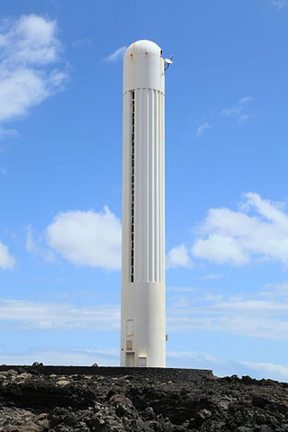
The Arenas Blancas Lighthouse is an active lighthouse on the Canary island of La Palma in the municipality of Villa de Mazo, near the village of La Salemera. The larger settlement of Mazo lies 8 km (5.0 mi) to the north-west.

Farol de Dona Maria Pia is a lighthouse at the southernmost point of the island of Santiago, Cape Verde. It stands on the headland Ponta Temerosa, at the entrance of Praia Harbour, 2 km south of the city centre of Praia. The lighthouse was built in 1881 and was named after Maria Pia of Savoy, queen of Portugal at the time. The octagonal tower is 21 m high and its focal plane is 25 m above mean sea level. It is painted white. The lighthouse is used for navigational purposes.

Tikus Island is an islet off the northern coast of Penang Island in the Malaysian state of Penang. Located nearly 770 m (0.48 mi) off Tanjung Bungah, a suburb of George Town, this uninhabited outcrop is now home to a solar-powered lighthouse. This active lighthouse marks the northern entrance to the Penang Strait and hence, the Port of Penang.

Ponta de Vera Cruz is a headland at the waterfront of the city Santa Maria in the south of Sal, Cape Verde. It is situated near the harbour of Santa Maria. There is a lighthouse on the headland, attached to a restaurant.