
The Riau Islands is a province of Indonesia—not to be confused with neighbouring Riau Province from which the Riau Islands Province were separated in 2002. The capital of the province is Tanjung Pinang, while the largest city is Batam. It shares a maritime border with Riau and Jambi to the west, Bangka Belitung Islands to the south, Singapore to the northeast, Malaysia and West Kalimantan to the east, and Vietnam and Cambodia to the north. It comprises a total of 2,028 islands scattered between Sumatra, Malay Peninsula, and Borneo including the Riau Archipelago. Situated on one of the world's busiest shipping lanes along the Malacca Strait and the Natuna Sea, the province shares water borders with neighboring countries such as Singapore, Malaysia, and Brunei. The Riau Islands also have relatively large potential mineral resources and energy, as well as marine resources.
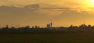
Alor Setar is the state capital of Kedah, Malaysia. It is the second-largest city in the state after Sungai Petani and one of the most-important cities on the west coast of Peninsular Malaysia. It is home to the third-tallest tower in Malaysia, the Alor Setar Tower.

Malacca City is the capital city of the Malaysian state of Malacca, in Melaka Tengah District. It is the oldest Malaysian city on the Straits of Malacca, having become a successful entrepôt in the era of the Malacca Sultanate. The present-day city was founded by Parameswara, a Sumatran prince who escaped to the Malay Peninsula when Srivijaya fell to the Majapahit. Following the establishment of the Malacca Sultanate, the city drew the attention of traders from the Middle East, South Asia, and East Asia, as well as the Portuguese, who intended to dominate the trade route in Asia. After Malacca was conquered by Portugal, the city became an area of conflict when the sultanates of Aceh and Johor attempted to take control from the Portuguese.
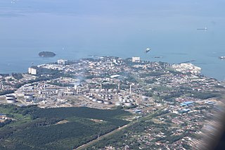
Port Dickson, colloquially referred to as PD is a beach resort in Port Dickson District, Negeri Sembilan, Malaysia. It is the second largest urban area in Negeri Sembilan after Seremban, its state capital. The town's administration is run by the Port Dickson Municipal Council, formerly known as the Port Dickson Sanitary Board from 29 March 1928 until 28 February 1950, Port Dickson Town Board from 1 March 1950 until 30 November 1979, Port Dickson District Council from 1 December 1979 until 1 February 2002.
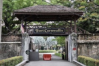
Fort Cornwallis is a bastion fort in George Town, Penang, Malaysia, built by the British East India Company in the late 18th century. Named after the then Lieutenant-General The 2nd Earl Cornwallis (1738–1805), the Governor-General of Bengal at the time of the fort's construction, it is the largest standing fort in Malaysia. The fort never engaged in combat during its operational history.

Horsburgh Lighthouse is an active lighthouse which marks the eastern entrance to the Straits of Singapore. It is situated on the island of Pedra Branca. Singapore's earliest lighthouse by date of completion, it is located approximately 54 kilometres (34 mi) to the east of Singapore and 14 kilometres (8.7 mi) from the Malaysian state of Johor.

Alor Gajah District is one of the three administrative districts in Malacca, Malaysia. It borders Tampin District, Rembau District and Port Dickson District in Negeri Sembilan to the north and borders Jasin District and Melaka Tengah District in the east and south respectively.

Tanjung Tuan is an area in Alor Gajah District, Malacca, Malaysia. It is a semi-exclave of Malacca adjacent to Port Dickson, Negeri Sembilan.

Pengkalan Kempas is a hamlet in Port Dickson District, Negeri Sembilan, Malaysia. The Pengkalan Kempas Historical Complex is located here. It is also called Keramat Ujung Pasir.
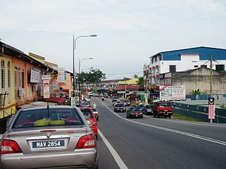
Kuala Sungai Baru is a mukim and town in Alor Gajah District, Malacca, Malaysia, with fishing as main economic activity. It is situated midway between Kuala Linggi and Pengkalan Balak and is approximately 15 kilometers from Masjid Tanah.

Dutch Malacca (1641–1825) was the longest period that Malacca was under foreign control. The Dutch ruled for almost 183 years with intermittent British occupation during the French Revolutionary and later the Napoleonic Wars (1795–1815). This era saw relative peace with little serious interruption from the Malay sultanates due to the understanding forged between the Dutch and the Sultanate of Johor in 1606. This period also marked the decline of Malacca's importance. The Dutch preferred Batavia as their economic and administrative centre in the region and their hold in Malacca was to prevent the loss of the city to other European powers and, subsequently, the competition that would come with it. Thus, in the 17th century, with Malacca ceasing to be an important port, the Johor Sultanate became the dominant local power in the region due to the opening of its ports and the alliance with the Dutch.

Portuguese control of Malacca –a city on the Malay Peninsula– spanned a 130 year period from 1511 to 1641 as a possession of the Portuguese East Indies. It was captured from the Malacca Sultanate as part of Portuguese attempts to gain control of trade in the region. Although multiple attempts to conquer it were repulsed, the city was eventually lost to an alliance of Dutch and regional forces, thus beginning a period of Dutch rule.
The Pulau Pisang Lighthouse is a lighthouse located on the highest point of Pulau Pisang, an island in the Strait of Malacca 15 kilometres from Pontian Kechil, Johor, Malaysia.
Undan Island Lighthouse is a lighthouse on the summit of the uninhabited islet of Undan Island, located 25 kilometres (16 mi) off the coast of mainland Malacca in Malaysia.

The One Fathom Bank Lighthouse refers to two offshore lighthouses in the Strait of Malacca, specifically, on a shoal within Malaysian waters, dubbed One Fathom Bank, off the coast of the state of Selangor.
Parameswara, thought to be the same person named in the Malay Annals as Iskandar Shah, was the last king of Singapura and the founder of Malacca. According to the Malay Annals, he ruled Singapura from 1389 to 1398. The king fled the island kingdom after a Majapahit naval invasion in 1398 and founded his new stronghold on the mouth of Bertam river in 1402. Within decades, the new city grew rapidly to become the capital of the Malacca Sultanate. Portuguese accounts however, written a hundred years after his death, suggest he was from Palembang in Sumatra and usurped the throne of Singapura; he was driven out, either by the Siamese or the Majapahit, and went on to found Malacca.

Malacca, officially the Historic State of Malacca, is a state in Malaysia located in the southern region of the Malay Peninsula, facing the Strait of Malacca. The state is bordered by Negeri Sembilan to the north and west and Johor to the south. The exclave of Tanjung Tuan also borders Negeri Sembilan to the north. Its capital is Malacca City, which has been listed as a UNESCO World Heritage Site since 7 July 2008.

The Fort Cornwallis Lighthouse is a lighthouse in Fort Cornwallis, George Town, Penang, Malaysia. It is currently under the management of the Maritime Authority of Malaysia.


