List of seaports in Mexico

Last updated

Cruising at the International Transatlantic Port Lieutenant Jose Azueta Cruise in Acapulco, Mexico.jpg
Cruising at the International Transatlantic Port Lieutenant José Azueta

This is a list of seaports in Mexico .

Atlantic Ocean (Gulf of Mexico and Caribbean Sea)

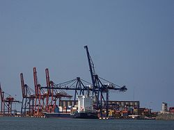
Port of Veracruz Detalle del Puerto-Veracruz-Mexico.jpeg
Port of Veracruz

Pacific Ocean (including the Gulf of California)

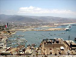
Port of Ensenada Ensenada23Mai2004h12m30pm.jpg
Port of Ensenada
Cabo San Lucas Marina 2004. CaboSanLucasMarina2004.JPG
Cabo San Lucas Marina 2004.

Mexico's 10 busiest freight ports by total cargo tonnage.

Contents

PortTotal Cargo (Metric Tons) - 2013
Lazaro Cardenas30,781,903
Manzanillo25,923,821
Veracruz20,530,234
Altamira15,333,440
Isla de Cedros15,234,436
Punta Venado9,064,845
Guerrero Negro7,573,513
Coatzacoalcos7,052,059
Guaymas5,832,015

[1]

Related Research Articles

Acapulco City in Guerrero, Mexico

Acapulco de Juárez, commonly called Acapulco, is a city and major seaport in the state of Guerrero on the Pacific coast of Mexico, 380 kilometres (240 mi) south of Mexico City. Acapulco is located on a deep, semicircular bay and has been a port since the early colonial period of Mexico's history. It is a port of call for shipping and cruise lines running between Panama and San Francisco, California, United States. The city of Acapulco is the largest in the state, far larger than the state capital Chilpancingo. Acapulco is also Mexico's largest beach and balneario resort city. Acapulco de Juárez is the municipal seat of the municipality of Acapulco.

Gulf Coast of the United States Coastline in the United States

The Gulf Coast of the United States is the coastline along the Southern United States where they meet the Gulf of Mexico. The coastal states that have a shoreline on the Gulf of Mexico are Texas, Louisiana, Mississippi, Alabama, and Florida, and these are known as the Gulf States.

Latin America Region of the Americas where Romance languages are primarily spoken

Latin America is the portion of the Americas comprising countries and regions where Romance languages—languages that derived from Latin—such as Spanish, Portuguese, and French are predominantly spoken. The term was originally used to refer to places in the Americas that were ruled under the Spanish, Portuguese, and French empires.

Rio Grande Major river forming part of the US–Mexico border

The Rio Grande, known in Mexico as the Río Bravo del Norte and as the Río Bravo, is one of the principal rivers in the southwestern United States and in northern Mexico. The length of the Rio Grande is 1,896 miles (3,051 km) and originates in south-central Colorado, in the United States, and flows to the Gulf of Mexico. The Rio Grande drainage basin (watershed) has an area of 182,200 square miles (472,000 km2); however, the endorheic basins that are adjacent to and within the greater drainage basin of the Rio Grande increase the total drainage-basin area to 336,000 square miles (870,000 km2).

Veracruz State of Mexico

Veracruz, formally Veracruz de Ignacio de la Llave, officially the Free and Sovereign State of Veracruz de Ignacio de la Llave, is one of the 31 states which, along with Mexico City, comprise the 32 Federal Entities of Mexico. It is divided into 212 municipalities, and its capital city is Xalapa-Enríquez.

Victoria, Texas City and county seat in Texas, United States

Victoria is the largest city and county seat of Victoria County, Texas. The population was 62,592 as of the 2010 census. The three counties of the Victoria Metropolitan Statistical Area had a population of 111,163 as of the 2000 census. Its elevation is 95 ft (29 m).

Matamoros, Tamaulipas City in Tamaulipas, Mexico

Matamoros, officially known as Heroica Matamoros, is a city in the northeastern Mexican state of Tamaulipas, and the municipal seat of the homonymous municipality. It is on the southern bank of the Rio Grande, directly across the border from Brownsville, Texas, in the United States. Matamoros is the second largest city in the state of Tamaulipas. As of 2016, Matamoros had a population of 520,367. In addition, the Matamoros–Brownsville Metropolitan Area has a population of 1,387,985, making it the 4th largest metropolitan area on the Mexico–US border. Matamoros is the 39th largest city in Mexico and anchors the second largest metropolitan area in Tamaulipas.

Tampico City in Tamaulipas, Mexico

Tampico is a city and port in the southeastern part of the state of Tamaulipas, Mexico. It is located on the north bank of the Pánuco River, about 10 kilometers (6 mi) inland from the Gulf of Mexico, and directly north of the state of Veracruz. Tampico is the fifth-largest city in Tamaulipas, with a population of 314,418 in the city proper and 929,174 in the metropolitan area.

Manzanillo, Colima City in Colima, Mexico

Manzanillo is a city and seat of Manzanillo Municipality, in the Mexican state of Colima. The city, located on the Pacific Ocean, contains Mexico's busiest port, responsible for handling Pacific cargo for the Mexico City area. It is the largest-producing municipality for the business sector and tourism in the small state of Colima.

Coatzacoalcos City and municipality in Veracruz, Mexico

Coatzacoalcos is a major port city in the southern part of the Mexican state of Veracruz, mostly on the western side of the Coatzacoalcos River estuary, on the Bay of Campeche, on the southern Gulf of Mexico coast. The city serves as the municipal seat of the municipality of the same name. It is the state's third largest city, after Veracruz City and Xalapa.

Veracruz (city) City and municipality in Veracruz, Mexico

Veracruz, officially known as Heroica Veracruz, is a major port city and municipal seat for the surrounding municipality of Veracruz on the Gulf of Mexico in the Mexican state of Veracruz. The city is located along the coast in the central part of the state, 90 km (56 mi) southeast of the state capital Xalapa along Federal Highway 140.

Tuxpan Municipality in Veracruz, Mexico

Tuxpan is both a municipality and city located in the Mexican state of Veracruz. The population of the city was 78,523 and of the municipality was 134,394 inhabitants, according to the INEGI census of 2005, residing in a total area of 1,051.89 km2 (406.14 sq mi). The municipality includes many smaller outlying communities, the largest of which are Alto Lucero and Santiago de la Peña. A local beachside community is also nearby.

Mexican Navy Maritime warfare branch of Mexicos military

The Mexican Navy is one of the two independent armed forces of Mexico. The actual naval forces are called the Armada de México. The Secretaría de Marina (SEMAR) includes both the Armada itself and the attached ministerial and civil service. The commander of the Navy is the Secretary of the Navy, who is both a cabinet minister and a career naval officer.

Mexico–United States border International border

The Mexico–United States border is an international border separating Mexico and the United States, extending from the Pacific Ocean in the west to the Gulf of Mexico in the east. The border traverses a variety of terrains, ranging from urban areas to deserts. The Mexico–United States border is the most frequently crossed border in the world, with approximately 350 million documented crossings annually. It is the tenth-longest border between two countries in the world.

San Diego–Tijuana International transborder agglomeration in Southern California and northwestern Baja California

San Diego–Tijuana is an international transborder agglomeration, straddling the border of the adjacent North American coastal cities of San Diego, California, United States and Tijuana, Baja California, Mexico. The 2012 population of the region was 4,922,723, making it the largest bi-national conurbation shared between the United States and Mexico, the second-largest shared between the US and another country. In its entirety, the region consists of San Diego County in the United States and the municipalities of Tijuana, Rosarito Beach, and Tecate in Mexico. It is the third most populous region in the California–Baja California region, smaller only than the metropolitan areas of Greater Los Angeles and the San Francisco Bay Area.

Federal Highway 2 is a free part of the Mexican federal highway corridors that runs along the U.S. border. The highway is in two separate improved segments, starting in the west at Tijuana, Baja California, on the Pacific coast and ending in the east in Matamoros, Tamaulipas, on the Gulf of Mexico. Fed. 2 passes through the border states of Baja California, Sonora, Chihuahua, Coahuila, Nuevo Leon and Tamaulipas. It has a total length of 1,963 kilometres (1,220 mi); 1,319 kilometres (820 mi) in the west and 644 kilometres (400 mi) in the east.

Spanish attempts to reconquer Mexico Counter-revolutionary attempted interventions by Spain to reclaim Mexico as a colony

The Spanish attempts to reconquer Mexico were an effort by the Spanish government to regain possession of its former colony of New Spain, resulting in episodes of war comprised in clashes between the newly born Mexican nation and Spain. The designation mainly covers two periods: the first attempts occurred from 1821 to 1825 and involved the defense of Mexico's territorial waters, while the second period had two stages, including the Mexican expansion plan to take the Spanish-held island of Cuba between 1826 and 1828 and the 1829 expedition of Spanish General Isidro Barradas, which landed on Mexican soil with the object of reconquering Mexican territory. Although the Spanish never regained control of the country, they damaged the fledgling Mexican economy.

San Ysidro Port of Entry Border crossing between Mexico and the U.S.

The San Ysidro Port of Entry is the largest land border crossing between San Diego and Tijuana, and the fourth-busiest land border crossing in the world with 70,000 northbound vehicles and 20,000 northbound pedestrians crossing each day, in addition to southbound traffic. It connects Mexican Federal Highway 1 on the Mexican side with Interstate 5 on the American side. The San Ysidro Port of Entry is one of three ports of entry in the San Diego–Tijuana metropolitan region.

Otay Mesa Port of Entry Border crossing between Mexico and the U.S.

The Otay Mesa Port of Entry is one of three ports of entry (POE) in the San Diego–Tijuana metropolitan region, in the U.S. state of California, connecting Otay Mesa in the City of San Diego with the Otay Centenario borough of Tijuana. The facility was opened in 1983, and was constructed primarily to divert growing commercial truck traffic from the busy San Ysidro Port of Entry. Since then, significant passenger vehicle and pedestrian traffic has grown as development in the area around the crossing has grown. Commercial importations through Otay Mesa accounts for billions of dollars' worth of freight.

2016 FIFA U-20 Womens World Cup 8th edition of the FIFA U-20 Womens World Cup

The 2016 FIFA U-20 Women’s World Cup was the 8th edition of the FIFA U-20 Women's World Cup, the biennial international women's youth football championship contested by the under-20 national teams of the member associations of FIFA. The tournament was held in Papua New Guinea from 13 November to 3 December 2016. This was the first FIFA tournament held in the country.

References