Listed buildings in Bramhope

Last updated

Bramhope is a civil parish in the metropolitan borough of the City of Leeds, West Yorkshire, England. It contains 20 listed buildings that are recorded in the National Heritage List for England. Of these, one is listed at Grade I, the highest of the three grades, and the others are at Grade II, the lowest grade. The parish contains the village of Bramhope and the surrounding countryside. Of the listed buildings, nine are mileposts, and the others include houses, farmhouses and farm buildings, a chapel and a church, the north portal of Bramhope Tunnel and a sighting tower used in the construction of the tunnel, and a gazebo.

Contents

Key

Map all coordinates using: OpenStreetMap  
Download coordinates as: KML
GradeCriteria [1]
IBuildings of exceptional interest, sometimes considered to be internationally important
IIBuildings of national importance and special interest

Buildings

Name and locationPhotographDateNotesGrade
Puritan Chapel
53°53′17″N1°37′21″W / 53.88794°N 1.62263°W / 53.88794; -1.62263 (Puritan Chapel)
Bramhope 006.jpg
1649The chapel is in sandstone with a stone slate roof and a rectangular plan. There is one storey and five bays. It contains segmental-headed doorways with moulded surrounds, and mullioned windows with hollow spandrels. On the west gable end is a bellcote. Inside are box pews, and an octagonal pulpit with sounding boards. [2] [3] I
1 Church Hill
53°53′08″N1°37′25″W / 53.88561°N 1.62353°W / 53.88561; -1.62353 (1 Church Hill)
Late 17th centuryA farmhouse, later used for other purposes, it is in sandstone, with quoins, a continuous hood mould, and a stone slate roof with coped gables and kneelers. There are two storeys, a single-depth plan, and two bays. The doorway has a chamfered surround, there is an inserted shop window, and the other windows are mullioned, with some mullions removed. [4] II
Rear portion, Old Manor Farmhouse
53°53′12″N1°37′24″W / 53.88653°N 1.62338°W / 53.88653; -1.62338 (Rear portion, Old Manor Farmhouse)
Late 17th centuryA farmhouse, later a private house, it is in sandstone, with quoins, and a slate roof. There are two storeys and two bays. The two doorways have plain surrounds, one has been converted into a window, some of the other windows are square, and the others are mullioned. [5] II
Barn west of Old Manor Farmhouse
53°53′11″N1°37′25″W / 53.88648°N 1.62367°W / 53.88648; -1.62367 (Barn west of Old Manor Farmhouse)
1691The barn is in sandstone, with quoins, and a stone slate roof. There is a U-shaped plan with a main range of three bays and two front outshuts. The barn contains a partly blocked wagon entrance, a blocked doorway, an inserted doorway and window, and an initialled datestone. [6] II
Weavers Cottage
53°53′06″N1°37′22″W / 53.88507°N 1.62269°W / 53.88507; -1.62269 (Weavers Cottage)
1709A farmhouse later divided into two, it is in sandstone with quoins, and a stone slate roof with a coped gable on the left. There are two storeys and three bays. On the front, a doorway has been inserted into a previous window, and at the rear are coupled doorways and a datestone. The windows are mullioned with some mullions removed, and over the ground floor openings are moulded cornices. [7] II
Gazebo
53°53′21″N1°37′13″W / 53.88909°N 1.62022°W / 53.88909; -1.62022 (Gazebo)
18th centuryThe gazebo in the garden of Westwood is in sandstone, and in Classical style. There are two storeys and a circular plan. In the ground floor is a three-bay colonnade, the columns and antae with moulded caps, and in the upper floor is a colonnade glazed with curved sash windows. Above this is a dentilled cornice and a domed roof with a ball finial. On the west side external steps lead up to a doorway with a Gibbs surround. [8] [9] II
Manor House
53°53′06″N1°37′24″W / 53.88494°N 1.62327°W / 53.88494; -1.62327 (Manor House)
Mid 18th centuryA sandstone house with quoins, moulded gutter brackets, and a stone slate roof with coped gables and kneelers. There are two storeys, a double-depth plan, and three bays. The central doorway has panelled pilasters and a pediment, to its left is an inserted rectangular bay window, and above is a single-light window. The other windows are mullioned with three lights, containing top-hung casements. [10] II
Milepost at SE 236 422
53°52′32″N1°38′32″W / 53.87555°N 1.64215°W / 53.87555; -1.64215 (Milepost at SE 236 422)
Milestone, Otley Old Road.jpg
18th century (probable)The milepost is on the north side of Otley Old Road, and is in sandstone. It is in the form of a mounting block, about 0.5 metres (1 ft 8 in) long and 0.5 metres (1 ft 8 in) high. There are three steps on the west side, and partly erased inscriptions on the front and right side. [11] II
The Hollies
53°53′07″N1°37′27″W / 53.88520°N 1.62405°W / 53.88520; -1.62405 (Manor House)
Mid to late 18th centuryA farmhouse, later a private house, it is in sandstone with quoins, and a stone slate roof with a coped gable on the right. There are two storeys, a double-depth plan, and three bays. The doorway has a plain surround, and the windows are mullioned with two lights. [12] II
Sighting tower
53°52′42″N1°37′31″W / 53.87825°N 1.62515°W / 53.87825; -1.62515 (Sighting tower)
Bramhope - Sighting Tower.jpg
1845 (probable)The sighting tower was built by the Leeds and Thirsk Railway for the construction of Bramhope Tunnel. It is in sandstone, tall and cylindrical, and about 2 metres (6 ft 7 in) in diameter. The tower contains four narrow vertical-rectangular openings near the top, and a flat coping. [13] II
North portal, Bramhope Tunnel
53°53′23″N1°36′44″W / 53.88974°N 1.61229°W / 53.88974; -1.61229 (North portal, Bramhope Tunnel)
Bramhope Tunnel north portal 1a.jpg
1845–49The tunnel was built for the Leeds and Thirsk Railway and the portal is in Gothic style. It is in sandstone, and consists of a horseshoe arch with a moulded surround, a large keystone, a machicolated cornice, a parapet of slabs, each with a hole, and a central raised panel containing a cartouche. To the left is a large three-stage cylindrical tower with round-headed windows, a machicolated cornice, and an embattled parapet with blind cruciform loops. On the right side is a smaller octagonal turret with corbelled battlements. The flanking quadrant retaining walls end in turrets. [8] [14] II
Milepost on east corner of junction with Breary Lane at SE 255 430
53°52′59″N1°36′45″W / 53.88306°N 1.61240°W / 53.88306; -1.61240 (Milepost on east corner of junction with Breary Lane at SE 255 430)
Old Milestone in Bramhope - geograph.org.uk - 239835.jpg
Mid 19th centuryThe milepost is in sandstone, about 0.5 metres (1 ft 8 in) high, and has a rectangular section and a rounded top. It is inscribed with the distances to a number of local places. [15] II
Milepost on east corner of junction with Breary Lane East, at SE 256 430
53°52′59″N1°36′43″W / 53.88317°N 1.61193°W / 53.88317; -1.61193 (Milepost on east corner of junction with Breary Lane East, at SE 256 430)
Milestone, Breary Lane East.jpg
Mid 19th centuryThe milepost is in sandstone, about 0.5 metres (1 ft 8 in) high, and has a rectangular section and a segmenally-rounded top. It is inscribed with the distances to a number of local places. [16] II
Milepost on east corner of junction with Church Hill at SE 249 434
53°53′12″N1°37′22″W / 53.88672°N 1.62274°W / 53.88672; -1.62274 (Milepost on east corner of junction with Church Hill at SE 249 434)
Milestone, Church Hill.jpg
Mid 19th centuryThe milepost is in sandstone, about 0.5 metres (1 ft 8 in) high, and has a rectangular section and a segmenally-rounded top. It is inscribed with the distances to a number of local places. [17] II
Milepost on south-east corner of junction with Pool Bank New Road at SE 241 440
53°53′30″N1°38′04″W / 53.89160°N 1.63449°W / 53.89160; -1.63449 (Milepost on south-east corner of junction with Pool Bank New Road at SE 241 440)
Milestone, Pool Bank New Road (North).jpg
Mid 19th centuryThe milepost is in sandstone, about 1 metre (3 ft 3 in) high, and has a rectangular section and a segmenally-rounded top. It is inscribed with the distances to a number of local places. [18] II
Milepost on west corner of junction with Creskeld Lane at SE 258 428
53°52′53″N1°36′29″W / 53.88129°N 1.60793°W / 53.88129; -1.60793 (Milepost on west corner of junction with Creskeld Lane at SE 258 428)
Milestone at Bramhope near Leeds (geograph 2569298).jpg
Mid 19th centuryThe milepost is in sandstone, about 0.5 metres (1 ft 8 in) high, and has a rectangular section and a segmenally-rounded top. It is inscribed on both sides with the distances to a number of local places. [19] II
Milepost at SE 240 439
53°53′28″N1°38′10″W / 53.89106°N 1.63619°W / 53.89106; -1.63619 (Milepost at SE 240 439)
Milestone, Pool Bank New Road.jpg
Late 19th centuryThe milepost is on the southeast side of Pool Bank New Road (A658 road). It is in sandstone with cast iron cladding and has a triangular plan, a semicircular top, and chamfered sides. The top is inscribed "DUDLEYHILL, KILLINGHALL & HARROGATE ROAD" and "BRAMHOPE" and on the sides are the distances to Bradford, Harrogate and Killinghall. [20] II
Milepost at SE 253 432
53°53′06″N1°37′00″W / 53.88504°N 1.61654°W
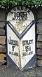
 / 53.88504; -1.61654 (Milepost at SE 253 432)
Milestone, Leeds Road, Bramhope.jpg
Late 19th centuryThe milepost is on the north side of Leeds Road (A660 road) in the village of Bramhope. It is in sandstone with cast iron cladding and has a triangular plan, a semicircular top, and chamfered sides. On the top is the distance to London, and on the sides are the distances to Leeds and Otley. [21] II
Milepost at SE 264 421
53°52′30″N1°35′57″W / 53.87500°N 1.59910°W / 53.87500; -1.59910 (Milepost at SE 264 421)
Milestone - Leeds Road (geograph 3243516).jpg
Late 19th centuryThe milepost is on the northeast side of Leeds Road (A660 road) southeast of the village of Bramhope. It is in sandstone with cast iron cladding and has a triangular plan, a semicircular top, and chamfered sides. On the top is the distance to London, and on the sides are the distances to Leeds and Otley. [22] II
Methodist Church
53°53′07″N1°37′17″W / 53.88526°N 1.62137°W / 53.88526; -1.62137 (Methodist Church)
Bramhope 027.jpg
1895–96The church was designed by W. J. Morley in Decorated style. It is built in sandstone with a slate roof, and consists of a nave, short north and south transepts, a chancel, and a southwest steeple. The steeple has a three-stage tower with angle buttresses rising to pinnacles, an arched doorway, an octagonal top stage, and an octagonal spire. The front facing the road is gabled, and contains s four-light window with a hood mould, beneath which are four small cusped windows, and to the left is a buttress rising to an octagonal pinnacle with a spirelet. [8] [23] II

Related Research Articles

Bramhope Village and civil parish in West Yorkshire, England

Bramhope is a village and civil parish in the City of Leeds metropolitan borough, West Yorkshire, England, north of Holt Park and north east of Cookridge.

Clifton Campville is a civil parish in the district of Lichfield, Staffordshire, England. It contains 17 listed buildings that are recorded in the National Heritage List for England. Of these, one is at Grade I, the highest of the three grades, two are at Grade II*, the middle grade, and the others are at Grade II, the lowest grade. The parish contains the villages of Clifton Campville and Haunton, and is otherwise rural. The listed buildings consist of two churches, a small country house and its associated coach house and stable, smaller houses, farmhouses and associated structures, a public house, a former convent, and a milepost.

Guiseley and Rawdon is a ward in the metropolitan borough and Rawdon is a civil parish in the City of Leeds, West Yorkshire, England. This list also contains the listed buildings in Otley and Yeadon ward. The wards and parish contain 99 listed buildings that are recorded in the National Heritage List for England. Of these, one is listed at Grade I, the highest of the three grades, three are at Grade II*, the middle grade, and the others are at Grade II, the lowest grade. The wards and parish contain the towns of Guiseley and Yeadon, the villages of Rawdon and Hawksworth, and the surrounding area. Most of the listed buildings are houses, cottages and associated structures, farmhouses and farm buildings. The other listed buildings include churches and items in churchyards, a village cross, a school, a former hospital, a railway bridge, a railway tunnel portal and retaining walls, a former tram shed, a town hall, and a telephone kiosk.

Shipley is a ward in the metropolitan borough of the City of Bradford, West Yorkshire, England. Excluding the listed buildings in the model village of Saltaire, which are the subject of a separate list, it contains 14 listed buildings that are recorded in the National Heritage List for England. Of these, one is at Grade II*, the middle of the three grades, and the others are at Grade II, the lowest grade. The listed buildings consist of a farmhouse and a barn, houses, churches and associated structures, a canal bridge and a warehouse, mill buildings, including a chimney, and a war memorial.

Bramham cum Oglethorpe is a civil parish in the metropolitan borough of the City of Leeds, West Yorkshire, England. It contains 40 listed buildings that are recorded in the National Heritage List for England. Of these, nine are listed at Grade I, the highest of the three grades, two are at Grade II*, the middle grade, and the others are at Grade II, the lowest grade. The parish contains the village of Bramham and the surrounding area. In the parish is Bramham Park, a country house, which is listed together with a number of structures in its grounds. The other listed buildings include houses, cottages and associated structures, farmhouses and farm buildings, a church, the remains of a medieval cross, a disused windmill, a former aircraft hangar, and a war memorial.

Collingham is a civil parish in the metropolitan borough of the City of Leeds, West Yorkshire, England. It contains eight listed buildings that are recorded in the National Heritage List for England. Of these, one is listed at Grade II*, the middle of the three grades, and the others are at Grade II, the lowest grade. The parish contains the villages of Collingham and Linton, and the surrounding countryside. The listed buildings consist of a church, two farmhouses, a barn, an outbuilding, two bridges, and a milestone.

Garforth and Swillington is a ward and Swillington is a civil parish in the metropolitan borough of the City of Leeds, West Yorkshire, England. The ward and parish contain 23 listed buildings that are recorded in the National Heritage List for England. Of these, two are listed at Grade II*, the middle of the three grades, and the others are at Grade II, the lowest grade. The area covered by the list includes the town of Garforth, the village of Swillington, and the surrounding countryside. The listed buildings include houses and associated structures, farmhouses, churches, a sundial in a churchyard, road and railway bridges, and mileposts.

Kippax is a civil parish in the metropolitan borough of the City of Leeds, West Yorkshire, England. The parish contains nine listed buildings that are recorded in the National Heritage List for England. Of these, one is listed at Grade I, the highest of the three grades, and the others are at Grade II, the lowest grade. The parish contains the village of Kippax and the surrounding countryside. The listed buildings consist of houses and associated structures, a church and items in the churchyard, a barn, a former public house, a former windmill, and a milepost.

Ledston is a civil parish in the metropolitan borough of the City of Leeds, West Yorkshire, England. It contains 20 listed buildings that are recorded in the National Heritage List for England. Of these, four are listed at Grade I, the highest of the three grades, two are at Grade II*, the middle grade, and the others are at Grade II, the lowest grade. The parish contains the village of Ledston and the surrounding countryside. The most important building in the parish is Ledston Hall, which is listed, together with a number of associated structures. The other listed buildings are a farmhouse, farm buildings, two mileposts, and two former winding houses at a colliery that has closed.

Aberford and Lotherton cum Aberford are adjacent civil parishes in the metropolitan borough of the City of Leeds, West Yorkshire, England. The parishes contain 25 listed buildings that are recorded in the National Heritage List for England. Of these, one is listed at Grade II*, the middle of the three grades, and the others are at Grade II, the lowest grade. The parishes contain the village of Aberford and the surrounding countryside, including the area around Lotherton Hall. Most of the listed buildings are houses and cottages, and the others include churches, a market cross, a former water mill and a former windmill, a bridge, farm buildings, a hotel and a former stable block, a war memorial, and three milestones.

Parlington is a civil parish in the metropolitan borough of the City of Leeds, West Yorkshire, England. The parish contains 18 listed buildings that are recorded in the National Heritage List for England. Of these, two are listed at Grade II*, the middle of the three grades, and the others are at Grade II, the lowest grade. The parish was centred on the country house of Parlington Hall, but this was largely demolished in 1952. Most of the listed buildings are in the remaining estate, and include a triumphal arch, a bridge, a tunnel, the home farm, a garden house and associated garden walls, an icehouse, a group of stallion pens, a deer shelter, and lodges at the entrances to the grounds. The other listed buildings are a group of almshouses and associated structures, a farmhouse, and a milepost.

Pool is a civil parish in the metropolitan borough of the City of Leeds, West Yorkshire, England. The parish contains twelve listed buildings that are recorded in the National Heritage List for England. All the listed buildings are designated at Grade II, the lowest of the three grades, which is applied to "buildings of national importance and special interest". The parish contains the village of Pool-in-Wharfedale and the surrounding countryside. Most of the listed buildings are houses and cottages, and the others include a church, a former toll house, a bridge, three mileposts, and a war memorial.

Rothwell is a ward in the metropolitan borough of the City of Leeds, West Yorkshire, England. It contains 40 listed buildings that are recorded in the National Heritage List for England. Of these, four are listed at Grade II*, the middle of the three grades, and the others are at Grade II, the lowest grade. In addition to the town of Rothwell, the parish contains the villages of Carlton, Oulton, and Woodlesford, and the surrounding area. Most of the listed buildings are houses and cottages, farmhouses and farm buildings. The other listed buildings include churches and a gravestone, a row of almshouses, a former poorhouse, former schools, the clock tower from a former workhouse, and a war memorial.

Shadwell is a civil parish in the metropolitan borough of the City of Leeds, West Yorkshire, England. The parish contains ten listed buildings that are recorded in the National Heritage List for England. All the listed buildings are designated at Grade II, the lowest of the three grades, which is applied to "buildings of national importance and special interest". The parish contains the village of Shadwell and the surrounding area, and the listed buildings consist of houses, a farmhouse and farm buildings, a library, a church and a war memorial.

Sitlington is a civil parish in the metropolitan borough of the City of Wakefield, West Yorkshire, England. The parish contains ten listed buildings that are recorded in the National Heritage List for England. Of these, two are listed at Grade II*, the middle of the three grades, and the others are at Grade II, the lowest grade. The parish contains the villages of Middlestown, Netherton, and Overton, and the surrounding countryside. In the parish is the large house, Netherton Hall, which is listed together with associated structures. Also in the parish is the former Caphouse Colliery, later the National Coal Mining Museum for England, which contains two listed buildings. The other listed buildings consist of farm buildings, a wagonway tunnel and its portal, a row of cottages, a milepost, and a church.

Brierley is a town and Grimethorpe is a village in the North East Ward in the metropolitan borough of Barnsley, South Yorkshire, England. The ward contains six listed buildings that are recorded in the National Heritage List for England. Of these, one is listed at Grade II*, the middle of the three grades, and the others are at Grade II, the lowest grade. The listed buildings consist of three houses, a farmhouse, a milepost, and a church.

Tankersley is a civil parish in the metropolitan borough of Barnsley, South Yorkshire, England. The parish contains twelve listed buildings that are recorded in the National Heritage List for England. Of these, one is listed at Grade II*, the middle of the three grades, and the others are at Grade II, the lowest grade. The parish contains the villages of Tankersley and Pilley, and the surrounding area. The listed buildings consist of a church, a sundial and a mounting block in the churchyard, houses, farmhouses and farm buildings, a milepost, and a former coal mines rescue station.

Hatfield is a civil parish in the metropolitan borough of Doncaster, South Yorkshire, England. The parish contains 32 listed buildings that are recorded in the National Heritage List for England. Of these, two are listed at Grade I, the highest of the three grades, and the others are at Grade II, the lowest grade. The parish contains the villages of Hatfield and Hatfield Woodhouse, and the surrounding area. Most of the listed buildings are houses, cottages and associated structures, farmhouses and farm buildings. The other listed buildings include churches and associated items, a former charity school, two former tower windmills, three mileposts, and a cemetery chapel.

Norton is a civil parish, and Norton and Askern is a ward, in the metropolitan borough of Doncaster, South Yorkshire, England. The parish and ward contain 27 listed buildings that are recorded in the National Heritage List for England. Of these, two are listed at Grade I, the highest of the three grades, and the others are at Grade II, the lowest grade. The parish and ward contain the villages of Norton, Campsall, Skellow, and Sutton and the surrounding countryside. Most of the listed buildings are houses, cottages and associated structures, farmhouses and farm buildings. The other listed buildings include a church, three cross bases, two bridges, a former windmill, a former watermill, a public house, two mileposts, a former toll house, and a village pump.

Maltby is a civil parish in the Metropolitan Borough of Rotherham, South Yorkshire, England. The parish contains 40 listed buildings that are recorded in the National Heritage List for England. Of these, one is listed at Grade I, the highest of the three grades, three are at Grade II*, the middle grade, and the others are at Grade II, the lowest grade. The parish contains the town of Maltby and a large area to the southeast of the town. This area includes the country house of Sandbeck Park, which is listed together with a number of associated buildings and structures. Also in the area is Roche Abbey, and items in its grounds are listed. The other listed buildings include houses and cottages, a church and a tomb in the churchyard, a market cross, former watermills, farmhouses and farm buildings, mileposts, and a war memorial.

References

Citations

Sources