Otley is a market town and civil parish at a bridging point on the River Wharfe, in the City of Leeds metropolitan borough in West Yorkshire, England. Historically a part of the West Riding of Yorkshire, the population was 13,668 at the 2011 census. It is in two parts: south of the river is the historic town of Otley and to the north is Newall, which was formerly a separate township. The town is in lower Wharfedale on the A660 road which connects it to Leeds.
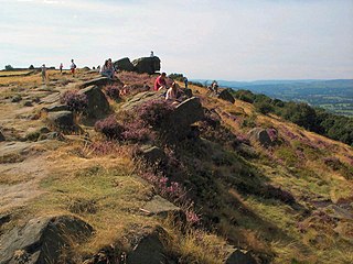
The Chevin is the ridge on the south side of Wharfedale in Leeds, West Yorkshire, England, overlooking the market town of Otley, and often known as Otley Chevin.

Wharfedale is the valley of the upper parts of the River Wharfe and one of the Yorkshire Dales. It is situated in North Yorkshire, and the cities of Leeds and Bradford in West Yorkshire. It is the upper valley of the River Wharfe. Towns and villages in Wharfedale include Buckden, Kettlewell, Conistone, Grassington, Hebden, Bolton Abbey, Addingham, Ilkley, Burley-in-Wharfedale, Otley, Pool-in-Wharfedale, Arthington, Collingham and Wetherby. Beyond Wetherby, the valley opens out and becomes part of the Vale of York.

The A65 is a major road in England. It runs north west from Leeds in West Yorkshire via Kirkstall, Horsforth, Yeadon, Guiseley, Ilkley and Skipton, west of Settle, Ingleton and Kirkby Lonsdale before terminating at Kendal in Cumbria.

West Park is a suburb of north-west Leeds, West Yorkshire, England, north of Headingley. It is a mixed area of private suburban housing and suburban council estates. The name derives from its main park containing playing fields together with a conservation area of grassy meadow ending in woodland. The largest housing estate in West Park is Moor Grange.

The Harrogate line is a passenger rail line through parts of North Yorkshire and the West Yorkshire area of northern England connecting Leeds to York by way of Harrogate and Knaresborough. Service on the line is operated by Northern, with a few additional workings by London North Eastern Railway starting and terminating at Harrogate. West Yorkshire Metro's bus and rail MetroCard ticket is available for journeys between Leeds and Harrogate.

The A64 is a major road in North and West Yorkshire, England, which links Leeds, York and Scarborough. The A64 starts as the A64(M) ring road motorway in Leeds, then towards York it becomes a high-quality dual carriageway until it is east of the city, where it becomes a single carriageway for most of its route to Scarborough.

Menston is a village and civil parish in the City of Bradford in the county of West Yorkshire, England. Along with Burley in Wharfedale, most of Menston is within Wharfedale Ward in the metropolitan borough of Bradford. The remainder of Menston is in the Leeds City Council area. At the 2011 census it has a population of 4,498.

Menston railway station serves Menston in the City of Bradford, West Yorkshire, England. On the Wharfedale Line between Ilkley and Leeds/Bradford Forster Square, it is served by Class 331 and 333 electric trains run by Northern Trains, who also manage the station.
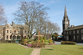
Burley in Wharfedale is a village and a civil parish in the City of Bradford in West Yorkshire, England. It is situated in the Wharfedale valley. In 2011 it had a population of 7041.

The Otley Run is the name given to a pub crawl in Leeds, West Yorkshire. The popular route covers Far Headingley, Headingley and Hyde Park areas and commonly continues towards Leeds City Centre.
Lawnswood is a small suburb in the north west of the city of Leeds in West Yorkshire, England. As such it is north north east of the West Yorkshire Urban Area. The suburb falls within the Adel and Wharefdale Ward of the City of Leeds Council.

Pool-in-Wharfedale or Pool in Wharfedale, usually abbreviated to Pool, is a village and civil parish in Lower Wharfedale, West Yorkshire, England, 10 miles (16 km) north of Leeds city centre, 11 miles (18 km) north-east of Bradford, and 2 miles (3.2 km) east of Otley. It is in the City of Leeds metropolitan borough, and within the historic boundaries of the West Riding of Yorkshire.

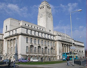
Transport within Leeds consists of road, bus and rail networks. Leeds railway station is one of the busiest in Britain, and Leeds is connected to the national road network via the A1(M) motorway, M1 motorway and M62 motorway. The city is served by Leeds Bradford Airport.

The Leeds Country Way is a circular long-distance footpath of 62 miles (99 km) around Leeds, West Yorkshire, England. It is never more than 7 miles (11 km) from City Square, Leeds, but is mainly rural with extensive views in the outlying areas of the Leeds metropolitan district. It follows public Rights of Way including footpaths, bridleways and minor lanes, with a few short sections along roads.

The 1980 Leeds City Council election took place on 1 May 1980 to elect members of Leeds City Council in England.
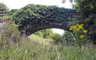
The Wharfedale Greenway is a proposed cycleway, footpath and equestrian route which will run along the route of the former Otley and Ilkley Joint Railway between Burley in Wharfedale and Pool in Wharfedale via Otley, West Yorkshire, England. The railway previously connected the extant Wharfedale and Harrogate lines until its closure in 1965. It will also have a branch southwards towards Menston alongside the remaining railway to Ilkley. The rail trail has been planned by Sustrans and the parish councils along the route since 2010 and was approved by Leeds City Council in July 2020.