The M1 motorway connects London to Leeds, where it joins the A1(M) near Aberford, to connect to Newcastle. It was the first inter-urban motorway to be completed in the UK; the first motorway in the country was the Preston Bypass, which later became part of the M6.

The A6 is one of the main north–south roads in England. It runs from Luton in Bedfordshire to Carlisle in Cumbria, although it formerly started at a junction with the A1 at Barnet in north London, and is described as running from London to Carlisle.

The A38, parts of which are known as Devon Expressway, Bristol Road and Gloucester Road, is a major A-class trunk road in England.

The A57 is a major road in England. It runs east from Liverpool to Lincoln via Warrington, Salford and Manchester, and then through the Pennines over the Snake Pass (between the high moorlands of Bleaklow and Kinder Scout), around the Ladybower Reservoir, through Sheffield and past Worksop. Between Liverpool and Glossop, the road has largely been superseded by the M62, M602 and M67 motorways. Within Manchester a short stretch becomes the Mancunian Way, designated A57(M).

The M18 is a motorway in Yorkshire, England. It runs from the east of Rotherham to Goole and is approximately 26 miles (42 km) long. A section of the road forms part of the unsigned Euroroute E13.

Oadby and Wigston is a local government district with borough status in Leicestershire, England. It covers the two towns of Oadby, where the council is based, and Wigston, which is the larger town. Both form part of the Leicester urban area, lying south-east of the city.

The A47 is a major trunk road in England linking Birmingham to Lowestoft, Suffolk, maintained and operated by National Highways. Most of the section between Birmingham and Nuneaton is now classified as the B4114. From Peterborough eastwards, it is a trunk road.

Glenfield is a large village and former civil parish, now in the parish of Glenfields, in the Blaby district of Leicestershire, England. At the 2011 Census, Glenfields had a population of 9,643.

The M69 is a 15.7-mile-long (25 km) dual three-lane dual carriageway motorway in Leicestershire and Warwickshire, England. It runs between junction 21 of the M1 near Leicester and junction 2 of the M6 near Coventry. It opened in 1977.

Oadby is a town in the borough of Oadby and Wigston in Leicestershire, England. Oadby is a district centre 4 miles (6.4 km) south-east of Leicester on the A6 road. Leicester Racecourse is situated on the border between Oadby and Stoneygate. The University of Leicester Botanical Garden is in Oadby. Oadby had a population of 23,849 in 2011, and like its neighbour Wigston is made up of five wards. The Borough of Oadby and Wigston is twinned with Maromme in France, and Norderstedt in Germany.

Leicester Forest East (LFE) is a large suburban village in Leicestershire, England, west of Leicester, straddling the M1 motorway. It is part of the Blaby district.

The A50 is a major trunk road in England between Warrington and Leicester; historically it was also a major route from London to Leicester.

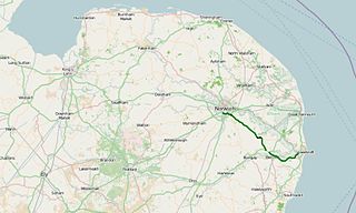
The A52 is a major road in the East Midlands, England. It runs east from a junction with the A53 at Newcastle-under-Lyme near Stoke-on-Trent via Ashbourne, Derby, Stapleford, Nottingham, West Bridgford, Bingham, Grantham, Boston and Skegness to the east Lincolnshire coast at Mablethorpe. It is approximately 147 miles (237 km) long.

The A1081 is a road in the south of England. It starts at Luton Airport in Bedfordshire and runs to High Barnet in Greater London via Harpenden, St Albans and London Colney, a distance of around 20.5 miles (33.0 km). For most of its length, the A1081 follows the route of the original A6.

The A4540 is a ring road in Birmingham, England, also known as the Middle Ring Road, or the Middleway. It runs around the centre of the city at a distance of approximately 1 mile (1.6 km). The ring road was planned and designed by Herbert Manzoni. It is now simply known as the Ring Road due to the removal of the old Inner Ring Road.

The A594 Central Ring is Leicester's central distributor road network.

The A146 is an A road that connects Norwich in Norfolk and Lowestoft in Suffolk, two of East Anglia's largest population centres. It is around 27 miles (43 km) in length and has primary classification along its entire route. It is mainly single carriageway throughout its route, with the exception of a section of dual carriageway on the southern edge of Norwich.

The A405 is a 4.8 miles dual carriageway road in Hertfordshire, England, from the A41 at Leavesden Green, near Watford, to the A414 at Park Street Roundabout near St Albans.

The A616 is a road that links Newark-on-Trent, Nottinghamshire, to the M1 motorway at Junction 30, then reappears at Junction 35A and goes on to Huddersfield, West Yorkshire.

The A607 is an A road in England that starts in Belgrave, Leicester and heads northeastwards through Leicestershire and the town of Grantham, Lincolnshire, terminating at Bracebridge Heath, a village on the outskirts of Lincoln. It is a primary route from Thurmaston to the A1 junction at Grantham.


