| A619 | ||||
|---|---|---|---|---|
 The start of the A6135 at Bakewell | ||||
| Major junctions | ||||
| Location | ||||
| Country | United Kingdom | |||
| Constituent country | England | |||
| Road network | ||||
| ||||
The A619 is an A road that links Bakewell, Derbyshire to Worksop, Nottinghamshire in England. [1]
| A619 | ||||
|---|---|---|---|---|
 The start of the A6135 at Bakewell | ||||
| Major junctions | ||||
| Location | ||||
| Country | United Kingdom | |||
| Constituent country | England | |||
| Road network | ||||
| ||||
The A619 is an A road that links Bakewell, Derbyshire to Worksop, Nottinghamshire in England. [1]
The route begins in Bakewell at Rutland Square, where it crosses the Bakewell Bridge over the River Wye, heading north towards Baslow. [2] The road then heads east through Wadshelf before reaching Chesterfield. [3] The road passes through the centre of the city, and briefly merges with the A61 before heading west as Rother Way and Chesterfield Road as it passes through Brimington, Hollingwood and Staveley. [4] The road becomes Worksop Road, where it passes over the M1 into Barlborough. The road continues east through Whitwell Common where it terminates in Worksop. [5]
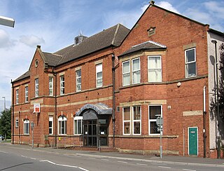
Staveley is a town and civil parish in the Borough of Chesterfield, Derbyshire, England. Located along the banks of the River Rother. It is northeast of Chesterfield, west of Clowne, northwest of Bolsover, southwest of Worksop and southeast of Sheffield.

The Chesterfield Canal is a narrow canal in the East Midlands of England and it is known locally as 'Cuckoo Dyke'. It was one of the last of the canals designed by James Brindley, who died while it was being constructed. It was opened in 1777 and ran for 46 miles (74 km) from the River Trent at West Stockwith, Nottinghamshire to Chesterfield, Derbyshire, passing through the Norwood Tunnel at Kiveton Park, at the time one of the longest tunnels on the British canal system. The canal was built to export coal, limestone, and lead from Derbyshire, iron from Chesterfield, and corn, deals, timber, groceries and general merchandise into Derbyshire. The stone for the Palace of Westminster was quarried in North Anston, Rotherham, and transported via the canal.

Bakewell is a market town and civil parish in the Derbyshire Dales district of Derbyshire, England, known for Bakewell pudding. It lies on the River Wye, 15 miles (23 km) south-west of Sheffield. It is the largest settlement and only town within the boundaries of the Peak District National Park. At the 2011 census, the population of the civil parish was 3,949. It was estimated at 3,695 in 2019. The town is close to the tourist attractions of Chatsworth House and Haddon Hall.

The River Ryton is a tributary of the River Idle. It rises close to the Chesterfield Canal near Kiveton Park, and is joined by a series of tributaries near Lindrick Common in the Metropolitan Borough of Rotherham, South Yorkshire, England. Most of its course is in Nottinghamshire, flowing through the town of Worksop. It meanders northwards to join the River Idle near the town of Bawtry on the South Yorkshire-Nottinghamshire border.
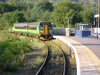
Ambergate railway station serves the village of Ambergate in Derbyshire, England. It is located on the Derwent Valley Line, which connects Derby and Matlock; it diverges from the Midland Main Line just south of the station at Ambergate Junction. The station owned by Network Rail and managed by East Midlands Railway.

Clowne is a town and civil parish in the Bolsover district of Derbyshire, England. The population was 7,590 at the 2011 Census and 7,755 at the 2021 Census. It lies 9 miles (14 km) north east of Chesterfield and 7 miles (11 km) south west of Worksop and is mentioned in the Domesday Book as Clune. The name is derived from the Celtic Clun for a river.

Whitwell railway station serves the village of Whitwell in Derbyshire, England. The station is on the Robin Hood Line 4¾ miles (7 km) south west of Worksop towards Nottingham.

Creswell railway station serves the village Creswell in Derbyshire, England. The station is on the Robin Hood Line between Nottingham and Worksop. It is also the nearest station to the larger village of Clowne.
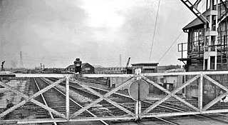
Beighton railway station is a former railway station near the village of Beighton on the border between Derbyshire and South Yorkshire, England.
The Monsal Trail is a cycling, horse riding and walking trail in the Derbyshire Peak District. It was constructed from a section of the former Manchester, Buxton, Matlock and Midland Junction Railway, which was built by the Midland Railway in 1863 to link Manchester with London and closed in 1968. The Monsal Trail is about 8.5 miles (13.7 km) long and opened in 1981. It starts at the Topley Pike junction in Wye Dale, 3 miles (4.8 km) east of Buxton, and runs to Coombs Viaduct, 1 mile (1.6 km) south-east of Bakewell. It follows the valley of the River Wye. The trail passes through Blackwell Mill, Chee Dale, Millers Dale, Cressbrook, Monsal Dale, Great Longstone, Hassop and Bakewell. The trail has numerous landmarks including Headstone Viaduct, Cressbrook Mill, Litton Mill and Hassop railway station, and passes through six tunnels.

The River Hipper is a tributary of the River Rother in Derbyshire, England. Its source is a large expanse of wetlands, fed by the surrounding moors between Chatsworth and Chesterfield, known as the Hipper Sick on Beeley Moor, which is part of the Chatsworth Estate. It then passes through Holymoorside and down into Chesterfield, just south of the town centre, before flowing into the River Rother. In July 2007, parts of Chesterfield flooded when the River Hipper burst its banks during a substantial storm that caused extensive flooding in North Derbyshire and South Yorkshire. The river burst its banks again after torrential rain in October 2023. The surrounding landscape is known as the Hipper Valley.

Shirebrook North railway station was a railway station serving the town of Shirebrook in Derbyshire, England. It was on the Lancashire, Derbyshire and East Coast Railway running from Chesterfield to Lincoln. The station was also on the former Shirebrook North to Nottingham Victoria Line and the Sheffield District Railway. The station has since been demolished and housing now occupies parts of the site with some stub rails nearby serving a train scrapper.
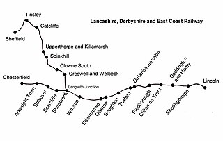
Warsop railway station is a former railway station in Market Warsop, Nottinghamshire, England.
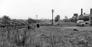
Boughton railway station served the village of Boughton in Nottinghamshire, England from 1897 to 1955 when it was closed. It has since been razed to the ground.
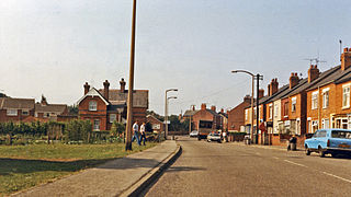
Creswell and Welbeck railway station used to serve the village of Creswell, in north eastern Derbyshire, England.

Bakewell railway station served the town of Bakewell in Derbyshire, England. It was built by the Midland Railway on its extension of the Manchester, Buxton, Matlock and Midland Junction Railway line from Rowsley to Buxton. The station was closed in 1967.
The Clowne Branch is a disused railway line in north eastern Derbyshire, England. Which runs from Creswell to Staveley. Historically it ran to Chesterfield. It is now in use as a greenway.
Beighton Junction is a set of railway junctions near Beighton on the border between Derbyshire and South Yorkshire, England.

National Cycle Network (NCN) Route 647 is a Sustrans National Route that runs from Clumber Park to Harby 53.233°N 0.683°W. The route is 19.6 miles (31.5 km) in length and is fully open and signed in both directions.

Bakewell Bridge is a Grade I listed stone arch bridge spanning the River Wye in Bakewell, Derbyshire. The bridge is also a scheduled monument.
53°12′58″N1°40′24″W / 53.2161°N 1.6734°W