Floyd County is a county located in the U.S. state of Kentucky. As of the 2010 census, the population was 39,451. Its county seat is Prestonsburg. The county, founded in 1800, is named for Colonel John Floyd (1750–1783).

Floyds Knobs is a small unincorporated community in Lafayette Township, Floyd County, Indiana, United States. Historically a farming community on the outskirts of New Albany, it has since become a bedroom community for Louisville, Kentucky. It contains subdivisions, farms, small shopping centers, churches, and transmitters for many of the area's television and radio stations. It is also the location of Floyd Central High School.

Nathan Thomas Hopkins was a U.S. Representative from Kentucky.

This is a list of the National Register of Historic Places listings in Warren County, Kentucky.

This is a list of the National Register of Historic Places listings in Pike County, Kentucky.

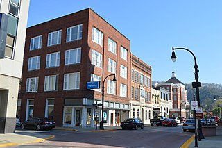
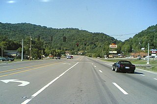
This is a list of the National Register of Historic Places listings in Floyd County, Kentucky.

This is a list of the National Register of Historic Places listings in McLean County, Kentucky.

This is a list of the National Register of Historic Places listings in Ballard County, Kentucky.
Betsy Layne is a census-designated place (CDP) and coal town in Floyd County, Kentucky, United States. It was established in 1875 along the Levisa Fork. The post office opened on May 1, 1908, with Clayton L. Hitchins as postmaster. Its ZIP code is 41605. The 2010 census reported the population to be 688. Stage actress Bette Henritze is a native of Betsy Layne.

Right Fork of Meathouse is an unincorporated community in Pike County, Kentucky, United States. Right Fork of Meathouse is located on Pigpen Branch, the right fork of Meathouse Fork, 12.7 miles (20.4 km) east-northeast of Pikeville.
Upper Dick is an unincorporated community in Pike County, Kentucky. Upper Dick is located on Dix Fork 11.5 miles (18.5 km) northeast of Pikeville.
Meta is an unincorporated community in Pike County, Kentucky. Meta is located at the junction of Kentucky Route 1426 and Kentucky Route 2169 7.7 miles (12.4 km) northeast of Pikeville. The community had a post office from 1896 to 1959.

Canada is an unincorporated community in Pike County, Kentucky. Canada is located on U.S. Route 119, 13.8 miles (22.2 km) northeast of Pikeville.
Huddy is an unincorporated community in Pike County, Kentucky. Huddy is located at the junction of U.S. Route 119 and Kentucky Route 199 15.5 miles (24.9 km) east-northeast of Pikeville. Huddy had a post office, which closed on January 22, 2011.
Belcher is an unincorporated community in Pike County, Kentucky. Belcher is located at the junction of U.S. Route 460 and Kentucky Route 80 2.9 miles (4.7 km) north-northwest of Elkhorn City. Belcher has a post office with ZIP code 41513.

Belfry is an unincorporated community in Pike County, Kentucky. Belfry is located on U.S. Route 119, 16.8 miles (27.0 km) northeast of Pikeville. Belfry has a post office with ZIP code 41514, which opened on February 26, 1921. The origin of the name "Belfry" is obscure.
Kimper is an unincorporated community in Pike County, Kentucky. Kimper is located at the junction of Kentucky Route 194 and Kentucky Route 632, 9.3 miles (15.0 km) east of Pikeville. Kimper has a post office with ZIP code 41539, which opened on August 8, 1919.
Little Dixie is an unincorporated community in Pike County, Kentucky, United States.
Jonkan is a ghost town in Pike County, Kentucky, United States. Jonkan was located along Jonican Branch and Jonican Road 7.2 miles (11.6 km) east-southeast of Pikeville. The community is still marked on county highway maps.