Little Richmond, North Carolina

Last updated
Little Richmond
Unincorporated community
USA North Carolina location map.svg
Red pog.svg
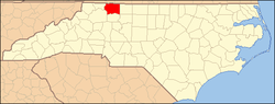
Little Richmond
Location within the state of North Carolina
Coordinates: 36°17′41″N80°45′27″W / 36.29472°N 80.75750°W / 36.29472; -80.75750 Coordinates: 36°17′41″N80°45′27″W / 36.29472°N 80.75750°W / 36.29472; -80.75750
Country United States
State North Carolina
County Surry
Elevation 1,110 ft (340 m)
Time zone Eastern (EST) (UTC-5)
  Summer (DST) EDT (UTC-4)
ZIP codes 28621 (Elkin)
Area code(s) 336
GNIS feature ID 988748

Little Richmond is an unincorporated community located in the Marsh Township of Surry County, North Carolina.

Marsh Township, Surry County, North Carolina township in Surry County, North Carolina

Marsh Township is one of fifteen townships in Surry County, North Carolina. The township had a population of 2,499 according to the 2000 census.

Surry County, North Carolina County in the United States

Surry County is a county located in the U.S. state of North Carolina. As of the 2010 census, the population was 73,673. Its county seat is Dobson, and its largest city is Mount Airy.

Contents

Geography

The community is centered on the intersection of North Carolina Highway 268 and Joe Layne Mill Road. Near this intersection are the Little Richmond Baptist Church, founded in 1872, and Little Richmond Cemetery. Other landmarks in the community include Little Richmond Primitive Baptist Church, New Hope Pentecostal Holiness Church and a C.C. Camp Volunteer Fire Department Substation. Former landmarks that once stood in this vicinity include the Little Richmond School and a former United States post office called Rusk.

North Carolina Highway 268 highway in North Carolina

North Carolina Highway 268 (NC 268) is a primary state highway in the U.S. state of North Carolina. It connects many communities as it traverses through the northwestern North Carolina mountains and foothills.

Generally, the community resides near the junction of Snow Creek and the Mitchell River and has an elevation of 1,110 feet (340 m) above sea level ( Powell 1968 , p. 291).

The Mitchell River is a tributary of the Yadkin River in northwestern North Carolina in the United States. Via the Yadkin it is part of the watershed of the Pee Dee River, which flows to the Atlantic Ocean. According to the Geographic Names Information System, it has also been known historically as "Mitchells River," "Mitchels River," and "Mountain Creek."

Related Research Articles

Centerville, North Carolina Census-designated place in North Carolina, United States

Centerville is a census-designated place (CDP) in the rural northeastern corner of Franklin County, North Carolina, United States. The population was 89 at the 2010 census, a loss of 10 persons from the previous count of 99 at the 2000 census. It was an incorporated town from 1965 to 2017.

Union Presbyterian Seminary seminary in the state of Virginia

Union Presbyterian Seminary, located on the near north side of the city of Richmond, Virginia, United States, is a theological seminary founded by the Presbyterian Church. Through its main campus in Richmond, Virginia, a non-residential campus in Charlotte, North Carolina, and an extended campus online, Union prepares men and women to serve the church as pastors, educators, scholars, chaplains and missionaries.

Mountain Park, North Carolina Unincorporated community in North Carolina, United States

Mountain Park is an unincorporated community located in the Bryan Township of western Surry County, North Carolina. The community's unique name is derived from its "mountain location in a park-like setting." Notable old-time musician and luthier Johnny Gentry is from Mountain Park.

Fairview Crossroads is an unincorporated community in Surry County, North Carolina. Historically, the community was known earliest as Alberty.

Zephyr in an unincorporated community in western Surry County, North Carolina in Bryan Township. The community is centered on the intersection of Zephyr-Mountain Park Road and Poplar Springs Road/Zephyr Road and lies between the Mitchell River and Little Creek. Prominent landmarks in the center of the community include Gum Orchard Baptist Church and the Zephyr Cemetery.

Ararat is an unincorporated community in the Long Hill Township of Surry County, North Carolina. Ararat is situated on, and is named for, the Ararat River. Ararat is along the former Atlantic & Yadkin Railway line from Mount Airy to Rural Hall that is now operated by the Yadkin Valley Railroad. Landmarks near the center of the community include the community post office, fire department and area churches.

Westfield in an unincorporated community in Surry and Stokes counties in North Carolina. The community itself is located almost entirely within Surry County, with a small portion extending east into Stokes County. The majority of Westfield's Zip Code Tabulation Area is located within Stokes County.

Stony Knoll is a small unincorporated community in the Rockford Township of Surry County, North Carolina.

Copeland is a small unincorporated community in the Rockford Township of Surry County, North Carolina.

Level Cross is an unincorporated community located in the Rockford Township of Surry County, North Carolina.

Shoals is a small unincorporated community in the Shoals Township of Surry County, North Carolina.

Mulberry is an unincorporated community in Surry County, North Carolina. The center of the community is roughly the intersection of Mulberry Church Road and Poplar Springs Road. Located on Mulberry Church Road is Mulberry Primitive Church and cemetery, the oldest church in the community and the origin of the community's name.

Salem is an unincorporated community located in northern Surry County, North Carolina on the outskirts of the city of Mount Airy. The community generally lies between Lovills Creek the Ararat River. Prominent landmarks include Salem United Methodist Church.

Union Cross is a small unincorporated community in the Dobson Township of central Surry County, North Carolina. The community is roughly centered on the intersection of Dobbins Mill Road and Twin Oaks Road. Prominent landmarks include Union Cross Baptist Church, Union Cross Baptist Church cemetery, the Dockery Family Cemetery, and a local Ruritan club. The land for the Union Cross Ruritan Club was donated to the community for this purpose by Mrs. Minnie Shinault Dockery, widow of T. Alvin Dockery, a prominent local farmer and owner of the local general store. This Community is served by the Jot-Um-Down Volunteer Fire Department, which was founded in 1980. The Current Fire Chief is Ricky Holsclaw.

Turkey Ford is a small unincorporated community in central Surry County, North Carolina. The community is roughly centered on the intersection of Turkey Ford Road and Turkey Ford Church Road and is generally between the town of Dobson and the community of Blackwater. Prominent landmarks include Turkey Ford Baptist Church.

Oak Grove is an unincorporated community in northern Surry County, North Carolina near Bottom.

Ladonia is an unincorporated community located in the Franklin Township of northwest Surry County, North Carolina. The community generally lies on the Fisher River and is centered on the intersection of Blevins Store Road and Ladonia Church Road. Area landmarks include Ladonia Baptist Church, M & M Signs and Awnings, and the nearby Raven Knob Scout Reservation.

Donnaha, North Carolina Unincorporated community in North Carolina, United States

Donnaha is a small unincorporated community along the Yadkin River in the Old Richmond Township of northwest Forsyth County, North Carolina. Donnaha is named for the last chief of the Sauras.

Cape Fear is an unincorporated community located along North Carolina Highway 210 in the Neills Creek Township of Harnett County, North Carolina near the town of Lillington. It is a part of the Dunn Micropolitan Area, which is also a part of the greater Raleigh–Durham–Cary Combined Statistical Area (CSA) as defined by the United States Census Bureau.

Cokesbury is an unincorporated community located in the Buckhorn Township of Harnett County, North Carolina. It is a part of the Dunn Micropolitan Area, which is also a part of the greater Raleigh–Durham–Cary Combined Statistical Area (CSA) as defined by the United States Census Bureau.

References

Powell, William S. (1968), The North Carolina Gazetteer: A Dictionary of Tar Heel Places, Chapel Hill: University of North Carolina Press, ISBN   0-8078-1247-1  

William S. Powell American historian

William Stevens Powell was an American historian, writer, academic, teacher and native of the Tar Heel State of North Carolina. He authored over 600 articles and books about the history of North Carolina and was the editor of the six volume Dictionary of North Carolina Biography. He was professor emeritus of history at the University of North Carolina at Chapel Hill, having retired in 1986.

International Standard Book Number Unique numeric book identifier

The International Standard Book Number (ISBN) is a numeric commercial book identifier which is intended to be unique. Publishers purchase ISBNs from an affiliate of the International ISBN Agency.