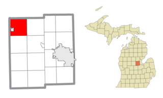
Warren Township is a civil township of Midland County in the U.S. state of Michigan. The population was 2,040 at the 2020 census. The township surrounds the city of Coleman, but the two are administered autonomously.
Mayhew Lake Township is a township in Benton County, Minnesota, United States. The population was 831 as of the 2010 census. Mayhew Lake Township was named for George V. Mayhew, an early settler of Benton County who became a state legislator.
Minden Township is a township in Benton County, Minnesota, United States. The population was 1,514 as of the 2020 census. Minden Township was organized in 1858.

Rice is a city in Benton County, Minnesota, United States. The population was 1,275 at the 2010 census. Its zip code also encompasses Graham, Langola, and Watab townships.
Sauk Rapids Township is a township in Benton County, Minnesota, United States near the Mississippi River. The population was 584 at the 2010 census.
Watab Township is an urban township in Benton County, Minnesota, United States, located north of the mouth of Watab Creek on the opposite side of the Mississippi River in Sartell. The population was 3,093 as of the 2010 census.
Becker Township is a township in Cass County, Minnesota, United States. The population was 485 as of the 2000 census. Becker Township was named for J. A. Becker, a pioneer settler.
Westbrook Township is a township in Cottonwood County, Minnesota, United States. The population was 216 at the 2010 census.

Rushford Village is a city in Fillmore County, Minnesota, United States. The population was 807 at the 2010 census. It surrounds the city of Rushford.
Arbo Township is a township in Itasca County, Minnesota, United States. The population was 867 at the 2010 census.
Balsam Township is a township in Itasca County, Minnesota, United States. The population was 550 at the 2010 census.
Marcell Township is a township in Itasca County, Minnesota, United States. The population was 467 at the 2010 census.
Westport Township is a township in Pope County, Minnesota, United States. The population was 279 at the 2000 census. It contains the village of Westport, Minnesota.
Fayal Township is an urban township in Saint Louis County, Minnesota, United States. The population was 1,809 at the 2010 census.
Avon Township is a township in Stearns County, Minnesota, United States. The population was 2,294 at the 2010 census. The township includes the city of Avon.
Le Sauk Township is a township in Stearns County, Minnesota, United States. The population was 1,766 at the 2010 census.
Sauk Centre Township is a township in Stearns County, Minnesota, United States. The population was 1,088 at the 2010 census.
Gordon Township is a township in Todd County, Minnesota, United States. The population was 545 at the 2000 census and 659 in the 2020 census.
Kandota Township is a township in Todd County, Minnesota, United States. The population was 679 at the 2000 census and in the 2020 census it was 805.
West Union Township is a township in Todd County, Minnesota, United States. The population was 312 at the 2000 census and 254 in the 2020 census. The incorporated village of West Union is within the township of the same name.


