Reynolds Township, Todd County, Minnesota

Last updated

Reynolds Township, Minnesota
USA Minnesota location map.svg
Red pog.svg
Reynolds Township, Minnesota
Location within the state of Minnesota
Usa edcp location map.svg
Red pog.svg
Reynolds Township, Minnesota
Reynolds Township, Minnesota (the United States)
Coordinates: 45°59′4″N94°56′43″W / 45.98444°N 94.94528°W / 45.98444; -94.94528
Country United States
State Minnesota
County Todd
Area
  Total36.1 sq mi (93.4 km2)
  Land35.6 sq mi (92.3 km2)
  Water0.4 sq mi (1.1 km2)
Elevation
1,375 ft (419 m)
Population
 (2020)
  Total735
  Density19.3/sq mi (7.5/km2)
Time zone UTC-6 (Central (CST))
  Summer (DST) UTC-5 (CDT)
FIPS code 27-53926 [1]
GNIS feature ID0665402 [2]

Reynolds Township is a township in Todd County, Minnesota, United States. The population was 688 at the 2000 census and 735 in the 2020 census. [3]

Contents

Geography

According to the United States Census Bureau, the township has a total area of 36.1 square miles (93.4 km2), of which 35.6 square miles (92.3 km2) is land and 0.4 square mile (1.1 km2) (1.19%) is water.

Stone bridge over Turtle Creek in Reynolds township. Turtle Creeek Stone bridge, Reynolds township, Todd County, MN.jpg
Stone bridge over Turtle Creek in Reynolds township.

Demographics

As of the census [1] of 2000, there were 688 people, 226 households, and 183 families residing in the township. The population density was 19.3 people per square mile (7.5/km2). There were 245 housing units at an average density of 6.9/sq mi (2.7/km2). The racial makeup of the township was 99.56% White, 0.15% African American, and 0.29% from two or more races. Hispanic or Latino of any race were 0.29% of the population.

There were 226 households, out of which 42.9% had children under the age of 18 living with them, 71.7% were married couples living together, 3.5% had a female householder with no husband present, and 19.0% were non-families. 15.9% of all households were made up of individuals, and 9.3% had someone living alone who was 65 years of age or older. The average household size was 3.04 and the average family size was 3.46.

In the township the population was spread out, with 34.4% under the age of 18, 7.7% from 18 to 24, 27.3% from 25 to 44, 20.3% from 45 to 64, and 10.2% who were 65 years of age or older. The median age was 33 years. For every 100 females, there were 108.5 males. For every 100 females age 18 and over, there were 122.2 males.

The median income for a household in the township was $33,393, and the median income for a family was $39,444. Males had a median income of $28,646 versus $21,563 for females. The per capita income for the township was $12,329. About 9.9% of families and 17.5% of the population were below the poverty line, including 22.5% of those under age 18 and 16.3% of those age 65 or over.

Related Research Articles

<span class="mw-page-title-main">Adams Township, Arenac County, Michigan</span> Civil township in Michigan, United States

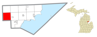
Adams Township is a civil township of Arenac County in the U.S. state of Michigan. As of the 2020 census, the township population was 554.

<span class="mw-page-title-main">Wayne Township, Michigan</span> Civil township in Michigan, United States

Wayne Township is a civil township of Cass County in the U.S. state of Michigan. The population was 2,654 at the 2010 census.

<span class="mw-page-title-main">Rubicon Township, Michigan</span> Civil township in Michigan, United States

Rubicon Township is a civil township of Huron County in the U.S. state of Michigan. The population was 732 at the 2010 census.

<span class="mw-page-title-main">Tofte Township, Cook County, Minnesota</span> Township in Minnesota, United States

Tofte Township is one of the three townships of Cook County, Minnesota, United States. The population was 226 at the 2000 census. The unincorporated community of Tofte is located within the township.

<span class="mw-page-title-main">Deerwood, Minnesota</span> City in Minnesota, United States

Deerwood is a city in Crow Wing County, Minnesota, United States. The population was 526 at the 2020 census. It is part of the Brainerd Micropolitan Statistical Area.

Roosevelt Township is a township in Crow Wing County, Minnesota, United States. The population was 534 at the 2000 census. Roosevelt Township was named for Theodore Roosevelt, 26th President of the United States.

<span class="mw-page-title-main">Greenwood, Minnesota</span> City in Minnesota, United States

Greenwood is a community on Saint Albans Bay on Lake Minnetonka in Hennepin County, Minnesota, United States just northeast of the community of Excelsior, Minnesota. The population was 688 at the 2010 census.

Oxford Township is a township in Isanti County, Minnesota, United States. The population was 799 at the 2000 census.

Lynn Township is a township in McLeod County, Minnesota, United States. The population was 604 at the 2000 census.

Elmdale Township is a township in Morrison County, Minnesota, United States. The population was 904 at the 2000 census.

Orion Township is a township in Olmsted County, Minnesota, United States. The population was 614 at the 2000 census.

Lynden Township is a township in Stearns County, Minnesota, United States. The population was 1,938 at the 2010 census.

<span class="mw-page-title-main">Carnot-Moon, Pennsylvania</span> Census-designated place in Pennsylvania, United States

Carnot-Moon is a census-designated place (CDP) in central Moon Township, Allegheny County, Pennsylvania, United States. The population was 13,151 at the 2020 census.

<span class="mw-page-title-main">Burlington Township, Bradford County, Pennsylvania</span> Township in Pennsylvania, United States

Burlington Township is a township in Bradford County, Pennsylvania, United States. It is part of Northeastern Pennsylvania. The population was 791 at the 2010 census. Children residing in the township are assigned to attend the Troy Area School District.

<span class="mw-page-title-main">Hopewell Township, Cumberland County, Pennsylvania</span> Township in Pennsylvania, United States

Hopewell Township is a township in Cumberland County, Pennsylvania, United States. The population was 2,329 at the 2010 census, up from 2,096 at the 2000 census.

<span class="mw-page-title-main">Rush Township, Dauphin County, Pennsylvania</span> Township in Pennsylvania, United States

Rush Township is a township in Dauphin County, Pennsylvania, United States. As of the 2020 census, the township population was 226, a decline from the figure of 231 tabulated in 2000.

<span class="mw-page-title-main">Southwest Madison Township, Perry County, Pennsylvania</span> Township in Pennsylvania, United States

Southwest Madison Township is a township in Perry County, Pennsylvania, United States. The population was 1,020 at the 2020 census.

<span class="mw-page-title-main">Abbott Township, Pennsylvania</span> Township in Pennsylvania, United States

Abbott Township is a township in Potter County, Pennsylvania, United States. The population was 230 at the 2010 census.

<span class="mw-page-title-main">Franklin Township, Susquehanna County, Pennsylvania</span> Township in Pennsylvania, United States

Franklin Township is a township in Susquehanna County, Pennsylvania, United States. The population was 833 at the 2020 census. Salt Springs State Park, a Pennsylvania state park, is in Franklin Township.

<span class="mw-page-title-main">Harmony, Rock County, Wisconsin</span> Town in Wisconsin, United States

The Town of Harmony is a town located in Rock County, Wisconsin, United States. The population was 2,569 at the 2020 census. The city of Janesville is adjacent to the town.

References

  1. 1 2 "U.S. Census website". United States Census Bureau . Retrieved January 31, 2008.
  2. "US Board on Geographic Names". United States Geological Survey. October 25, 2007. Retrieved January 31, 2008.
  3. Bureau, US Census. "Minnesota's Population at 5,706,494 in 2020, Up 7.6% Since 2010". Census.gov. Retrieved April 2, 2023.