Solway is a city in Beltrami County, Minnesota, United States. The population was 96 at the 2010 census. Solway serves as a bedroom community for nearby Bemidji.

Cromwell is a city in Carlton County, Minnesota, United States. The population was 240 at the 2020 census.

Wright is a city in Carlton County, Minnesota, United States. The population was 168 at the 2020 census.

Chickamaw Beach is a city in Cass County, Minnesota, United States. The population was 128 at the 2020 census. It is part of the Brainerd Micropolitan Statistical Area.

Sunburg is a city in Kandiyohi County, Minnesota, United States. The population was 94 at the 2020 census.

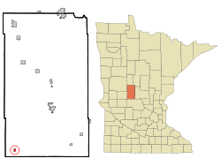
Stewart is a city in McLeod County, Minnesota, United States. The population was 489 at the 2020 census, down from 571 in 2010.

Elmdale is a city in Morrison County, Minnesota, United States. The population was 114 at the 2020 census.

Harding is a city in Morrison County, Minnesota, United States. The population was 123 at the 2020 census. There’s also a parade in winter called the Harding Horse parade and have Harding days around the Fourth of July, which attracts a few thousand people especially The rodeo

Hillman is a city in Morrison County, Minnesota, United States. The population was 23 at the 2020 census.

Sargeant is a city in Mower County, Minnesota, United States. The population was 63 at the 2020 census.

Dovray is a city in Murray County, Minnesota, United States. The population was 58 at the 2020 census.

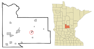
Deer Creek is a city in Otter Tail County, Minnesota, United States. The population was 330 at the 2020 census.

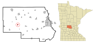
Henning is a city in Otter Tail County, Minnesota, United States. The population was 854 at the 2020 census.

Vergas is a city in northern Otter Tail County, Minnesota, United States. The population was 348 at the 2020 census.

Leonidas is a city in Saint Louis County, Minnesota, United States. The population was 50 at the 2020 census.
Genola is a city in Morrison County, Minnesota, United States. The population was 70 at the 2020 census.

Meire Grove is a city in Stearns County, Minnesota, United States. The population was 179 at the 2010 census. It is part of the St. Cloud Metropolitan Statistical Area.
Spring Hill is a city in Stearns County, Minnesota, United States. The population was 85 at the 2010 census. It is part of the St. Cloud Metropolitan Statistical Area.

Oliver is a village in Douglas County, Wisconsin, United States. The population was 423 at the 2020 census.

Minnesota Lake is a city in Blue Earth and Faribault counties in the State of Minnesota. The population was 661 at the 2020 census. The bulk of the city is in Faribault County; a small part extends into Blue Earth County.