
Oregon Hill is a historic working-class neighborhood in Richmond, Virginia. Oregon Hill overlooks the James River and Belle Isle, and provides access to Hollywood Cemetery. Due to the neighborhoods proximity to the Monroe Park Campus of Virginia Commonwealth University, the neighborhood is sometimes referred to as a student quarter because of its high college student population.

City Stadium is a sports stadium in Richmond, Virginia. It is owned by the City of Richmond and is located south of the Carytown district off the Downtown Expressway. The stadium was built in 1929 and seats approximately 22,000 people. It has been used by the Richmond Kickers of the United Soccer League since 1995.

Westham Bridge crossed the James River between Henrico County and Chesterfield County. The bridge was located between Bosher Dam and Williams Island Dam just west of the 7 miles of rapids and falls which constitute the fall line of the James River at Richmond, Virginia.
Carytown is an urban retail district lining Cary Street at the southern end of the Museum District in Richmond, Virginia. Located near The Fan District, the district has an eclectic flavor and includes over 230 shops, restaurants, and offices. The area is also home to one of the city's institutions, the Byrd Theatre, a restored movie palace that has operated continuously since 1928.

Triple Crossing in Richmond, Virginia is believed to be the only place in North America where three Class I railroads cross at different levels at the same spot.
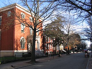
Court End is a neighborhood in Richmond, Virginia, that sits to the north of the Capitol Square and East Broad Street. It developed in the Federal era, after Virginia's capital moved from Williamsburg.

The East End of Richmond, Virginia is the quadrant of the City of Richmond, Virginia, and more loosely the Richmond metropolitan area, east of the downtown.
Upper Shockoe Valley is a neighborhood in Richmond, Virginia that straddles alongside Interstate 95. The name is given based on the Shockoe River Valley created within the boundaries of the neighborhood.
Creighton Court is a neighborhood in Richmond, Virginia's East End region. Creighton Court sits on the border between the City of Richmond and eastern Henrico County. The neighborhood is situated directly north of the Oakwood Cemetery and alongside the interchange of Virginia Route 33 and Interstate 64. North 29th Street and Creighton Road serve as the main arteries of the community.
The Biotech and MCV District is the community that surrounds the MCV Campus of Virginia Commonwealth University in Downtown Richmond, Virginia.
Pine Camp is a neighborhood in Richmond, Virginia's North Side. The area is heavily forested, and houses the Pine Camp Community Center, one of the largest recreational centers in Northern Richmond. The neighborhood is north of John Marshall High School and west of the Forest Lawn Cemetery.
Gilpin is a small neighborhood located in Richmond, Virginia and within the boundaries of the North Side of the city limits. The community of Gilpin lies adjacent to the interchange of Interstates 64 and 95, and houses two cemeteries: the Hebrew and Shockoe Hill Cemetery. The headquarters for the Richmond Department of Redevelopment and Housing are situated in the neighborhood along with the Richmond Alternative School.
Green Park is a small neighborhood of approximately 240 homes located in Richmond, Virginia, United States. The neighborhood is within the boundaries of the North Side of the city limits.
Jahnke is a neighborhood in Richmond, Virginia located in the Southside region of the city. The neighborhood is largely suburban, but lies within the city limits. The zip code for the neighborhood is 23225. Jahnke is named after Jahnke Road which is the main road through the neighborhood. The heart of Jahnke is at the intersection of Jahnke Road and German School Road.

Mosby Court, often referred to as Mosby is a neighborhood and public housing project that is located in the East End quadrant of Richmond, Virginia. Adjacent to the Richmond City Jail, Mosby Court is primarily served by Coalter Street, which accesses the community North 18th Street. Directly south of the neighborhood is Martin Luther King Jr. Middle School.
Carillon is a neighborhood in the West End of Richmond that is situated in between Virginia State Routes 146 and 161. Adjacent to Maymont and Byrd Park, the middle-class neighborhood is home to the Dogwood Dell Amphitheater. Pump House Drive and Rugby Road are the arteries of the southern tier of the community, while Douglasdale Avenue and South Belmont Drive form the spin of the northern portions of Carillon.
Old Town Manchester is a neighborhood in Richmond, Virginia's Southside quadrant. The neighborhood is where downtown Manchester was situated before the city merged with Richmond. The area is heavily industrialized, but has gone through a series of gentrification for the last 10 years. Several lofts and art galleries have opened in the area.
Stadium neighborhood or sometimes just known as Stadium is a neighborhood in the West End quadrant of Richmond, Virginia. The neighborhood encompasses City Stadium, which used to host the Richmond Spiders football program, and currently serves as the main venue for the Richmond Kickers pro soccer club.
Randolph is a historically black middle class neighborhood located within the West End of Richmond, Virginia. The neighborhood is named in honor of Virginia E. Randolph, a former African-American educator in Henrico County, Virginia during the 19th century. The neighborhood is bounded by the Downtown Expressway to the north, Harrison Street to the east, Colorado Avenue to the south, and South Meadow street to the west. Some famous landmarks and places of interest in the neighborhood include Petronius Park, the Randolph Community Center, and just adjacent to the neighborhood, the Hollywood Cemetery.


