
The Fan is a district of Richmond, Virginia, so named because of the "fan" shape of the array of streets that extend west from Belvidere Street, on the eastern edge of Monroe Park, westward to Arthur Ashe Boulevard. However, the streets rapidly resemble a grid after they go through what is now Virginia Commonwealth University. The Fan is one of the easterly points of the city's West End section, and is bordered to the north by Broad Street and to the south by VA 195, although the Fan District Association considers the southern border to be the properties abutting the south side of Main Street. The western side is sometimes called the Upper Fan and the eastern side the Lower Fan, though confusingly the Uptown district is located near VCU in the Lower Fan. Many cafes and locally owned restaurants are located here, as well as historic Monument Avenue, a boulevard featuring enormous equine statuary of Civil War Confederate generals and a statue of tennis icon Arthur Ashe. Development of the Fan district was strongly influenced by the City Beautiful movement of the late 19th century.

Oregon Hill is a historic working-class neighborhood in Richmond, Virginia. Oregon Hill overlooks the James River and Belle Isle, and provides access to Hollywood Cemetery. Due to the neighborhood's proximity to the Monroe Park Campus of Virginia Commonwealth University, the neighborhood is sometimes referred to as a student quarter because of its high college student population.

Manchester is a former independent city in Virginia in the United States. Prior to receiving independent status, it served as the county seat of Chesterfield County, between 1870 and 1876. Today, it is a part of the city of Richmond, Virginia.

The West End is a part of Richmond, Virginia. Definitions of the bounds of the West End vary, it may include only the western part of the city of Richmond or extend as far as western Henrico County. As there is no one municipal organization that represents this specific region, the boundaries are loosely defined as being north of the James River, west of I-195, and south of Broad Street. Historically, the Richmond neighborhoods of the Fan and the Museum District were a part of the West End. A primary conduit through the West End is Interstate 64.
This article is about the many neighborhoods and districts in the Greater Richmond, Virginia area. Note that this article is an attempt to be inclusive of the broader definitions of the areas which are often considered part of the Greater Richmond Region, based on their urban or suburban character and nature, rather than by strictly political boundaries.

Jackson Ward is a historically African-American district in Richmond, Virginia with a long tradition of African-American businesses. It is located less than a mile from the Virginia State Capitol, sitting to the west of Court End and north of Broad Street. It was listed as a National Historic Landmark District in 1978. "Jackson Ward" was originally the name of the area's political district within the city, or ward, from 1871 to 1905, yet has remained in use long after losing its original meaning.
Carver Langston is a cluster of two neighborhoods, Carver and Langston, just south of the United States National Arboretum in Northeast Washington, D.C. The two neighborhoods are most often referred to as one, because they are two small triangular neighborhoods that together form a square of land on the western bank of the Anacostia River.

Park Place is a neighborhood in the western half of Norfolk, Virginia. Its boundaries are roughly Granby Street on the east, Colley Avenue on the west, 23rd Street on the south and up to 38th Street to the north. Within these boundaries Park Place is made up of 4 historic subdivisions; Virginia Place, East Kensington, Park Place, and East Old Dominion Place.

Shockoe Bottom is an area in Richmond, Virginia, just east of downtown, along the James River. Located between Shockoe Hill and Church Hill, Shockoe Bottom contains much of the land included in Colonel William Mayo's 1737 plan of Richmond, making it one of the city's oldest neighborhoods.
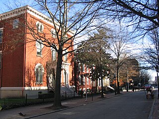
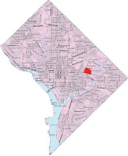
Court End is a neighborhood in Richmond, Virginia, that sits to the north of the Capitol Square and East Broad Street. It developed in the Federal era, after Virginia's capital moved from Williamsburg.

Charles Morrison Robinson, most commonly known as Charles M. Robinson, was an American architect. He worked in Altoona and Pittsburgh, Pennsylvania from 1889 to 1906 and in Richmond, Virginia from 1906 until the time of his death in 1932. He is most remembered as a prolific designer of educational buildings in Virginia, including public schools in Richmond and throughout Virginia, and university buildings for James Madison University, College of William and Mary, Radford University, Virginia State University, University of Mary Washington, and the University of Richmond. He was also the public school architect of the Richmond Public Schools from 1910 to 1929. Many of his works have been listed on the National Register of Historic Places.

Wyoming is a village and census-designated place on the Wood River in southern Rhode Island, primarily in the town of Richmond, Rhode Island, but extending north across the river into the town of Hopkinton, Rhode Island. The population was 270 at the 2010 census. It is the site of the Wyoming Village Historic District and a post office assigned ZIP code 02898.

Union Hill is a historic district of Richmond, Virginia. According to the Richmond Times Dispatch, the neighborhood "generally is bordered on the south by East Marshall Street and Jefferson Avenue, on the west by Mosby Street, on the north by O and Carrington streets, and angled on the east by North 25th Street." The neighborhood is on the Virginia Landmarks Register and the National Register of Historic Places, and is also one of sixteen designated "Old and Historic Districts" in Richmond.

Pocahontas Island is a peninsula in Petersburg, Virginia once on the opposite side of the Appomattox River from Petersburg. Since 1915 a new channel for the river separated it from Chesterfield County and the former channel no longer separates it from the city. Once a warehouse and wharf-filled urban landscape initially platted in 1749, the island was devastated by a 1993 tornado before citizen involvement caused creation of the Pocahontas Island Historic District, which in 2006 achieved listing on the National Register of Historic Places (NRHP) as a historic district because of its significance in African-American history and for its prehistoric indigenous archeological assets.

The Museum District, alternately known as West of the Boulevard, is a neighborhood in the city of Richmond, Virginia. It is anchored by the contiguous six-block tract of museums along the west side of Boulevard, including the Virginia Museum of Fine Arts and the Virginia Museum of History & Culture, hence the name.
The Chamberlayne Industrial Center, sometimes simply known as Chamberlayne is a heavy industry district within the boundaries of Richmond, Virginia's North Side region. The neighborhood contains a mixture of residential, commercial industrial-zoned areas, but most of the residential and commercial buildings are in the eastern corner of the neighborhood. The neighborhood is named after Chamberlayne Avenue which serves as the spine for the neighborhood.

The Carver Industrial Historic District is a national historic district located at Carver, Richmond, Virginia. The district encompasses 13 contributing buildings located west of downtown Richmond. The industrial area developed between 1890 and 1930, along the tracks of the Richmond, Fredericksburg and Potomac Railroad. The buildings are in a variety of popular 19th-century and early 20th century architectural styles including Queen Anne and Romanesque.

The Carver Residential Historic District is a national historic district located at Carver, Richmond, Virginia. The district encompasses 312 contributing buildings and 1 contributing site located west of downtown Richmond. The primarily residential area developed starting in the mid-19th century. The buildings are in a variety of popular 19th-century and early 20th-century architectural styles, including Gothic Revival and Greek Revival. Notable buildings include the Hardin Davis House (1842), Amanda Ragland House (1843), Reuben Lacy House (1859), Rueben T. Hill House (1900), George Washington Carver Elementary School (1887), Moore Street Baptist Church (1909), Baughman Brothers/Biggs Antique Company building (1924), and the T&E Laundry Company Building.

The Laburnum Park Historic District is a national historic district located at Richmond, Virginia. The district encompasses 226 contributing buildings and 2 contributing structures located north of downtown Richmond. The primarily residential area developed starting in the early-20th century as one of the city's early "streetcar suburbs" and as home to several important local institutions. The buildings are in a variety of popular early-20th century architectural styles including Queen Anne and Colonial Revival. It was developed as neighborhood of middle-to-upper-class, single-family dwellings. Notable buildings include the Laburnum House (1908), Richmond Memorial Hospital (1954-1957), Richmond Memorial Hospital Nursing School (1960-1961), "The Hermitage" (1911), Laburnum Court (1919), Veritas School.
